........................... Return to Sumner's Home Page....
... Return Suzuki 650 Main Menu.... Return Colorado Trip Menu
==============================================================
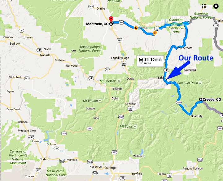
...................--- Day 3 -- Creede, Colorado to Montrose, Colorado ---
==============================================================
............Previous Page...............................Next Page If There Is One
==============================================================
We had considered staying an extra day in Creede as we liked it and also liked our room, but in the morning changed our minds on that. We checked the weather and saw that it was supposed to deteriorate over the next 3-4 days due to moisture coming ashore from the remnants of Hurricane Paine. The hurricane had just broken up off the coast of Baja, Mexico and moisture was streaming up into the 4-corners area. The rain that was predicted didn't look major but Thursday the winds were supposed to start gusting into the 30's and that didn't sound so good.
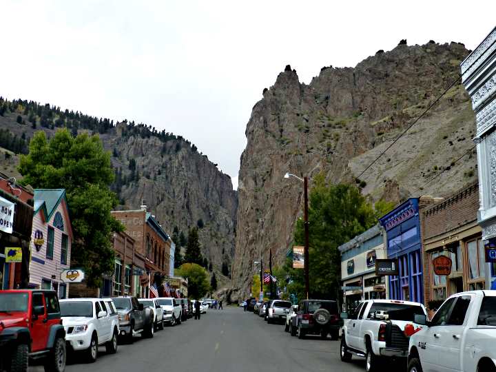
We walked up town and had a nice breakfast at Arp's. We returned to the motel and took our time packing as the rains weren't expected till late in the afternoon and we wanted it to warm up a little. With the bike packed we drove back through town and .....
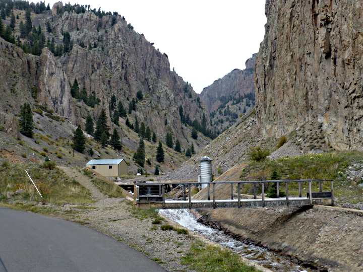
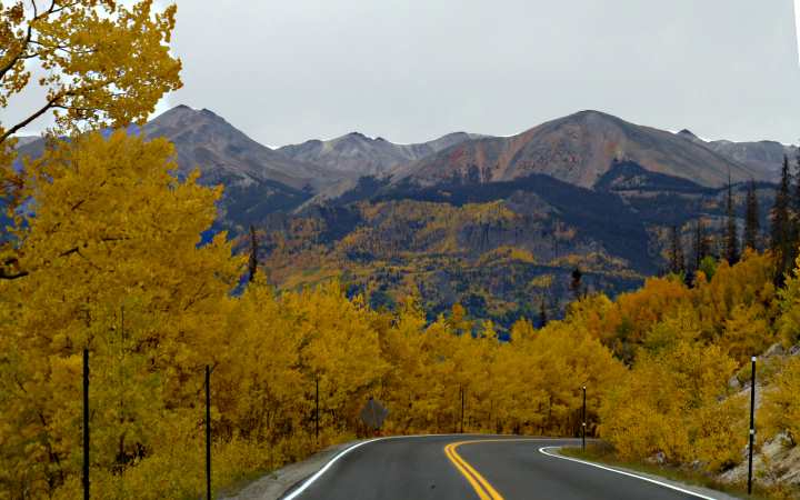
..... up into the canyon just past the end of the business district. Creede was the last silver boom town in Colorado with mines there operating continuously from 1890 to 1985. After leaving town on Highway 149 we followed the Rio Grande River valley for a ways and then started our climb to the first of two passes we would have to traverse.
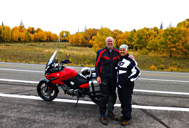
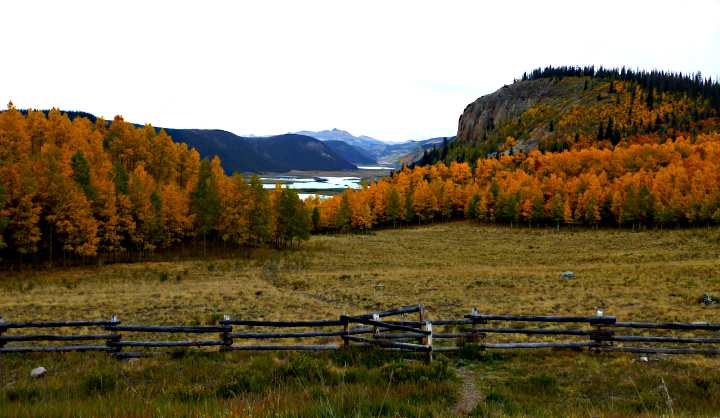
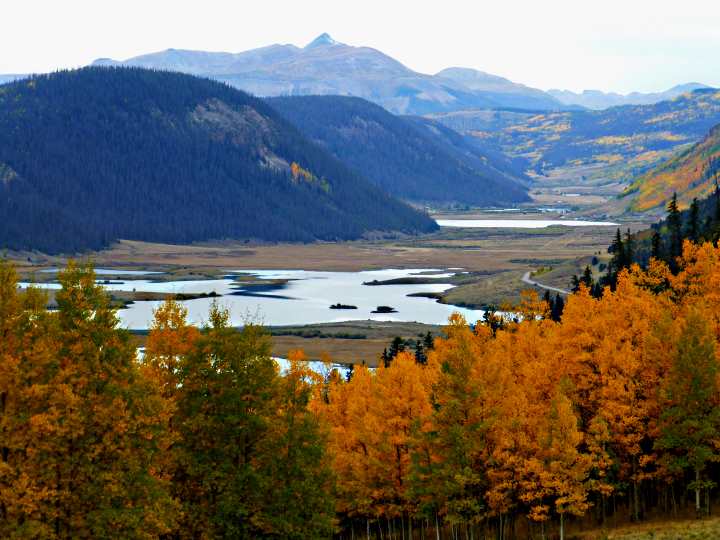
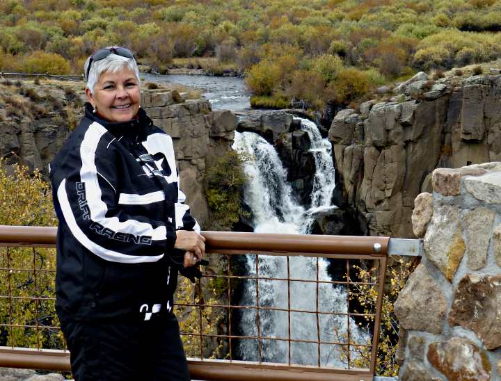
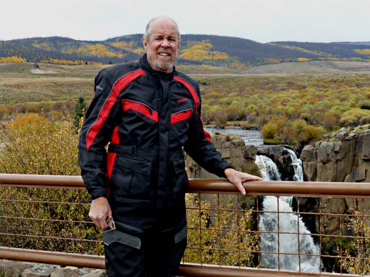
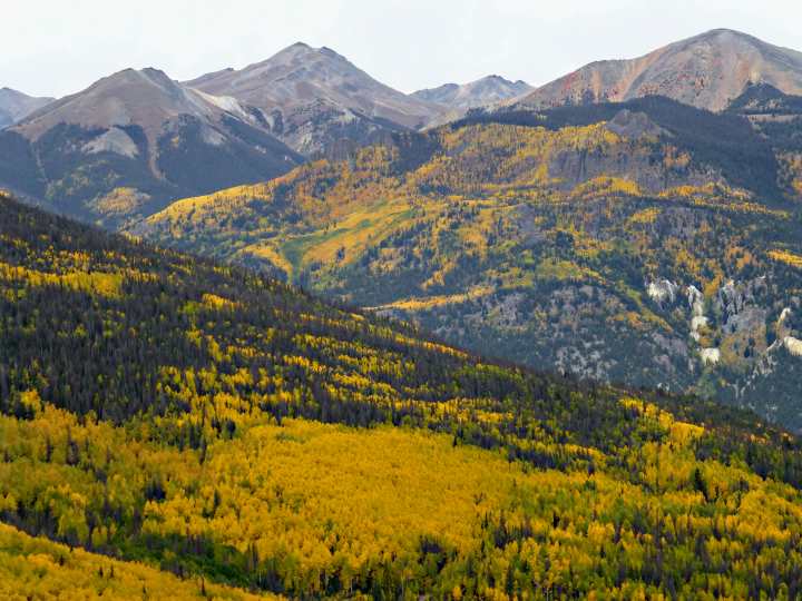
On the way to the first pass, we stopped at a beautiful overlook and had another tourist snap our picture ....
..... then Dottie took some great pictures of ....
.... the valley and lakes in the distance.
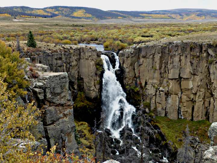
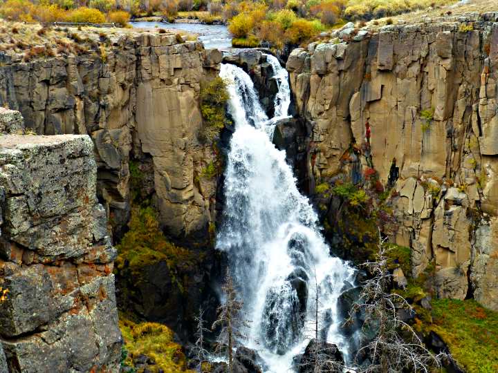
Just a short ways further up the road, we turned off onto a paved road (county road 510).
A short ways down it one will find parking for the overlook of North Clear Creek Falls.
They are the result of a lava flow flowing across the valley in the distant past.
This is a must see stop if you ....
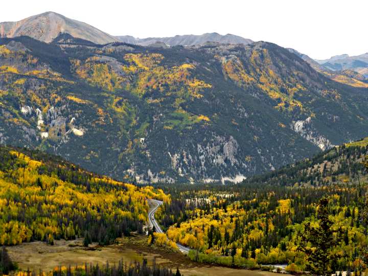
.... make this trip. After the falls, we first passed over 10,901 foot Spring Creek Pass. Then after a slight descent we made our way over Slumgullion Pass, where the road peaks out at 11,361 feet above sea level. Spring Creek Pass was the second time we had crossed the Continental Divide. At Wolf Creek pass we had passed from the Pacific side to the Atlantic side and at Spring Creek Pass we returned to the Pacific side, where we would remain for the rest of the trip.
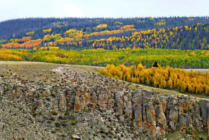
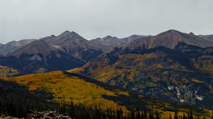
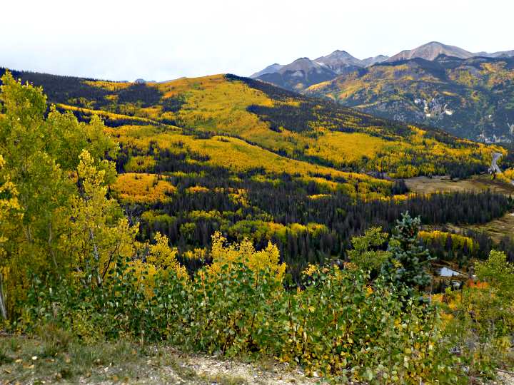
A slight distance past Slumgullion Pass, you come to an overlook on the northeast side of the highway that is easy to miss. Take the time to turn into it as you will be rewarded with some fantastic views to the west.
After enjoying the overlook, we followed the road .......
...as it ...
... plunged down ...
..... into the ....
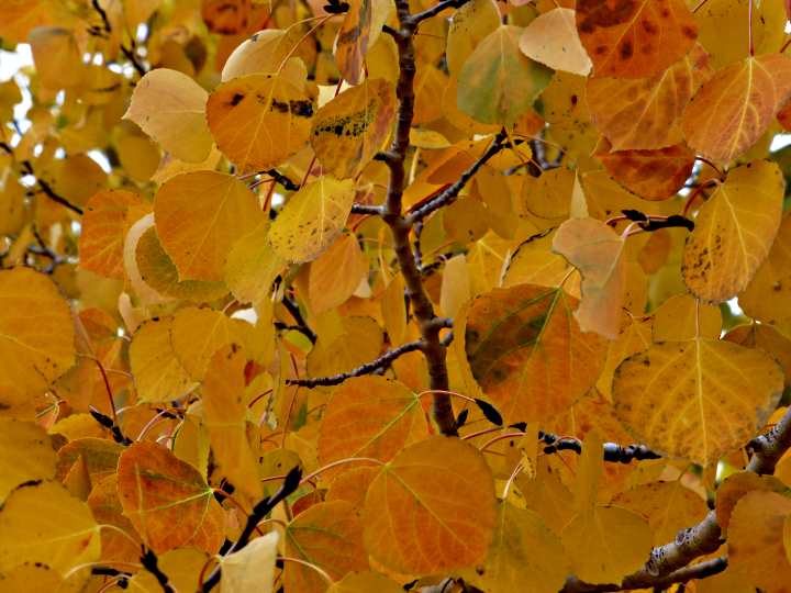
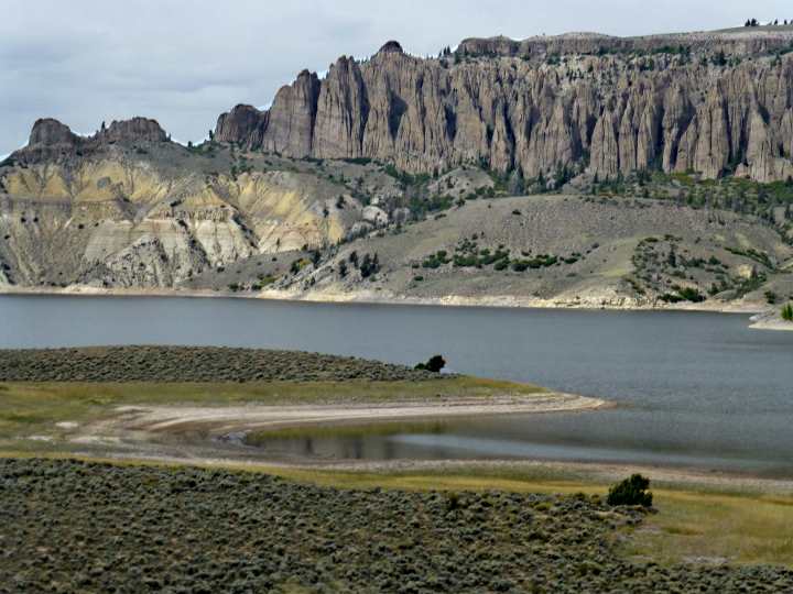
..... the valley of the Lake Fork of the Gunnison River. We passed the little town of Lake City and proceeded north until we finally came to the end of Highway 149. Finding this highway turned out to be a very rewarding visual experience.
Highway 149 terminates at Highway 50 just after it goes over the headwaters of Blue Mesa Reservoir. We then proceeded west on 50 to Montrose, where we checked into a Super 8 for the night. Going to dinner, we got some exercise by walking to the Horsefly Brewing Company and back from the motel, a total distance of 2 miles. Then we turned in for the night with no rain up to this point.
==============================================================
...........................One.........Next Page If There Is One