...................MacGregor Index Page.......... 2015 Bahama Trip Index Page
....................................Previous Page......................................Next Page If There Is One
=========================================================
|
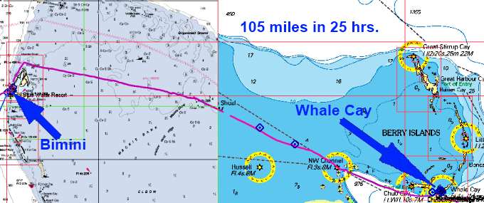
............ .--- Alice Town, N. Bimini, Bahama's --- ......................................................--- to --- ......--- Whale Cay in the Berry's --- ........... |
.....................................................................................................
|
.... ....................(March 24th to 25th) ..Anchorage --- N 25º 24.082´ ==== Trip Mileage = 497 miles ...................W 77º 48.238´ ==== Day's Mileage = 107 miles |
===============================================
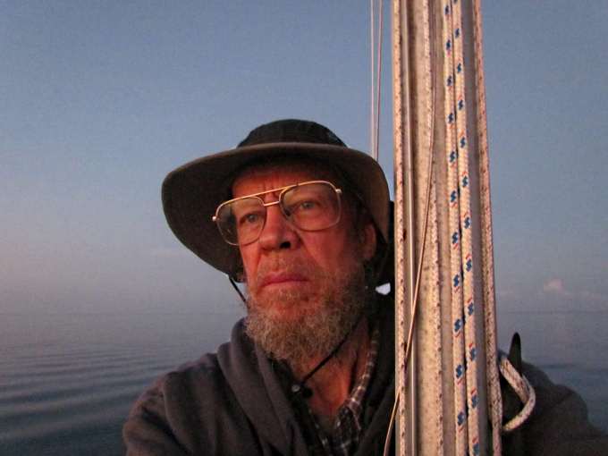
The crossing of the 'Banks' to the east of Bimini was going to probably be my biggest crossing I'd make on the entire trip. There are a couple different ways people do this so no real right or wrong way. Most aren't single-handing the crossing so that also opens options that I didn't have. Mike and Sandy with Chinook went north and to the east and then back south of North Rock and anchored just off North Bimini on the east side and I think then left about 3 in the morning and made it to Bird Cay that night before dark. Bird Cay is just past Chub Cay where you can also stop but the marina there is not cheap. I think that is a good plan for most but it wasn't going to work for me. The weather was changing and I had to leave the next day or probably was going to have to wait in Bimini for the next front to pass and didn't want to do that as I'd made up my mind to ignore my health situation from that day and get going and didn't want to hang around and maybe change my mind. Two other things weighed against me. They can motor with their X between 5 and 6 kts comfortably and I like to run around 5 with my outboard. Also since I couldn't spend a day moving up around to the other side of Bimini I was going to have another 12 miles on the east end of the trip they didn't have and also about another 6 or so on the other end as I wanted to pass Bird Cay and go in at Whale Cay thinking it would be better protected from the coming front (I ended up not being right on that one). So I had a little over 100 miles to go and at 5 mph that was going to be at least 20 hours so it was going to be overnight no matter which way I looked at it. So I would leave in the morning buy no need to leave too early or even have to run at 5 mph as I didn't want to get into Whale before the sun was up some so that I could 'read' the water going in like you are suppose to do and you need the sun to be up some to do that.
I was up at 6 and readied the dinghy, keeping it on the starboard side as I was going to have to run in reverse out of the slip, put the outboard and rudder down and tried to come up with a final plan for exiting the slip and the thoroughfare out to the main channel. I'd finally decided to keep it simple and just run in reverse the 100 yards or so.
Left about 7:30 just before the sun was up and low tide was suppose to of been about 6:30 and was hoping the current would still be pretty slack. Actually it was still going out a little and I went right out without the problems I'd had coming in. I started up the west coast of N. Bimini...
.... passing the work boat above. Looked to me they were dredging the bottom not for a channel but for the bottom itself so they could possibly make one of the Islands bigger. My guess anyway.
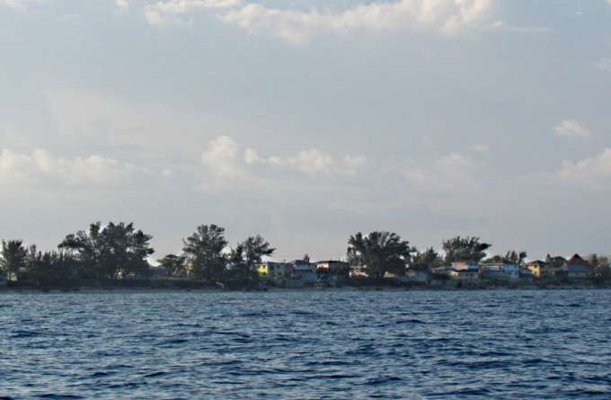
Passed some of the houses in the older part of Alice Town and then...
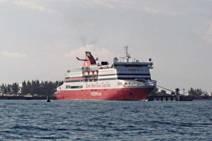
.... past the cruise ship or the permanent casino, not sure which.
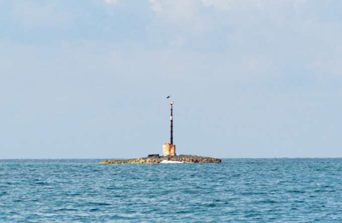
About 7 miles north to come to North Rock and here I'd already passed it on its north side and took this shot looking back at it since the sun had it highlighted.
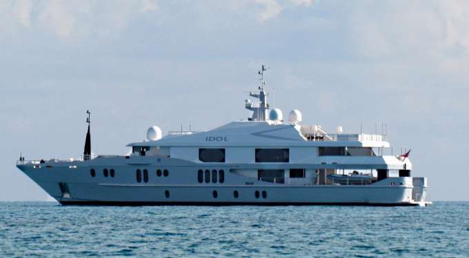
Just north of it was this 'small' pleasure craft anchored.
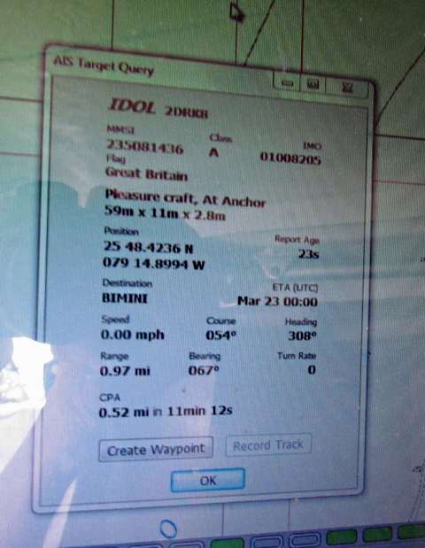
The info above shown via OpenCPN which received the data from the Standard Horizon AIS radio shows it to be about 180 feet long with about a 33 foot beam. This was one of the largest of the personal pleasure crafts I saw but there were a lot in the Bahamas not much smaller. Some of these ship builders must be making a lot of money as a number look really new.
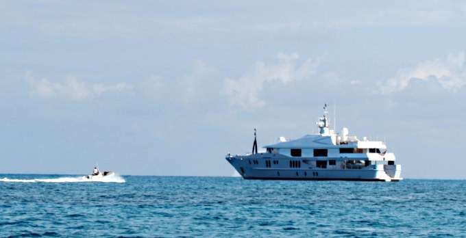
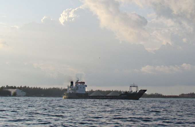
As I passed this inflatable delivered one person out to the ship. Every where you go in the Bahamas you will see these ships anchored some ways from shore in most cases with the exceptions being some places that have deeper harbors. Later in the night they passed me and then the destination from the AIS info said they were headed for Chub Cay in the Berry's.
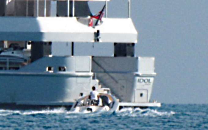
Above they are about ready to off-load the one passenger on that huge rear deck just off the water and checkout the staircase, probably 15 feet wide that goes from the deck up into the boat.
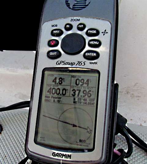
About this point I also logged the 400th mile since leaving the boatyard.
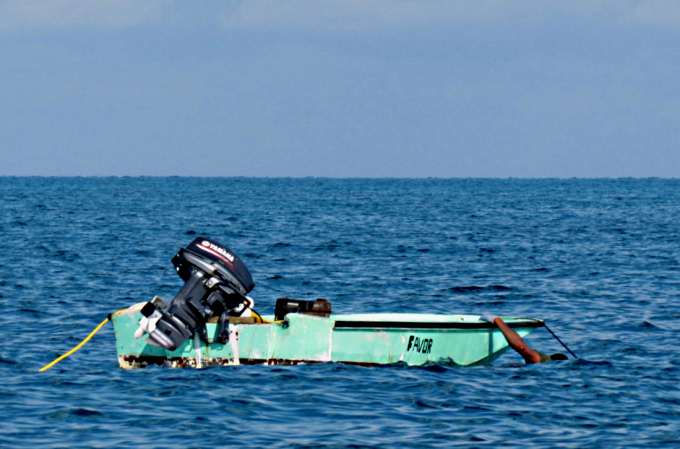
Also I noticed a small boat that didn't look like anyone was with 300-400 yards off my starboard side. Then I saw someone in the water and they were waving at me. Well dumb me wondered if they were in trouble so started over that way only to see them bring something up off the bottom and dump in the boat. They were by themselves free diving and it looked like from a distance maybe they were bringing up conch shells. Seeing what was going on I resumed heading east.
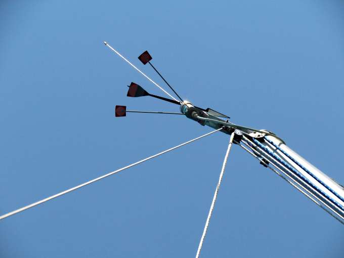
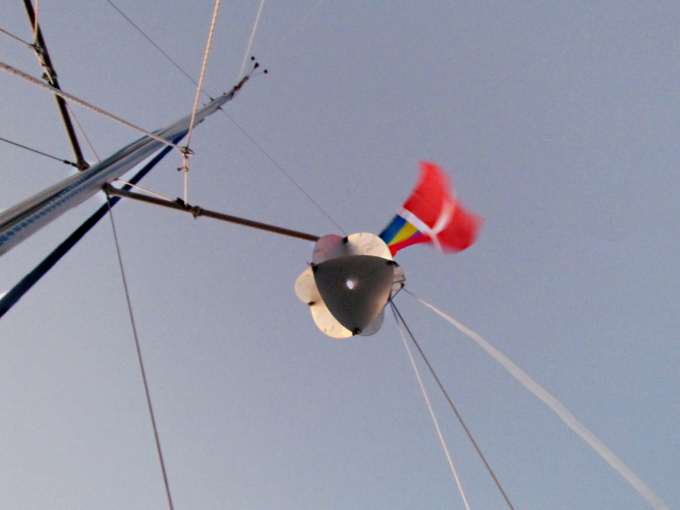
It looks like the wind was on the nose but I think that just the wind from the boat's forward speed was indexing the windex as they was virtually no wind but that wasn't going to last.
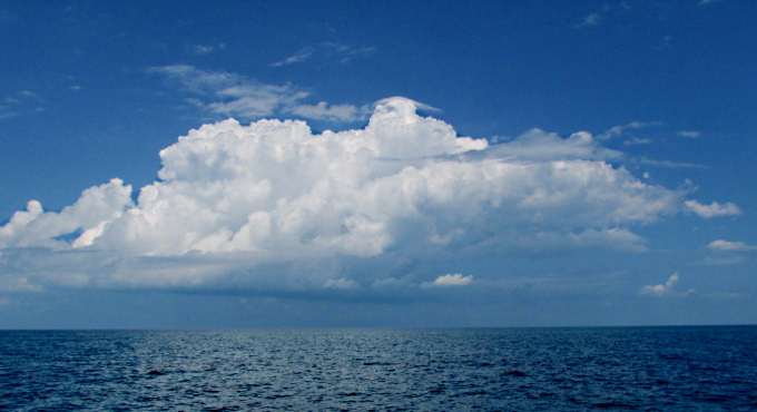
I started to see thunderheads forming like this one to the north that just seemed to sit there forever. Another built in the south and looked much more menacing but I thought it would slide by me and go off to the west.
Then it appeared that wasn't where it was going to go as after I took the picture above I could see for miles to the north, east and west, but not very far to the south. I got out my rain gear but just the top and not the bottoms, a mistake. Soon I could still see for miles to the north but only a few hundred yards to the south. Then the squall hit at about 4:30 pm and I mean hit. The wind was probably over 30 kts from the south and the seas immediately jumped so that I started to get sets of three footers very closely spaced. I couldn't continue East as they were coming in on the beam and really rolling the boat over. So I turned to SE and that helped a lot but the charts also showed a bank not to far to the south as I was coming up on Mackie Shoal where I would also make a slight turn. So I ran south and then NE. The rain was torrential and I became wet everywhere except my chest area. I'd put on my life jacket under the rain gear and it is good gear. About the only place I was comfortable was kneeling on a cushion in the cockpit as the boat was pitching every which way. I never really felt there was any real danger and the boat just plowed ahead in and out of the waves at about 3 kts with the throttle turned up from what it had been running at. Then in about 45 minutes it was over and....
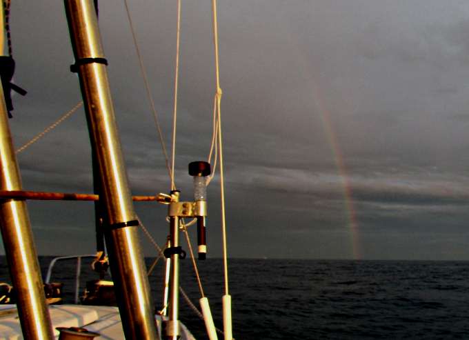
.... the seas started to settle back down as the day was coming to and end. Not a good experience but one more to catalog and remember.
A short video ( HERE ) of just a bit of the motoring the 105 miles from Bimini to Whale Cay. Not much to see out there, just a lot of water and a boat every now and then.
One of the last boats that passed during the day but there were a number at night. This is a well used passage. I'd also considered anchoring on the banks for some sleep but if I would of done that I would of gone a couple miles south of this route where I would of hoped no one was but did see one other sailboat down that way. I didn't like the idea of just going to sleep for some hours so tried the set an alarm for about 15-20 minutes and try and sleep like that. I'd bought a couple of those white kitchen wind up alarms but they weren't going to work they weren't load enough as the outboard just drowned them out. What did work 'most of the time' was my smart phone set on ring and vibrate. I'd put it in my pocket and try and keep one hand on top of it. It worked but twice either I didn't set it right or something as when I awoke I realized it was about 45 minutes later, not good.
There wasn't the big container haulers and tankers I'd seen in the Florida straits but still boats that were plenty big that you wouldn't want to have one run you down. I had my radar reflector up in the rigging buy wondered how much it really helped. I could see most of the larger boats on the AIS but about 4 in the morning the AIS showed a boat ahead of me and approaching on a heading that would bring us very close together. So I see a large boat coming but it seemed too close for the 'target' and it was. I also couldn't figure out the lighting on it and for sure what was going on. Being sleep deprived wasn't helping much either. I finally passed about 300 yards off my starboard side and it was a large vessel towing another fairly large vessel. The light thing that didn't make sense from a distance was that the last light was actually on the towed vessel. To me the tow one certainly looked large enough that it should of had AIS but it didn't. I had my running lights on but will never know if he saw me or not.
Everyone is running towards or away from the Northwest Shoal and the Northwest Channel Marker right were there is a narrow channel where the banks end and you go into the deep waters of the Northwest Channel. I set my waypoints to keep me a little ways off the markers and the Northwest Shoal one is missing according to the chart and I never say it. There are coral heads on both sides of the channel just past the Shoal marker at the Northwest Channel marker so you want to stay close to its location.
As I was coming up on the passage into the Northwest Channel I had a large boat coming up on my stern running about twice as fast as I was. I saw them and their name with the help of the AIS and called and asked if they saw me and he responded that he then could see my stern light. He said he would slow a little and then as I turned slightly in a more easterly direction just past the channel marker he would pass me on my starboard side as he turned a little more to the SE as he was going to Nassau. That all worked just fine.
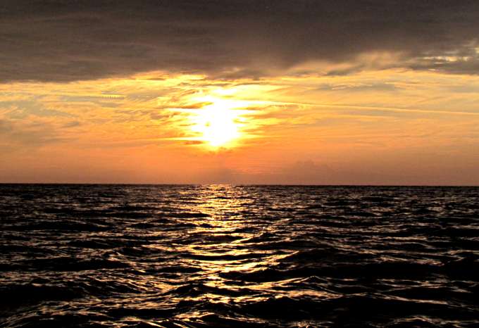
As I started to near Chub Cay, in the distance to the left above the sky started to lighten.
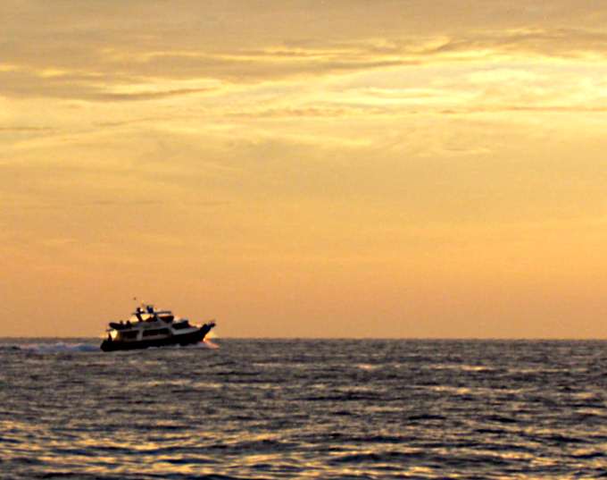
Chub is the light about center picture. Just after I took this I dozed for just a minute or so and when I awoke one of the larger 'pleasure' boats was bearing down on me. I felt I had the right of way but it only took a couple seconds for me to wonder if they even saw me or not so I went hard to port and they passed by about 100 yards ahead of me. That woke me up and I started to take pictures and it was a reminder to really stay alert going by these Cays where boats were entering and exiting.
The water and the light had a surreal feel and look. It was kind of mesmerizing to say the least ....
.... to one wore out and beat sailor but now I was only about 6 miles or a little over an hours from my ...
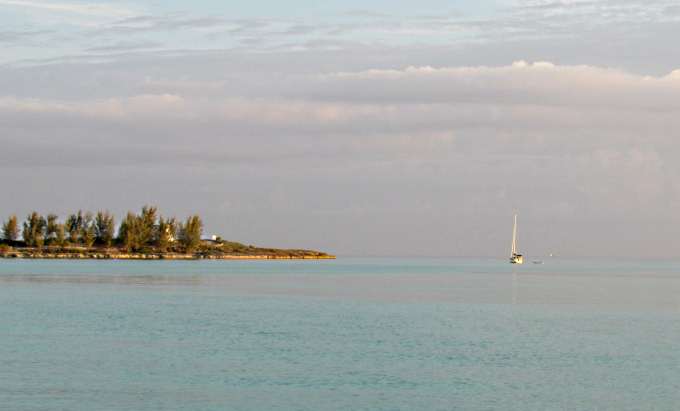
.... anchorage. I arrived at my intended anchorage between Bird Cay and Whale Cay about 8 am or so. This was my first real 'read the water' anchorage in the Bahamas and I hoped to get it right so tried to error on the safe side and anchored about where the 'little anchor' was on the NV digital chart. I did notice the surge symbol on the chart south and to the east of the little anchor symbol closer to the bay opening and felt I'd be protected somewhat from it anchoring further in near the midpoints of the two points, one on Bird and the other Whale. Wrong as you will see on the next page.
I called it quit for that part of the day about 9:30 am and crawled into the V-Berth and slept till a little after 1 in the afternoon. Got up and threw some water on my face and made something to eat. Later a couple in a 35+ foot sailboat came in (see picture above) and anchored down near the 'surge' symbol on the map. They later fired up their dinghy and went ashore to check out the abandon lighthouse and then buzzed by me checking me out but didn't slow. At this point things weren't bad. I was rocking some but the Kera Jane was pointed at a good angle to the waves coming into the bay from the south.
I was too tired to think about going ashore myself so stayed put and went to bed early around 8. I was glad the crossing was behind me and not sure I'd want to do it the same way again. I think I'd either try sleeping a while on the banks or try and station myself east of Bimini if you could go there as if you have an east wind it isn't going to be comfortable spending a night there.
The other option after talking with Vincent would be check in at Bimini and then go down and stage at North or South Cat Cay south of Bimini as you could cross the Banks from there and cut some miles off and that passage isn't used so much. You can also clear into customs/immigration there but the marina there charges you $100 to come in and just use the marina to go to customs/immigration. There are some places t stage there with east wind protection if you have to wait that out.
=========================================================
........................................................................................Next Page If There Is One...