........................MacGregor Index Page.......... 2015 Bahama Trip Index Page
................................Previous Page..........................................Next Page If There Is One
=========================================================
|
--- Whale Cay -- Lower Berry's --- .......--- Holed Up by Weather ---
|
.....................................................................................................
|
...................(March 25th to 29th) ..Anchorage --- See text below ==== Trip Mileage = 497 miles ................... See text below ==== Day's Mileage = 1 mile |
===============================================
Let me start this page by saying never, never use this anchorage unless weather is ideal, winds if any are “not” out of the SE, S or SW and you only plan on staying one night. I got stuck here by weather for 5 days and it was about the worst 5 days on an anchorage I've ever spent. You ask 'if it was so bad, then why stay?'. I got to Whale and hoped to move on the next day but a front was approaching and I didn't feel good about the run across the 30+ miles of open water over to Rose Island to the NE of Nassau my next destination. I listened to Chris Parker's weather report for the next few days and felt I needed to stay put until the next front passed by. I also really needed to rest up after pushing the trip to this point and especially after the overnight 105 mile run from Bimini to Whale. I was beat (remember I'm 71). So with the above in mind let's talk about the days at Whale Cay.
About 2 the night before I awoke to the boat rolling back and forth probably 25 degrees or so and everything in the cabinets slamming from side to side. I got up and stuffed clothing in the cabinets to handle that problem and then tried to get some sleep which was hard to do.
There is a short video of sitting awake in the middle of the night with the surge rocking the boat side to side ( HERE ).
It was like I was anchored very close to say the ICW and large power boats were running along side one after the other. What had happened is that the wind/current, one or the other or both, had clocked the boat around facing east which left its beam being hit with one after the other large waves coming in from the south. Not much I could do about it except hang in there.
NOTE: Later in the trip I found I could help this situation some by putting a second anchor down and pulling the boat around on the rode attached near the stern so that the bow was pointed more into the surge. I also rigged up a platform once in the cabin and slept crosswise in the cabin and that helped and I'll make a platform to take along to do just that in the future. In heavier winds I didn't like clocking the boat using the second anchor as the wind then put a lot of strain on the anchoring gear.
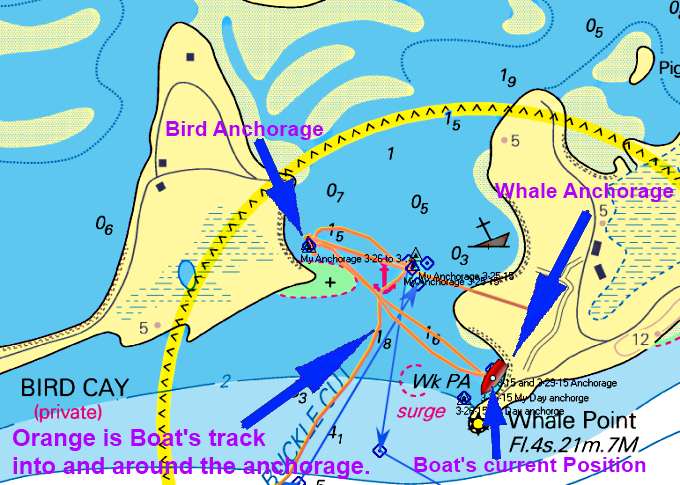
The OpenCPN screen shot above shows the boats track in the first morning and then some of the tracks back and forth between anchorages over the next couple days.
With the bad, probably worst ever, night behind me I had to do something if I was going to stay here and after listening to Chris Parker's weather report felt that I should. I tried first to run over behind the point off the east side of Bird Cay but getting over there the waves coming in from the SE were still running in to that area. So I continued motoring and went back over in behind the NW side of Whale point ( Wed. Day's Anchorage N 25º 23.765´ --- W 77º 48.028´). I was able to suck in about 100 feet off shore and the point was breaking the waves coming from the SE. All was good for a while until the wind started to clock more S and then a little SW.
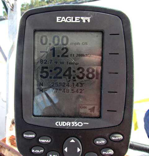
Seeing that this could be another bad night I decided to move back over to just north of the point on Bird that I'd been to earlier in the day. Over there I could see a shelf of shallow water over a sand bar just off the beach. I was in about 4 feet of water when I put the anchor down and thought that low tide was about in an hour at 5 pm. Not sure how I was so far off but low tide was actually around 8:45 and this day had the lowest and highest tide for this period of the month.
I put one anchor down and then found out I could only let out about 50 feet of rode as I was swinging in too close to shore. I pulled myself forward to the first anchor and was able to get off to port of it about 20 feet and put the second anchor down.
I felt a little better but I was anchored exactly how they tell you not to as the wind was trying to push the boat into the rocky shore just behind it.
I did feel better knowing that I had 2 anchors holding me. So as the boat swung towards shore and that shallow shelf of sand I only had about 3 feet under the boat.
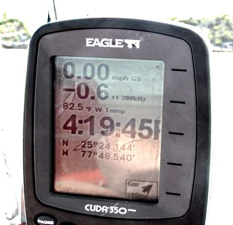
I looked at the tide charts and found out I'd made a mistake on when low tide was by about 3 hours. I really wasn't in a position to pull the anchors and try moving at this point so decided to sit where I was with the sand under me. I have the depthfinder set to where '0' feet is actually just a bit under 3 feet of water under the stern where the transducer is (about where the rudder also kicks). I had the rudder and outboard up as usual and always have the centerboard in the trunk on anchorage.
I watched the depthfinder continue its decline down under 3 feet. Soon the boat started 'bumping' the bottom. I still felt I'd just have to wait it out and wasn't too concerned with the soft sand under the boat. Still I felt I was going to probably loose some bottom paint during this event.
Not too much later I was down to under 2 feet under the boat and it had quit bumping and just sat there. Good thing was that I didn't have to worry about getting blown into the rocks directly behind. Then the depthfinder quit working as it was out of the water.
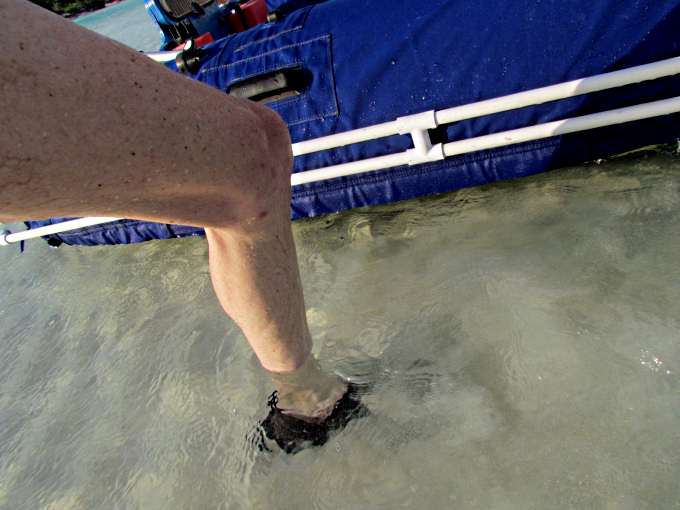
I climbed down into the water to check things out.
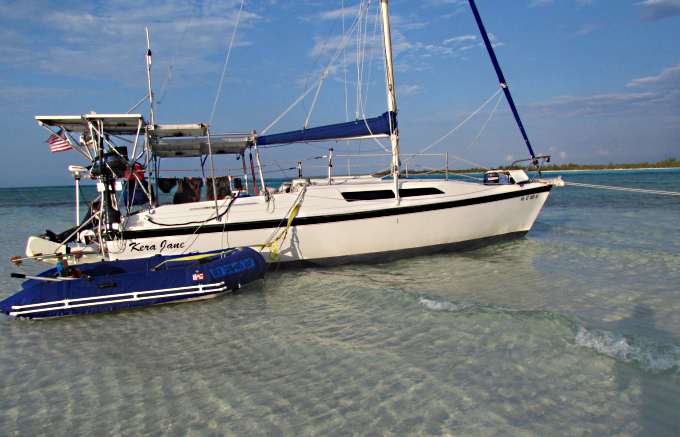
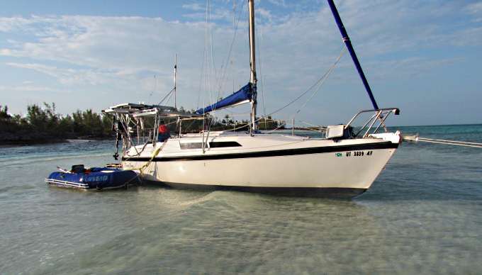
With over 1000+ lbs of water/gas/food and other supplies I started the trip with the boat actually sitting in the water deep enough that you couldn't see the bottom paint if the water was still and I long ago had moved the bottom paint up a couple inches higher than what it was from the factory. So seeing all of the bottom paint showing above the boat was now very much aground, a first for it and myself. It gave me the chance to check for barnacle growth and I didn't see any which was good. Part of the reason for that besides the bottom paint was I'd been moving a lot so the ablative paint was more effective vs. sitting on an anchor a lot.
I also took advantage of the situation by walking the anchors about 75 feet further out into the waist deep water there. I planned on pulling the boat out a little further when the tide came in. I first uncleated one rode at the bow, from standing next to the boat, and walked that anchor out 75 feet further. Recleated it and then did the same with the other. I spaced them about 25 feet apart and also moved claw on the port side a little further anticipating a wind shift. One thing in my favor was the low tides over the following days wouldn't be as low as this one.
With all of that done I could only now wait for the tide to come back in. I was surprised by the over 3 foot tides here. I ate and about 10:30 the boat was 'bumping' the bottom again and soon after that floating. I pulled the boat out about 50 feet on both rodes and went to bed with a day behind me like one I hadn't experienced before. It was an interesting day and ended good.
Thur. And Friday night's I was able to stay on this anchorage ( N 25º 24.123´ --- W 77º 48.516´ ) both nights with no further drama and during this time the wind shifted to the SW then W and then NW over the next 48 hours. Thursday night it rained a lot. I had a couple inches in the dinghy and looks like I need to seal my chain-plates again and maybe the windows on the side. Had about 25 sponges of water under the port settee and about half that many on the starboard side. I took advantage on the water in the dinghy and Sunday filled a wash tub with it and washed towels and clothes using Ultra Joy and then rinsed them with the water in the dinghy. It tasted a little salty probably due to there is always some salt water in the dinghy but not like the sea water. The articles came out fine and seemed no different than if I would of washed them at home.
Friday when the wind shifted early in the evening to the SW the boat's bow swung in that direction but the swells were still coming in from about the SSE and were rocking the boat hitting it on the beam. I took the starboard Manson rode back to a cleat off the side of the cockpit and pulled the stern to starboard until the bow was taking the swells just off the bow. I wasn't going to bed tied like this so about 10pm moved the line from the cockpit back up to the bow. The wind then shifted further to the west and the swell lessened so all was good for a good night's sleep.
Saturday with the wind shifting more to the north and the conditions on this anchorage starting to deteriorate I decided to make the move back over by the lighthouse ( N 25º 23.806´ --- W 77º 48.011´ ) where the cove would give me some protection from the north and then NW winds as they clocked around. I had a hard time getting the two anchors up by myself into the heavy wind and got about half way to the chain on both and gave up and went and put the outboard in forward just off idle with the tillerpilot also running. It wasn't enough throttle to move the boat into the wind but It eased the tension enough that I could retrieve both of the anchors.
Over in the cove by the abandoned lighthouse I again put two anchors down as I was in close to shore with the wind at this point trying to blow me towards it. If the wind shifted to the NE early enough on Sunday and I started to swing away from shore I'd planned on pulling one anchor up on Sunday night which I did.
Saturday was a good day and two small planes flew in low and landed on the landing strip on Whale about ½ mile from the boat's position. About 7:30 pm that night the largest wave ever hit the boat from the side and I'll bet she rolled about 45 degrees a couple times before settling back down. There must of been a large ship go by some ways off shore that sent it in. After that things were good except you could tell the front was going by as it got cold. I had been sleeping with just a sheet on part of the night but had to put two wool throw blankets on top of it. I slept from about 8:30 till 7:00 the next morning. I must of needed it.
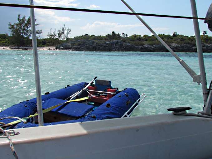
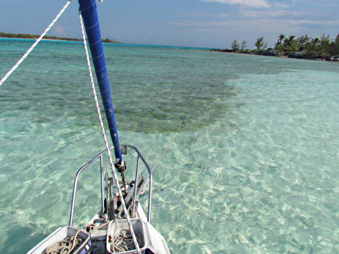
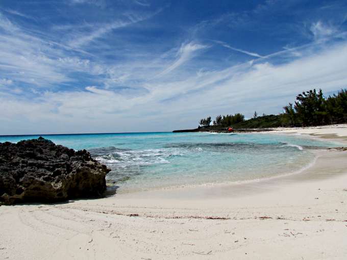
Sunday was a really nice day and with the wind coming in from the NNE I started to feel better about the anchorage with these conditions. I went ashore for about a 2 mile walk and it was really pleasant and the pictures that follow don't really give the total picture of how beautiful it is here.
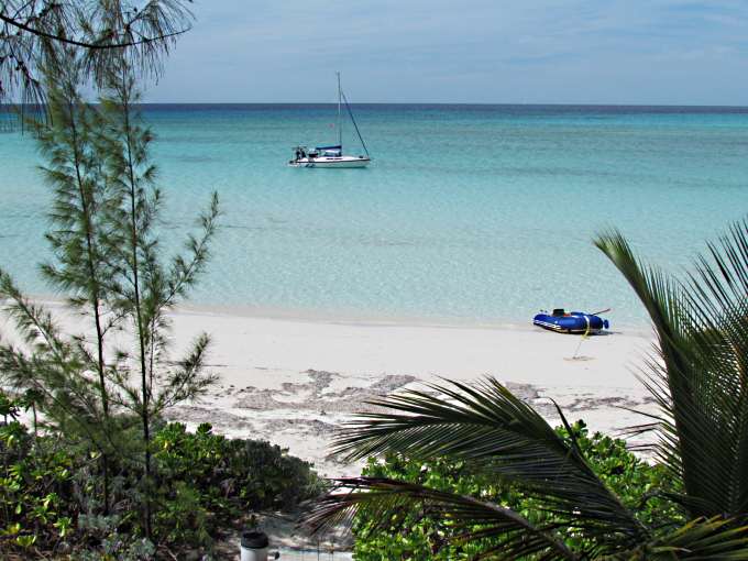
Nice beach just inside of the abandon lighthouse on the bay side.
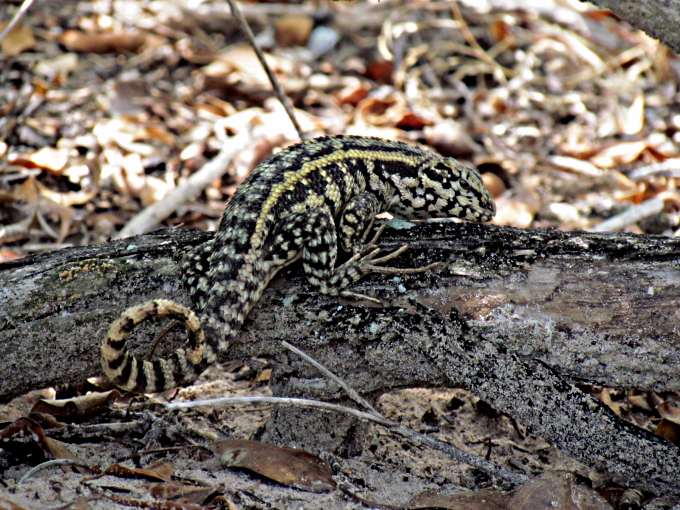
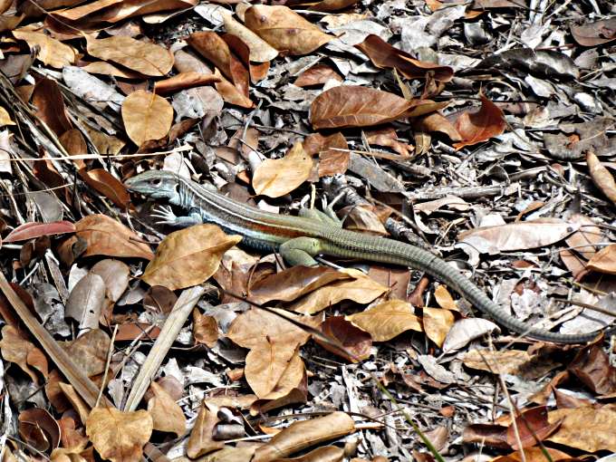
Saw a number of this type lizard with the curled tail. This one was maybe 8-9 inches long.
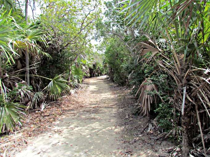
I followed a primitive road north along the islands west side until it ran out and then a ways further but it got hard going. The brush is thick and since I hadn't been on land for a couple weeks my balance on something that wasn't moving wasn't great and I didn't want to fall in this coral and cut myself so quit.
I then followed the road off east.
The other type lizard I saw on the walk, again about 9 inches long.
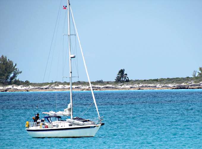
While I was walking and circled by the lighthouse another boat came in and anchored..
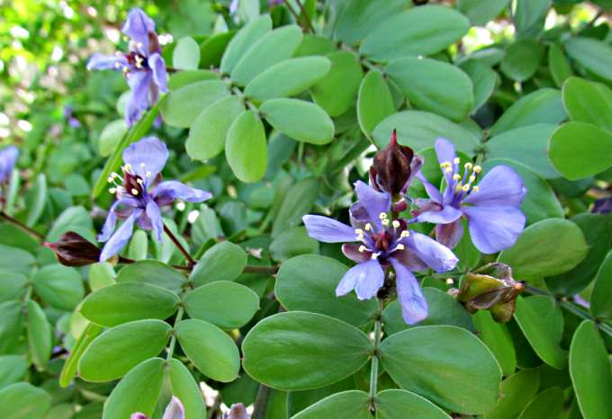
There wasn't much in the way of flowering plants. This was actually a tree in bloom.
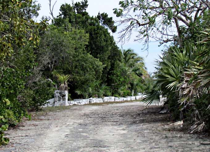
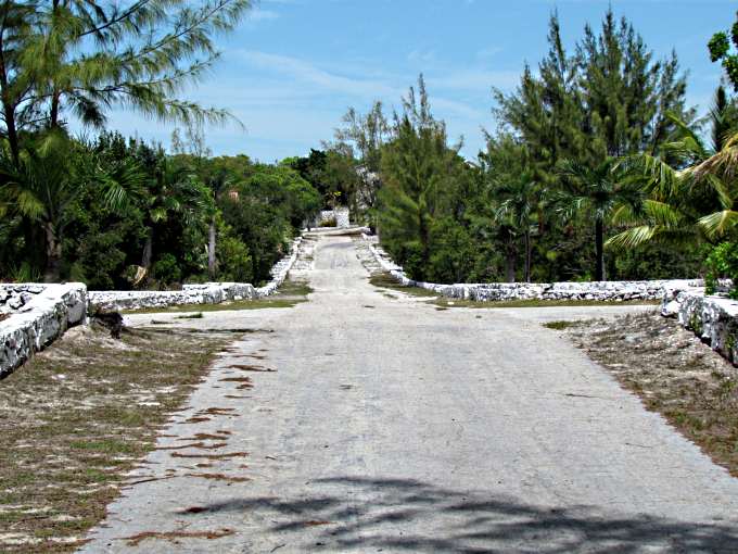
Down about 1/3 of a mile I hit pavement and an area...
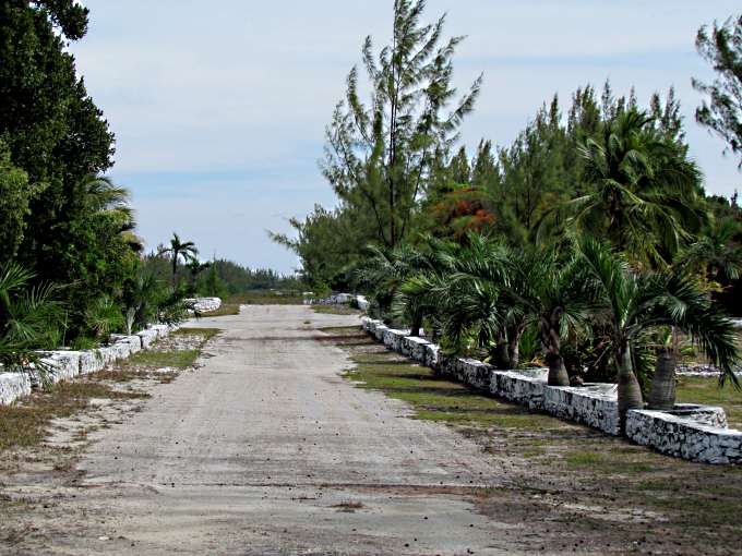
... that someone put some money into. The person who had the money and bought the island and others in the Bahamas was Marion Barbara 'Joe' Carstairs who was a very interesting lady who dressed as a man, was a very successful power boat racer, was openly lesbian, had numerous affairs with some very famous women and supported famous land speed record cars of the time. More about her (HERE). I'd like to thank Russ for doing the historical digging about her and the island.
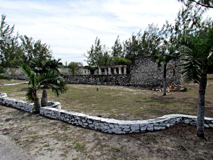
I take it that this was .....
.... a commons type area for entertainment.
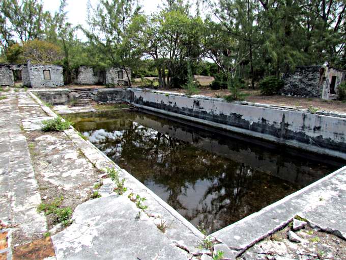
... there was a large swimming pool ...
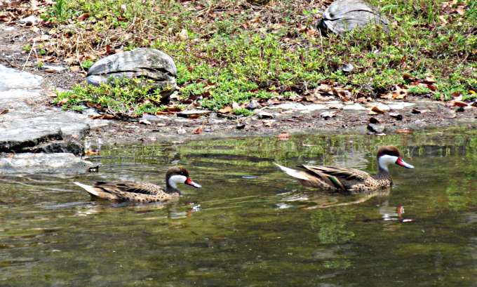
... which two ducks are using for there Bahama home.
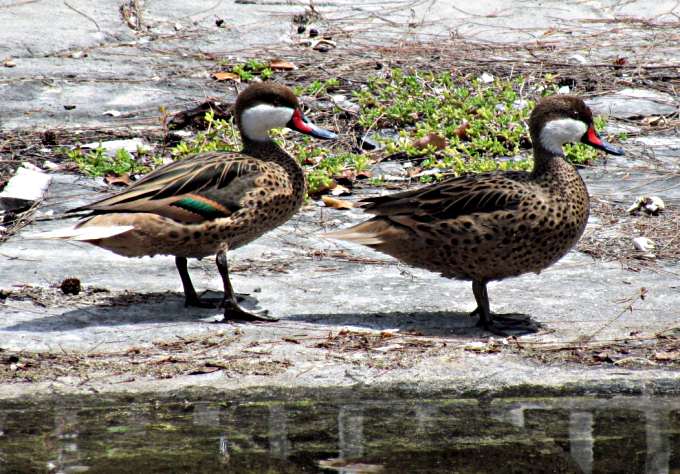
I don't know ducks but these are the prettiest ones I've ever seen. No babies around that I could see. I later found out that the ducks were Bahamian White Cheeked Pintails, thanks to Mike (Chinook).
The main road goes to the left and right and the one straight ahead I think goes to the two houses.
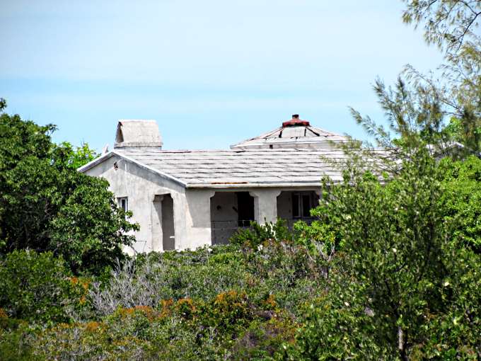
At least I could see one off of it and the map shows a second.
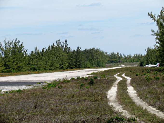
Just to the right of that intersection is this runway and it ....
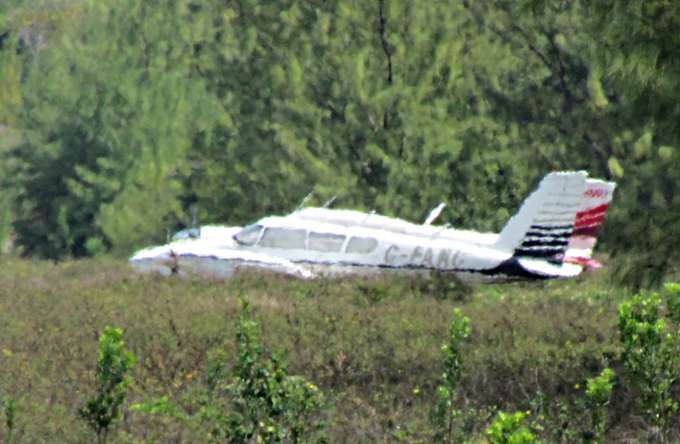
had two planes parked just off of it. I saw two land the day before but only one of these looked like one of the ones I saw land. No other evidence of people and I didn't go looking as I wasn't sure if I should be walking around or not. Bird Cay is marked 'private' on the chart but I didn't see that about Whale.
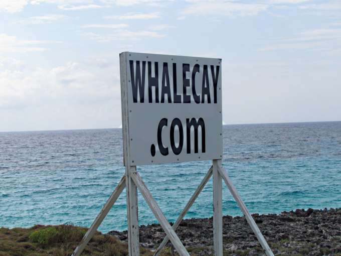
Also it looks like they are looking still or again for investors by the sign above.
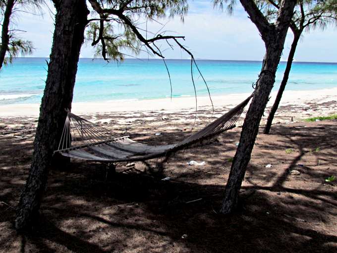
A nice beach on the ocean side with a hammock that hadn't been used in some time.
A view towards the lighthouse that is visible between the trees at the point. Also note the red object in the rocks over there just above the waterline.
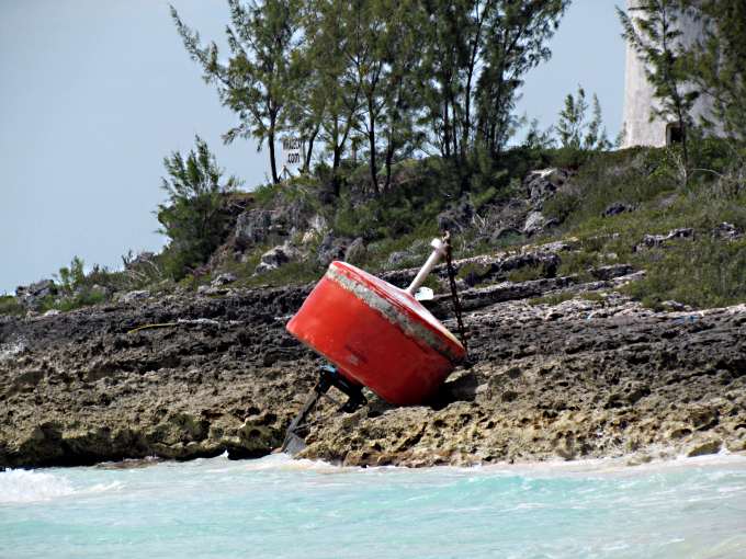
A channel marker that has washed ashore from somewhere. You can tell that there is some huge storm surge as there is wave driven junk from the ocean way inland at places and it has even washed up and over the road near the beach and back out on the bay side some distance to the north.
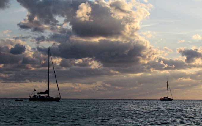
Later in the evening a second, and last, boat came in. The first I'd seen for a few days, signaling that maybe it was time for me to move on also.
I'd been listening to Chris's weather reports and Monday, the next day, was looking to be good to make the SE 45 mile run to Rose Island and if not then Tuesday. He doesn't broadcast on Sundays so I'd be ready to go on Monday and listen to the 6:30 broadcast and go if it looked good and if not then hopefully Tuesday. After Tuesday the next front was coming and I didn't want to be here to sit through a similar situation again.
Talking about Chris Parker and the great job he does on very detailed weather reports if you go to the Bahamas you want to make sure you can take advantage of his reports because they will be about the only weather you will have. At home we take all the weather on the TV, the NOAA on the VHF and the Internet and all the other weather we can get at any time with a computer, radio or smart phone. Well you get to the Bahamas and that is all gone in most places so get a radio that can receive SSB (single side band) transmissions and learn how to use it. Here is what others have used and what I found to work well.
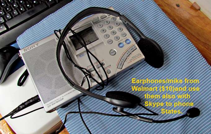
Sony shortwave radio and earphones from Walmart (only the earphones). The earphones make it much easier to understand the audio. Get them. I also use them with their speaker with Skype. To call U.S. Landlines from anywhere in the world just costs $3.00 a month and I signed up for that and it works great if you have good Internet. I'm writing this on the trip so can't tell you how it works other places but in Bimini I was hooked up to a marina's wifi with my long distance wifi (see this site elsewhere) and the calls were perfect.
There is also a jack to plug a recorder into and I wish I would of bought one so that I could of replayed a part of the broadcast if I needed to. I did have a handheld recorder (USB type) and could record on the smart phone I had but then I couldn't of used the earphones and they make so much difference I didn't want to do without them so developed better shorthand to write predictions down as I heard them.
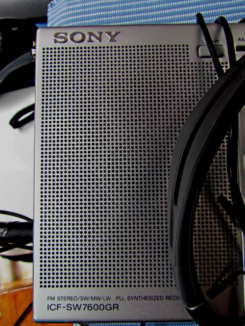
Above is the radio's model number.
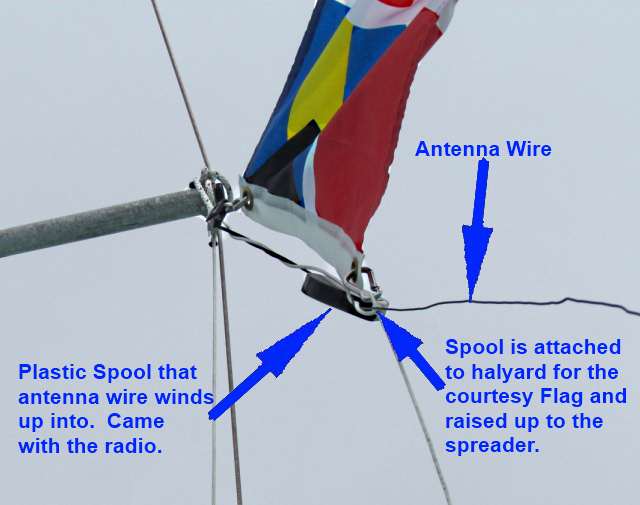
Mine came with an antenna that is housed in a round plastic spool container. You pull it out and spool it in.
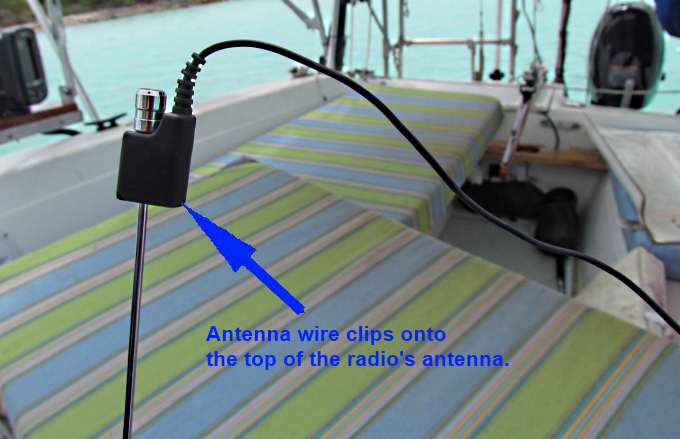
One end then clips on the radio's antenna. It helped some places and others the radio worked fine without it.
I did find that I had something in the boat causing interference. It was one of those cigarette type plugs that you can plug USB type devices into to charge them or run them. I unplugged it when using the radio and the interference when away. The hand-held Garmin 76S also caused a little interference and the fridge caused a lot if it kicked on? I'd experiment. Chris came in good on 4.045 UBS but he also broadcasts simultaneously on 8.137 USB so you can try it also. He usually starts the Bahama report about 6:30 Florida time after he finishes with the Caribbean report.
Read how to program a frequency in and how to save it as a preset frequency. On the right end of the radio have the switches set to 'SSB' and 'USB' and go to the frequency and then use the fine tune knob on the right side. Turn it very slowly. I could barely get Chris at times on Florida's west coast but once in the Berry's and onward received him fine. Go to his web site for more info. If you don't have a radio like this you will be looking at the sky and giving it your best guess and that isn't a good situation to be in.
=========================================================
...........................................................................................Next Page If There Is One..
......