.....................MacGregor Index Page.......... 2015 Bahama Trip Index Page
..................................Previous Page.......................................Next Page If There Is One
=========================================================
|
..........--- Atlantic Side of North Key Largo --- ......................................................--- to --- ......--- Alice Town, North Bimini, Bahamas ---
|
................................................................................................
|
............. .....(March 22nd to 23rd) In a Slip --- N 25º 43.491´ ==== Trip Mileage = 390 miles ..............W 79º 17.871´ ==== Day's Mileage = 75 miles |
====================== March 22nd ==========================
The 'big day', the Gulf Stream crossing which gives boaters anaxity and I had some myself. Hate to say it but this was actually one of the easier days of the trip. The forecast was for seas under one foot and SE to S winds of 10 kts.. Well to get this out of the way the seas were basically flat and the wind under the 10 kts.. The real drama was the start of the trip in the dark with maybe missing flashing markers and at the end going into Bimini under heavy chop with an outgoing strong current against the wind (at that point) driven chop. Well there were a couple large ships that kept things interesting. So let's begin 'the crossing'.
I went to bed about 7 hoping to get up at 3 and underway. I was in the Atlantic waters off North Key Largo but not much wind so the exposed anchorage wasn't bad except for boats going into Anglefish Pass nearby sending off wakes that would rock the little Mac. I got asleep about 7:45 and then at 8:30 pm was awaken by the phone. It was my safety counselor, ship's supplier, and good friend Scott who wanted to give me some last minute advice. I took the advice into note as Scott has a lot more expeience than I and went back to sleep, quicker this time. I awoke at 2 and knew I wasn't going to get back to sleep this time so got up and ate some cereal and got the boat ready to go, rudder down, centerboard down a little, outboard down, both chartplotters running, auto-tiller mounted and turned on and finally the anchor up. I was underway in total darkness with only a little sliver of a moon.
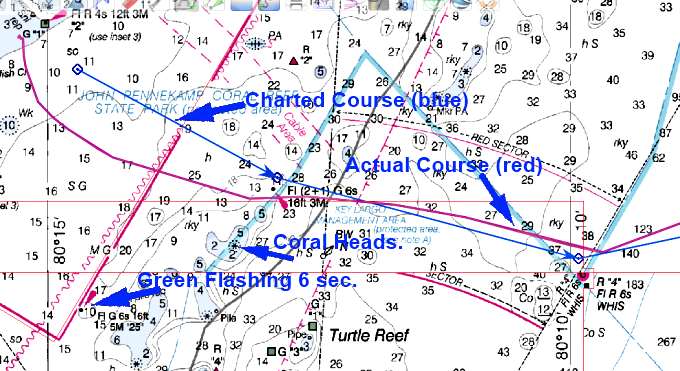
There was a Green Flashing light that I would head for and I'd set the first waypoint for just north of it, not a good idea to run into things like this. Well when I head for the waypoint using the waypoint the light was off considerably to the starboard so I started running more towards the light. Things just weren't making sense as I was going more and more off the course the chartplotter said I should be taking. So I had to decide on one or the other and chose the chartplotter. There are coral heads in this area and I didn't want to run aground on one. I started to head back to the plotted course and tried to forget the light I was seeing.
If you look at the chart above you can see my course actually went south by a little bit of the light I was suppose to be seeing, marked Fl (2+1) G 6s. Never saw it so don't know if it wasn't working or just not there anymore. The light I did see was another one south of my course. If I understand how they work they were both suppose to be flashing every 6 seconds. I need to study up on that more.
So now ahead of me at my next way point was suppose to be another flashing marker, R “4” Fl R 6s. Never saw it either and I should of passed it within .1 of a mile like the previous one I never saw.
I got the boat running on a heading of 78 degrees and set the auto-tiller-pilot on that and sat back, didn't go to sleep as I was pretty wired about all of this but glad to be out past the coral heads.
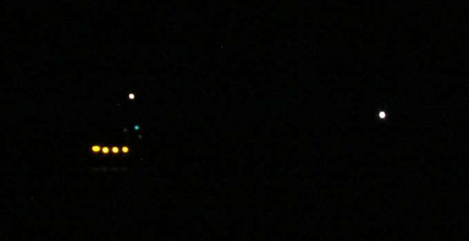
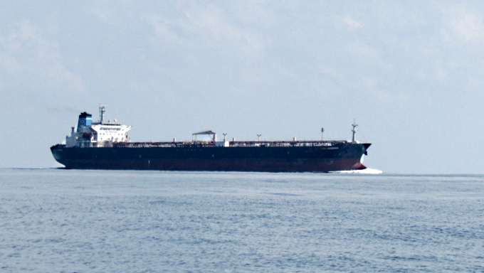
I soon started to see large, large ships being plotted onto the chartplotter screen by OpenCPN and the Standard Horizon radio with AIS. The radio is connected to the computer running OpenCPN with a serial cable that transmits the NEMA 0183 sentences from the radio to the computer. Sounds complicated but it isn't, just a couple wires from one to the other.
I had studied ships lighting at night some but a few times the lighting on these large ships would confuse me as I was use to the Red/Green to be on the bow of the boat and on these large container ships and tankers it is near the stern. So above we are looking at the starboard side and the ship is headed off to the right. This ship was plenty far out that it didn't concern me but later a few did. Three large ships passed by ahead of me in the dark but the closest was about ¾ of a mile ahead when we passed on our closest CPA. I did call that one when he was still north of me, more for practice than anything and he responded and said that he saw me and there would be no problem. I like the AIS a lot and you will hear that more than once in this trip report.
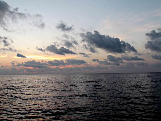
Dawn started to come finally about 6:45 and I was out in the stream and it was evident on the boat's speed.
As you can see thought at this point the water was still flat as could be.
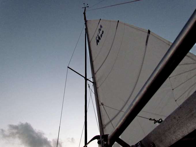
Finally I got a little north wind, it was suppose to be SE but I guess when they predict variable that is what it can be. I was running a little over 6 kts with the stream's help of course on just part throttle on the outboard. I don't think the main was doing much at this point.
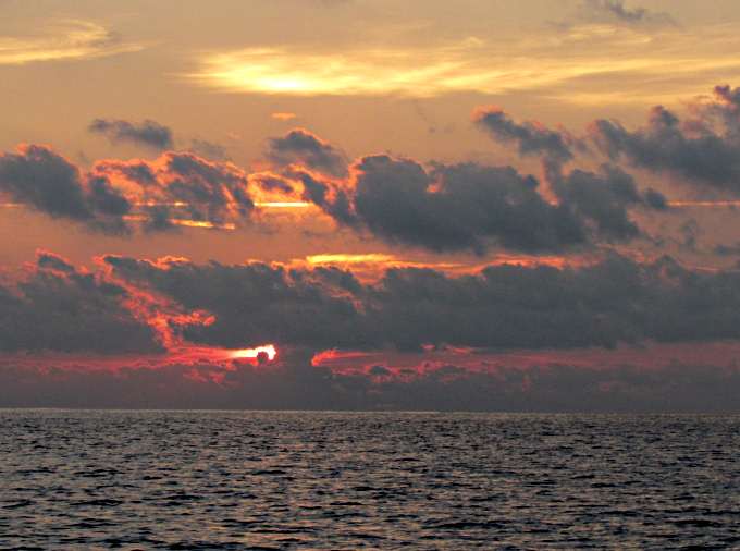
The sunrise was spectacular but almost all the sunsets and sunrises are so there will be photos of more.
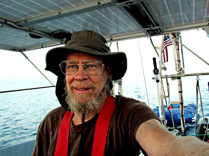
The captain, crew, first make, cook and bottle washer and hopefully at some point a better sailor.
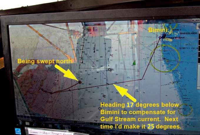
Above you can see the reason for the heading of way south of the intended destination. I should of even made it a little more southerly.
Then as the day went by, morning, more large ships and ...
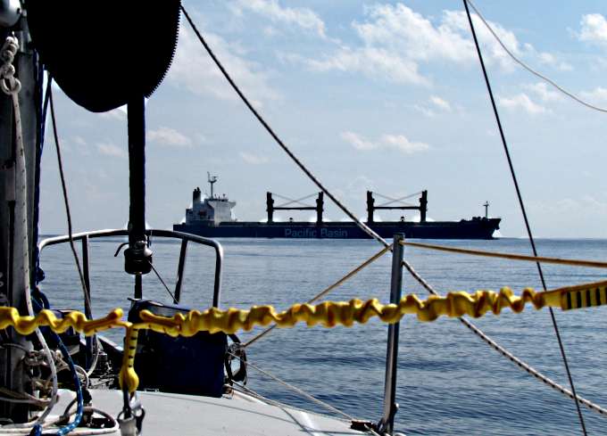
..... they look large even from some distance.
.
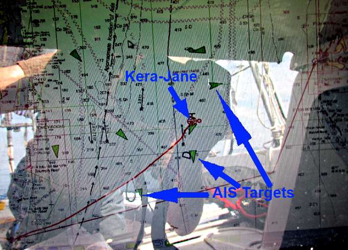
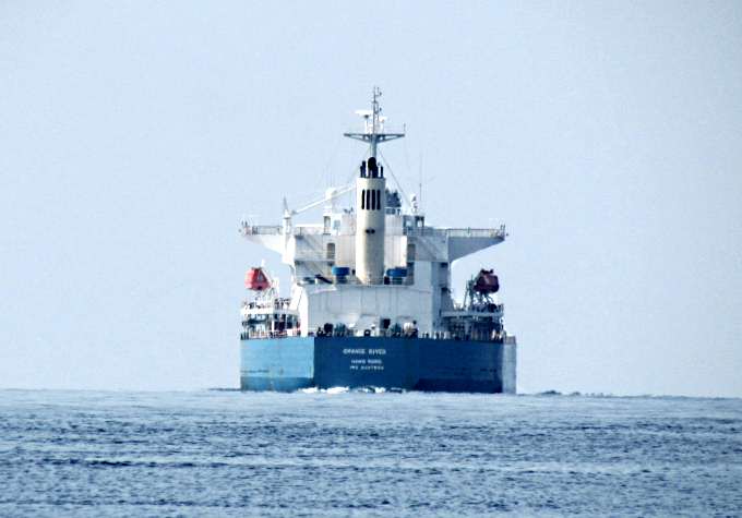
OpenCPN figures if you are on a potential collision course and gives you a constant update on your anticipated CPA (cloest point of approach) and will turn the ship in question red from the green and shows where you might contact each other. This happened with the ship just below Kera-Jane's position above. I contacted them and then they saw me and asked me to slow and turn to port so that we would pass to starboard. You can see where I did that right where that 'current arrow' is on the chart. Once I did that the ship went back to being 'green' again and all was well. You don't want to be in a position of doing this at the last moment as they are going too fast and you too slow. Visually it is hard to tell how much room for error you have. You can do the 'see if it is moving in relation to a fixed spot on your boat but you usually are crabing into the current or the wind or both and it isn't as easy as it seems. Get AIS capabilities and make sure you can use it on/with your chartplotter and not just the radio and use it as another tool to make your trip safer.
After running north to clear the ship and then with the 'stream's current' having more effect than I thought it would in closer to Bimini I had to turn more to starboard and crab into the stream more and that slowed things down. More on that further down the page.
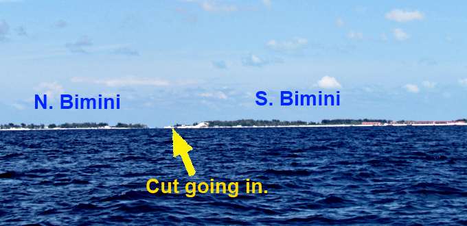
Finally I could see North and South Bimini starting to arise above the horizon.
Here again the chartplotter really helps in knowing where you are headed as the entrance is not very clear until you are almost right on it.
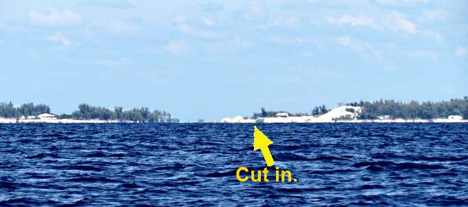
As you go in you pass the newer development that has taken place on South Bimini. As you can see the wind had picked up during the afternoon and was driving waves, not big ones, north and when they hit the current coming out of the cut it was a real mess with waves in every direction and the current was strong. I was running over 3/4's throttle and could only maintain a little over 2 kts. Like that.
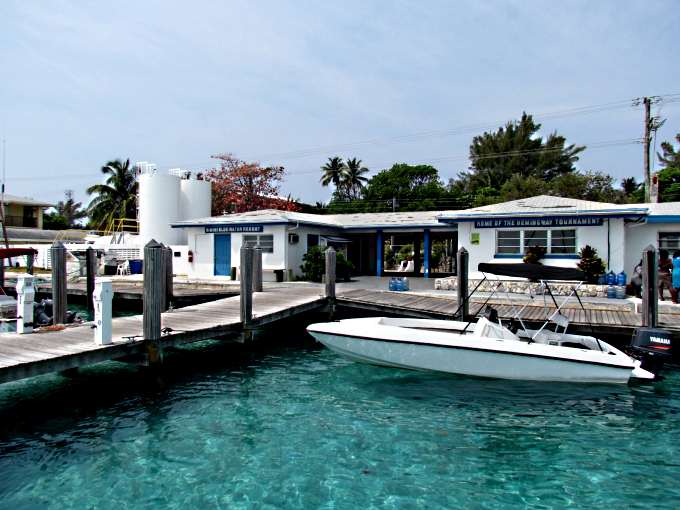
I had hoped for a slip at Blue Water Marina and tried to reach them repeatedly via the VHF with no luck. As I had neared Bimini a larger sailboat had caught me and I asked them if they had been in before and said I'd follow them. Well it was their first time also and they moved in faster than me. When I was at the entrance to the cut a large sport fishing boat came in and dove in ahead of me and that actually worked well as I could see which side of the channel they favored, which was towards the red markers off to starboard.
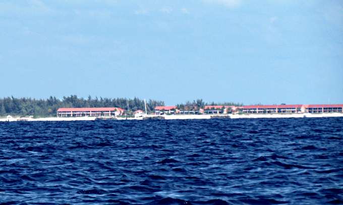
So I work up into the harbor and can't find Blue Water and can't raise them. I get up aways and see that the sailboat that had passed had pulled into a marina and figured I'd try the same place so did the tight circle back and approached the marina and saw the sign, which said “BIMINI BLUE WATER MARINA” , so maybe they hadn't answered because I didn't put the “Bimini” before the Blue Water before, or maybe that wasn't the problem.
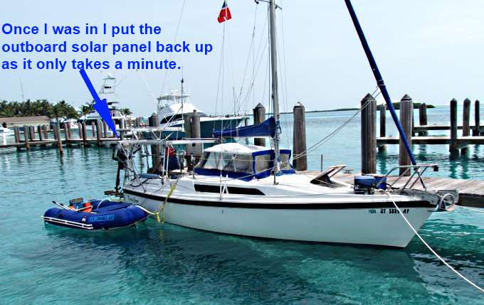
I yelled at a guy on the dock if they had a slip and he motioned to me to follow him and he jumped on a bike and headed to a slip in as far as you could go. Well I hate this as this is only the second time I've ever come into a slip like this and the other was over 4 years ago. I take my time with the throttle and forward and reverse and having the outboard's tiller connected to the rudders's tiller gives me good controll. I had attached stern lines, bow lines and spring lines before entering the harbor so was all set and would of gotten in first try but I missed the dock hand when I threw the line and it was only like 8 feet. Felt like an idiot and fell back some in the current and such and tried again, with success this time. We tied off two bow lines and the two spring lines (you need these with the 3 foot tide) and one stern line and I was in Bimini. I had also remembered to swing the two outboard solar panels over and on top of the center ones. I also had my quarantine flag up.
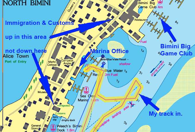
I got custom's and immigration paperwork from the nice guy that had helped me and filled it out the best I could leaving some things blank that I didn't understand. I walked a block or so down the street to custom's and they helped me complete the paper work and were really nice. A young staff that made you feel welcome. I didn't have the exact $150 for the cruising/fishing permit you get from them so it cost me $160, so have the right amount on you. Then it was off another block or so to Immigration where a nice young lady stamped my passport and gave me some other paper work to keep with me.
This all went smoothly and I had made it to a foreign country in my own boat. That felt pretty good. Enjoyed the moment and ate and was off to bed.
============= Some Crossing Info =============================

Some notes on a stream crossing and this is from other sources and what I used. You don't want to try and maintain a heading directly to Bimini regardless of if you cross further south like I did or closer to Miami. Your course should look like a “S”. If you try and run a direct heading you will be crabbed more and more into the current and your speed will really slow down. Bear south and you will run south of the true heading for a ways until you get into the stream. Then still on the same heading it will start sweeping you north until you are above the true heading, middle of chart above. Then as you come out of the stream you will start bearing back south towards the true heading and end up in Bimini if you did it all correctly and you will have good speed all the way as you won't be fighting the stream.
Just past midway where there is an 'arrow' on the chart and I veered north to let that ship pass that moved me further north than where I wanted to be and as it became more evident to me I finally had to turn more east and slowed fighting the stream that was still working to some degree over there. You can see where I did that between the two smaller arrows. Once I figured I had moved far enough east I started back on the original heading or close to it. If I had it to do again I would of set my heading another 10 degrees further south of Bimini to start with as it would of been easier and fast to of corrected by having to run more north at the end of the run. Before you cross get on the Internet and study up on this some. How far you choose to head south of Bimini will relate also to your intended speed while crossing.
===================March 23rd =============================
My night tied in the slip went well and I slept well. Above is the office to the right side and the heads and showers are to the left. They were clean and I didn't notice them to later in the day and by then wasn't well so no shower but it would of been nice.
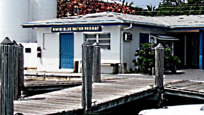
The picture above isn't great but the idea is if you hail them on the radio maybe ask for Bimini Blue Water Resort and not 'Blue Water Resort' like I did.
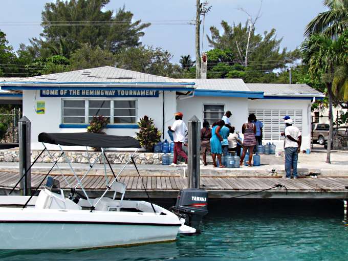
A lot of people came by in the morning to fill water. Not sure what they were paying but the office told me 40 cents per gallon. I didn't need any but the price wasn't that bad.
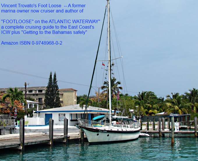
The second night I meet Vincent who owns the boat above and has a nice book on the ICW. He is an ex-marina owner and sold Macgregors and Ventures. He was interested in the Mac and commented on the heavy anchoring gear. He was waiting for his son to fly in and then head to the Exumas. I hope to run into him again and I'm giving more and more consideration all the time to running up the east coast with the Mac.
The water of course was very clear and this is a nice marina. They were charging $1.00 per foot but had a $30 minimum. I felt that it was very fair and might of stayed another day or so if I would of felt better and I also wanted to move on before the next front came, which was suppose to be within a day or so.
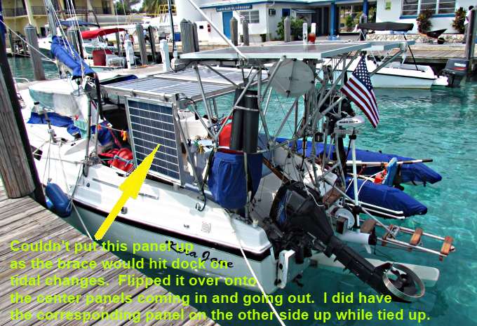
I flipped the port side outboard panel off the center ones and was going to put it up but the diagonal uprights were going to hit the dock so just left if down. That way I still had sun on the 4 center ones. Since I wasn't using the trolling motor I kept the outboard panels switched to the house bank so that gave a total of 320 watts going to the house bank and 240 to the trolling motor bank which I also used a few times as the house bank at night.
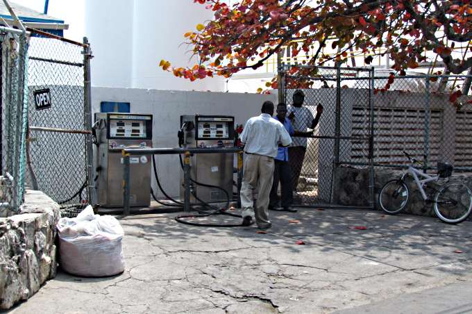
I topped off the main inboard 20 gallon tank with one of the 5 gallon containers I had and then took it over and had it filled (about $4.50 to $5.00 gallon--can't remember). The pumps are on the street but they can pull a hose back beyond the wall behind the pumps and fill a boat there. They are the only ones on the island selling gas period. I see other marinas have fuel so I guess it is just diesel at them. Everyone is really nice and friendly.
For gas I had the 20 gallon inboard tank I had installed (see site elsewhere) and two 5 gallon containers and one 2 gallon containers and a 2 ½ gallon tank in the dinghy. I kept the two 5 gallon containers on the port cockpit seat just aft of the traveler. The 2 gallon container was kept on top of the gen-set just to port of the motor well and above it. I considered keeping the two 5 gallon containers forward but since I was alone I had plenty of room in the cockpit and I didn't want to mess up my vision forward. Also as it turned out on some of the runs they would of taken a lot of spray. The whole front of the boat was covered with salt at times. I'd wipe the deck down and the sides when I could wade around the boat in a shallow anchorage.
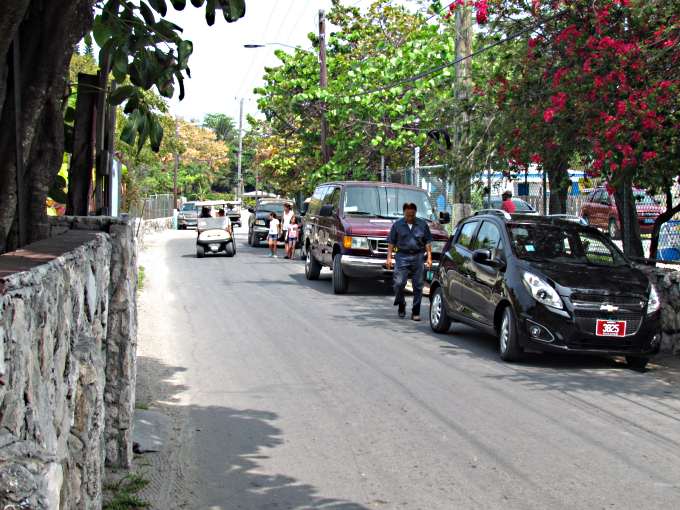
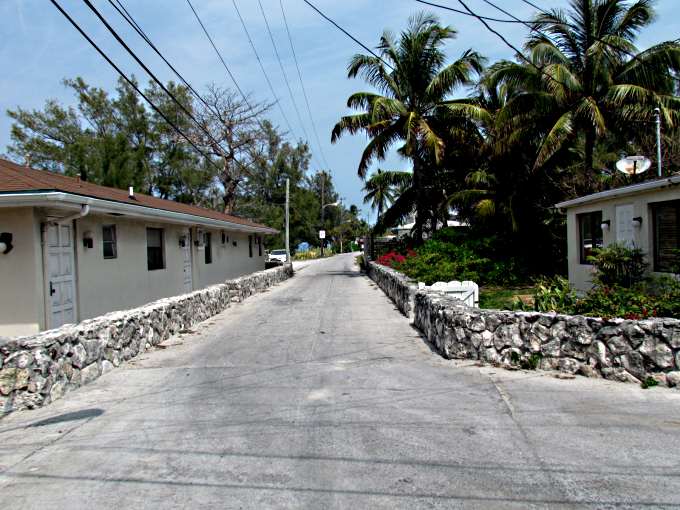
From what I could tell in this part of the Island there were two north-south streets. The one above, looking north, Kings Highway which ran right in front of the marina and ...
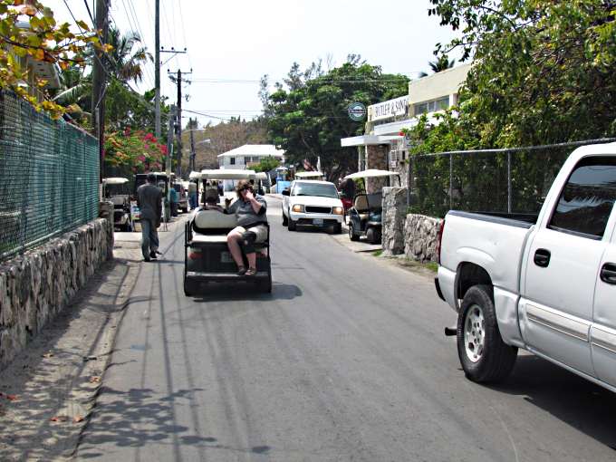
... looking south. This road was the low side of the island as ....
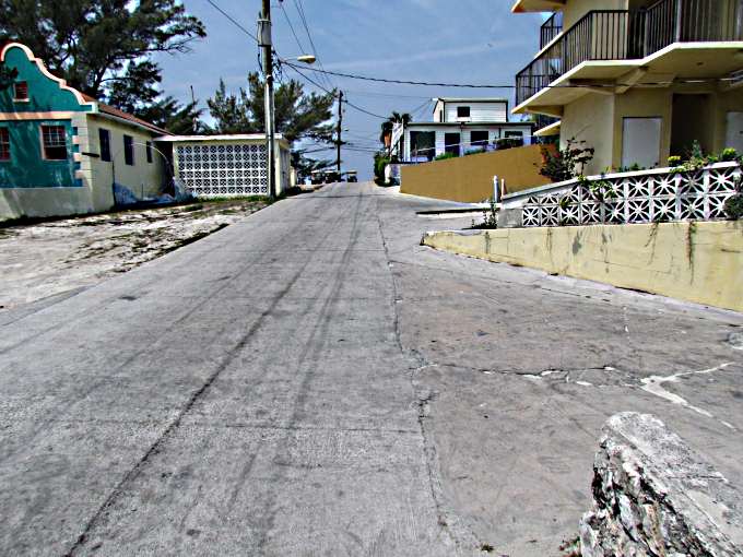
... if you headed west you went up a hill and at the top was the Queen's Highway which paralleled the King's highway a long block to the east of it . Now you are on the other side of the island. Everything is very compact and vehicles have to stop at times and wait for oncoming vehicles to pass narrow spots in the road. I like it but had one problem and that was I wasn't feeling too hot and wasn't sure why. I had a couple slight dizzy spells in the morning but shrugged them off as not being use to walking on land. On land it is moving and on the boat it is moving but you seem to be still after you are on it day after day.
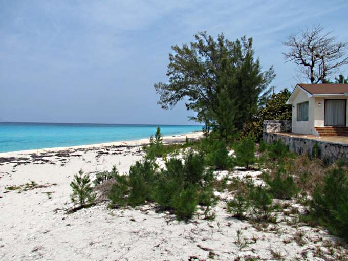
I continued on at the top of the hill you looked 'down' at the coast line. Quite pretty.
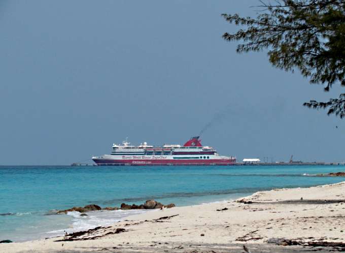
At first I thought this was a cruise ship up on the north end of the island I took this with the telephoto so it wasn't this close.
Latter I wasn't so sure that it isn't maybe there all the time as a casino. I have no Internet as I write this (in Highborne) so can't Google it.
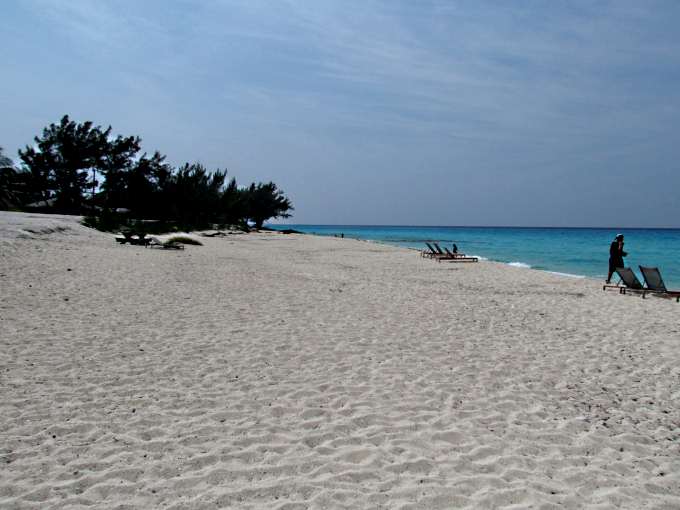
A view south along the beach. There were only a few people on the beach. I still wasn't feeling good and wondered if I needed to eat some thing so headed to ...
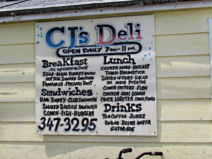
CJ's just up the hill as a number of people were eating there out on the patio on the ocean side. I went in a door on the street side where you could stand and order at a counter. Standing there looking around I spotted a wastebasket with probably 50-100 flys circling it. Seeing that and not feeling well I left but I'm sure from the crowd on the other side that they have good food.
I passed over Queen's Highway, above, and headed down the hill and turned to the left towards the marina.
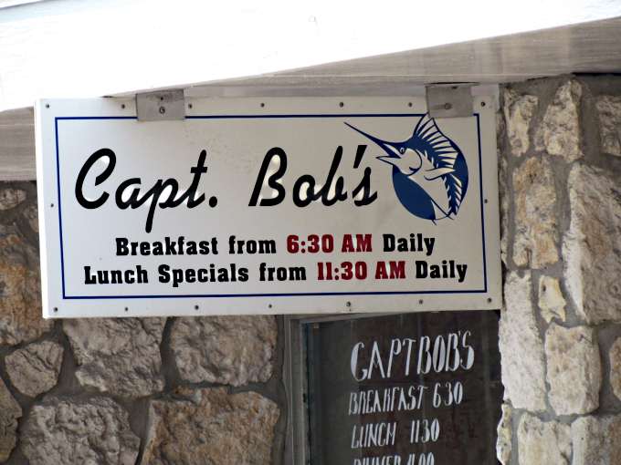
Just before you get to the marina is Capt. Bob's and a fellow boater had recommended the place the night before. It was clean and fairly cool inside. I got a table and proceeded to feel worst. I ordered some conch fritters and as I waited I started to know I was going to pass out. I got the guy waiting on me and told him I'd just like to pay and leave. He talked me into some cold water and a cold grapefruit drink. I think he could see I wasn't doing so well so offer to help me into the bathroom where he wanted to give me a cool wet towel to put on my head. So we started towards the bathroom a few steps away and I had to kneel down on the floor and get my head low as I was going to be on the floor anyway if I stayed on my feet. I was then able to get up and get some cool water on me but I don't think it was heat exhaustion. My mind went back to passing out while driving past Dallas on the way to Florida and ending up with a pace maker being installed there because of my slow heart rate.
I got the conch fritters to go as I just wanted to get to the boat. I thanked my 'nurse' for taking good care of me and walked the block to the marina and the boat. In the boat I drank more water and laid down in the V-berth with the fan on me and slept for an hour or so.
I had a major decision to make now. Go on or head back to Florida? I decided to hell with it and got the boat ready that night to leave in the morning for a 100+ mile crossing of the Great Bahama Bank and onto the Berry's.
=========================================================
......................................................................................Next Page If There Is One...
......