.........................MacGregor Index Page.......... 2015 Bahama Trip Index Page
....................................Previous Page......................................Next Page If There Is One
=========================================================
|
............ ......................................--- Darby Island ---.. ..........................................................--- to --- .............................--- Lee Stocking Island --- ........... |
.....................................................................................................
|
..........................................................(April 13th) Anchorage --- N 23º 45.653´ ==== Trip Mileage = 700 miles .7...............W 76º 05.179´ ==== Day's Mileage = 15 miles |
===============================================
(Sorry about the quality of some of the pictures below. I might of left the camera in video mode and some were from some distance in a rocking boat.)
Before we start with the pictures a few notes about navigating the waters in the Bahamas. I was in no real hurry to move down to Lee Stocking Island where I planned on staging for the run outside the Exuma Bank and into the 6000 feet deep water of Exuma Sound so got underway around 9 am when I thought the light would be good to see the water as this section had a lot of shallow water. Once I got out of the wind shadow of Darby I found it to be much windier that I expected and for part of this trip, actually anytime I was running in a SE direction the wind driven waves and the sun combined to make it about impossible to 'read' the water due to the reflection on the waves. Due to this I had to put a lot of faith into the charts and the waypoints I'd entered into both chartplotters. I also looked at the Explore Paper Charts to make sure the NV digital charts agreed with each other and they seemed to be in agreement so off I, we, the boat and I went.
The route on the chartplotter always looks so easy but most of the features you are seeing except for the land above the water are under water and there is a lot of water out there.
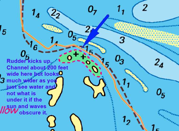
For instance above we see where the route takes us between some sandbars (only at low water) and some coral heads or more correctly an area that has coral heads. So you have water that can become sand and other water that can have a coral head lurking just below the surface. Also all of this is happening pretty fast even at 3-5 kts and the area you need to be in is maybe 200 feet wide. So the question becomes are all these underwater features exactly where the chart shows them to be and how close are you to being right on your course?
As I rounded West Pimlico Cays I had the rudder kickup and immediately saw less than 4 feet on the deptfinder about where the arrow is above. I think I clipped the top of a coral head with the rudder. I got it down and at the same time tried to go to port but you don't want to over compensate in turning trying to miss one thing and then hitting another. With the Mac's shallow draft you can find yourself getting sucked into trying these shallow passages that you wouldn't even look at if you were doing this in a larger boat. That can be good and bad.
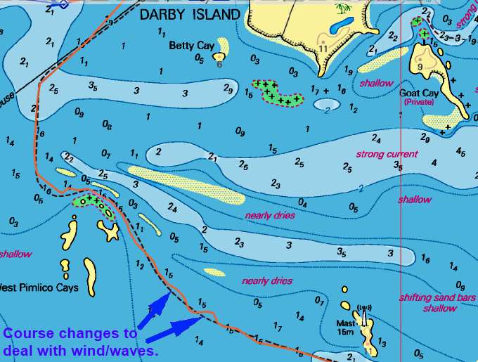
Clearing the West Pimlico Cays I found myself nose right into the increasing winds and waves. Man I was tired of this. You can see where I started running one way and the other to put some angle on the waves as I started to bury the anchors again and cavitate the outboard (get an extra long shaft and put it all the way down--mine is about 2 inches further down than a long shaft but I'm going to modify the mount I made to move it further down). I thought when I left Darby that this was going to be a nice easy run over to Lee Stocking but it wasn't.
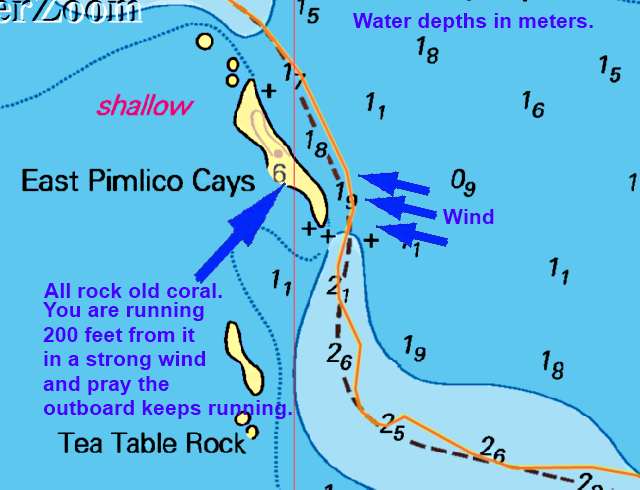
A little further I had to run very close to East Pimlico Cays with the wind now off my port side and a lot of rocks/reef within 200 feet of the starboard side. I try not to think about how dependent I am to the outboard continuing to run at moments like this. The wind was ripping and I wondered if the outboard quit could I even get to the bow and an anchor down and holding before I'd be swept into the rocky side of the cay? I didn't have sails up and even if I had the main up and sheeted in tight there wouldn't be time to do anything with it considering my angle on the wind. Thankfully I was only in this situation for 4-6 minutes before I cleared the Cay and turned back into the wind/waves and my zig-zag course through them. As I moved further to the east and the Islands there I was able to get back on the tiller-pilot (it had been overwhelmed for a while). I'd still have to turn the outboard a bit so that it would help the tiller-pilot and help it run with the rudder neutral (tiller straight ahead most of the time).
So now that things weren't needing my full attention I could get the camere out of its plastic bag and shoot a few pictures.
Over on what I think was Melvin Cay and maybe Bock right behind it (they look like one larger cay as you pass as they almost connect) there was some type of industrial operation going on or had gone on in the past.
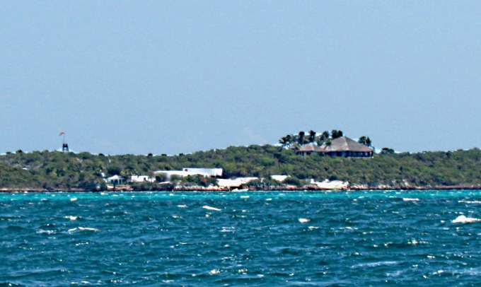
It seemed way out of place...
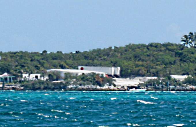
... to see the large trailers on this small island. Notice wind on the water. It was probably 15-20 for a lot of the day.
I saw no signs of activity at any of the places pictured above. This seems to be typical of a lot of places in the Bahamas.
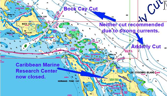
Finally I passed Bock Cay and Adderly Cuts where I had wondered what the current would be like while near them as the charts have lots of 'strong current' warnings there but they also have them at all of these cuts. Well the current was no issue so that was good and as I had worked over close to these cays I had more shelter from the wind and wave and that was real good.
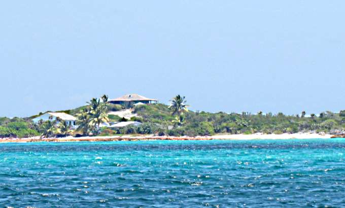
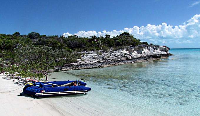
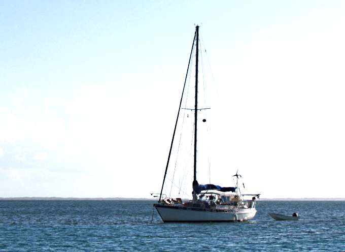
I made the turn into the shelter of Lee Stocking Island and ....
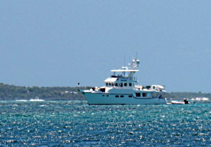
... passed the serious looking boat above that was anchored off of where the Caribbean Research Center was, now closed according to one of my charts. I think I'd feel pretty safe in most seas on that boat.
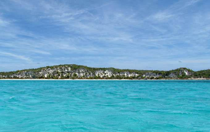
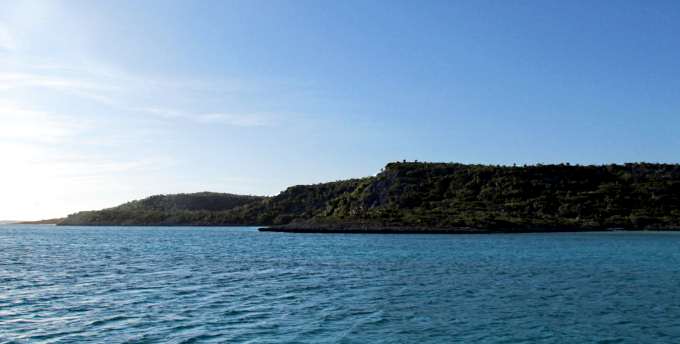
A little further south I passed the highest point in the Exumas.
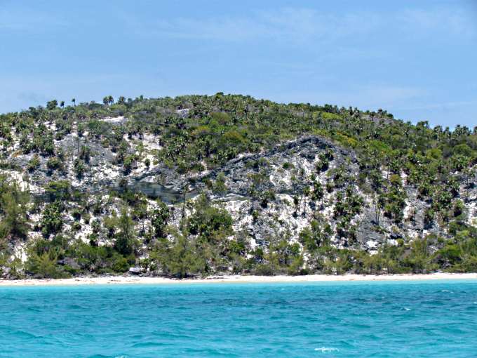
The charts show it as being about 120 feet in elevation. Just past there a short ways I anchored in Williams Bay. There was a fairly large power yacht there and I went inside of them and later they pulled anchor and moved south. Hopefully is wasn't because I had messed up their view. So I was once again determined to not move south and out the cut at Rat Cay until I felt I had a 'good' weather report but sometimes I'm not so good at keeping these promises I make to myself.
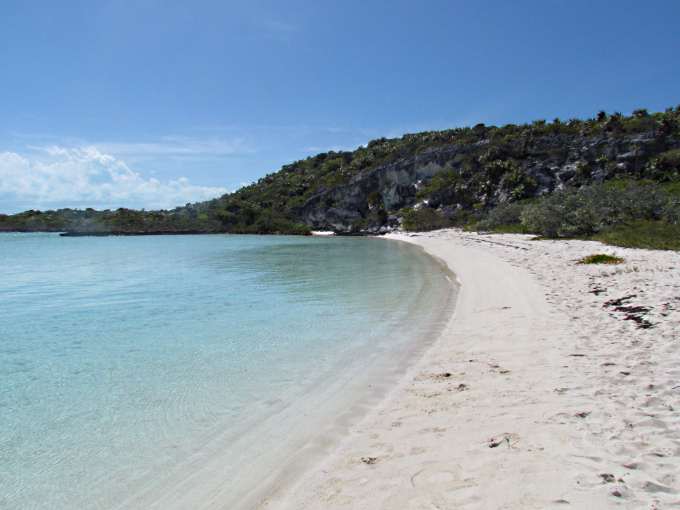
A powerboat tour came in and dropped a load of people off in the water off one of the two beaches there. They disappeared up a trail and then later came back and waded out to the boat and were off. I had to see what they saw so paddled over ......
..to the beach and left the dinghy and ...
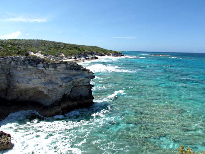
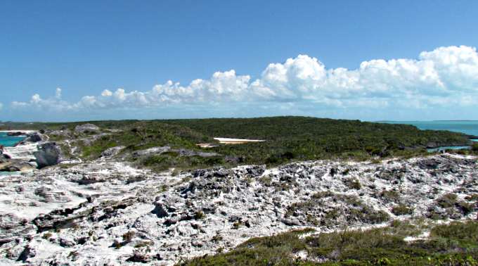
... the trail up and over to the Exuma Sound side of the island. It was a very short hike actually. Once over there you ....
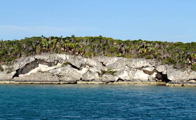
... had a really pretty view up and down the coast and just below the viewpoint was....
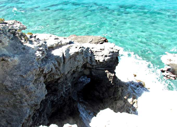
... a nice little arch with water surging through it when some of the waves broke.
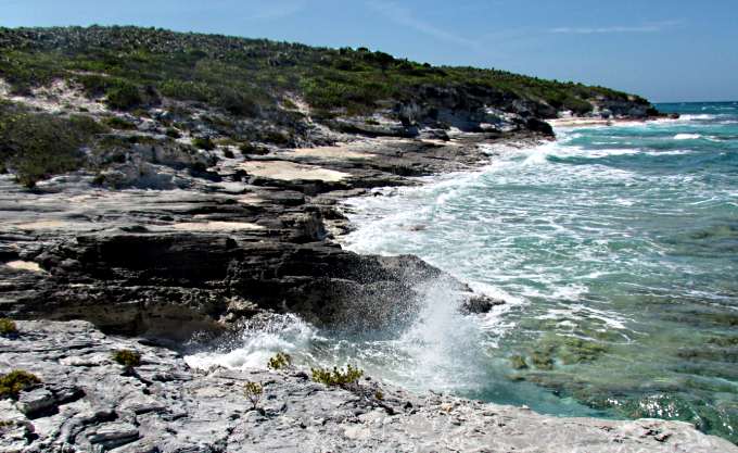
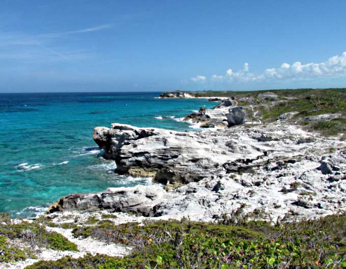
I followed a short path a little further north and sat down and watched the waves pound the coast there. This wasn't too good in some ways as I was going to have to get outside these waves on the next part of the journey and I'd heard all kinds of horror stories about doing that.
At the far right you can see the SE shore of Williams Bay and in the center of the Island there ....
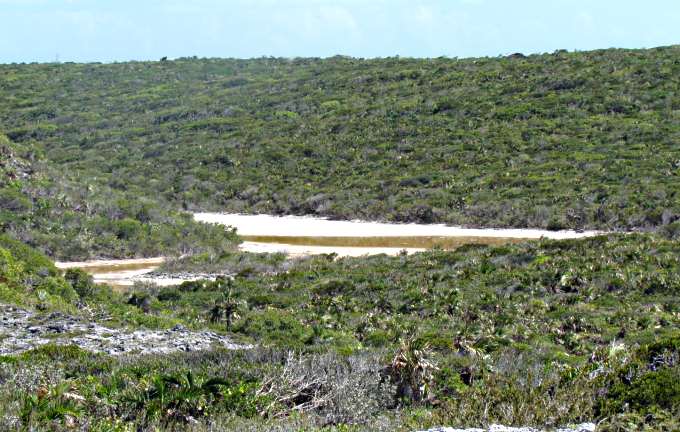
... is a valley with a pond in it. I find things like this real intriguing and they just draw me in and I might have to see if I can work into it if I anchor here on the way north and I'd like to do that as I write this.
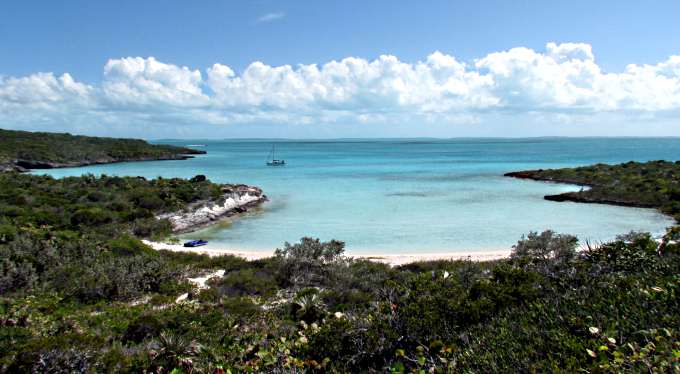
I really liked the view from up there back overlooking Williams Bay. What a nice spot.
A view north from the boat on anchor and ...

... the cliff over at the beach where I went ashore and ...
... the cliff to the south near the other beach there.
Later in the day Paul and Stacy Ababe came in and anchored with their boat, Shambala. I talked to Paul later on the VHF about going out Rat Cut and he was very reassuring that I'd be fine going out the cut if I timed it for slack tide. I really appreciated that as I was forming a fair amount of anxiety about going out any of these cuts into Exuma Sound. Later we meet on the dinghy dock in Georgetown and I found out they were headed to the Caribbean for a year and a half of cruising. What a great trip that will be. Also found out that they were from Colorado and had been to my part of the country, Moab where I lived for some time and just north of where I am now in Blanding, UT. It is a small world and I wish them nothing but the best for their trip/adventure.
I have to be truthful and get it out here that I started to question my decision on making Georgetown as my final destination south. For a lot of sailors it is the 'Meca' of the Bahamas and on a lot of sailor's bucket list. Me, who doesn't get that excited about towns and a lot of people/boats and now getting anxious about safely getting out one of these cuts, was wondering what my real motive was in wanting to go there. I guess it was like climbing a mountain and stopping 500 feet below the summit and going back down always wondering what the view would of been like from the summit and what the feeling would of been to made it to the top, not just near the top. I usually strive to make it to the top and in this case Georgetown was the summit and I needed to just put my mind to it and do it.
=========================================================
........................................................................................Next Page If There Is One...