......................MacGregor Index Page.......... 2015 Bahama Trip Index Page
....................................Previous Page......................................Next Page If There Is One
=========================================================
|
............ .............................--- Lee Stocking Island ---.. ...........................................................--- to --- ........................................--- Georgetown --- ..................................--- and Stay There ---
|
.....................................................................................................
|
..........................................................(April 14th) Anchorage --- N 23º 31.661´ ==== Trip Mileage = 729 miles ..................W 75º 45.926´ ==== Day's Mileage = 29 miles |
(I find Georgetown spelled as two separate words and as one at credible sources so don't know which one to use for sure.)
===============================================
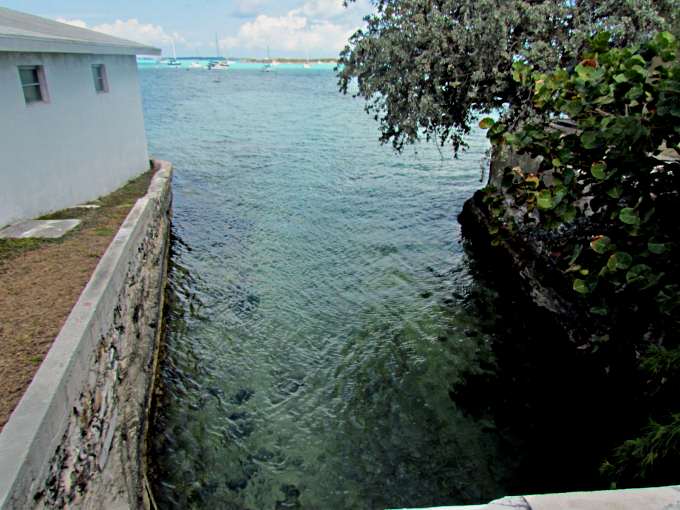
I'd gotten to Lee Stocking Island and was at my last anchorage before the leg to Georgetown. After the trials and tribulations of the previous few days I really didn't want to do this leg unless conditions were very favorable. I was ready to move on at a moments notice and with that in mind listened to Chris's weather report at 6:30 am. I wasn't thrilled with what I heard as for the nest 4-5 days winds were suppose to be around 15 kts gusting higher and out of the SE, more or less my direction of travel.
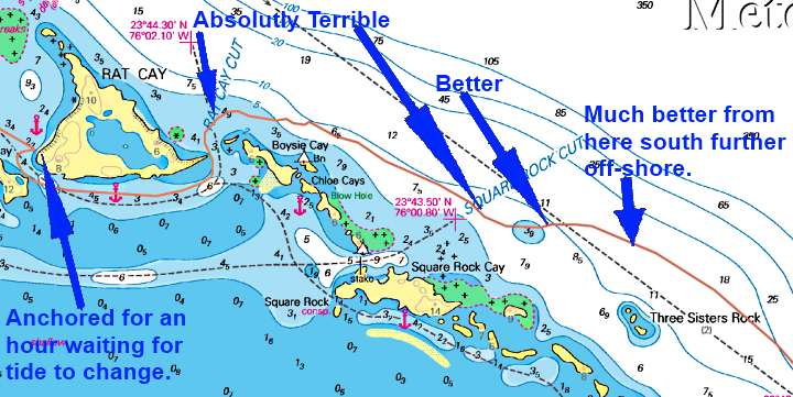
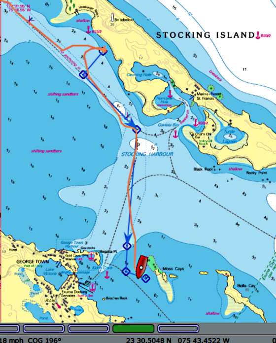
With that in mind I thought I can handle mid-teens wind speeds so thought I need to go before I sit here and change my mind. I'd heard horror stories about going out these cuts with breaking waves that people had busted through and I didn't have the boat or power to do that so I needed good conditions and the best cut I found for me to exit by into Exuma Sound was Rat Cay cut. It faces kind of NE so should be good in a SE wind. Also if you exit on an ebb tide with it running against the waves things can really get bad.
With that in mind I figured I'd like to try Rat Cay cut at about 11:30 and if it was bad wait a little in an anchorage nearby. The low tide for Nassau was suppose to be about 10:45 am and I was purely guessing that the actual slack time might be 45-60 minutes after that, but is was just a guess. Georgetown's tides are at the same time Nassau's are and I was near there so there again just had to guess. I wanted slack or just a bit of the beginning of the flood tide.
I had plenty of time the cut was just a couple miles from where I was anchored. I got the boat in order, pulled up anchor and headed SE towards Rat. I got there way early just past 9 am so anchored in a little cove on Rat's NW side (can't see the cut from there). I almost left about 10:30 but was able to restrain myself to just past 11 when I pulled the anchor up and took off.
These cuts are so dangerous as on one side you have the shallow water of The Exuma Bank and on the outside waters up to 6000 feet deep of Exuma Sound and if you look at a chart from here east you have a straight shot across the Atlantic as Long Island in the Bahamas is to the south and Cat Island is to the north with a gap between them opposite this part of the Exumas so here there is no protection to the east, or very little.
While sitting there waiting I happened to look at a boat showing up on the chartplotter thanks to AIS that was running north outside. I clicked on it and it was Foot Loose and Vincent who I had meet in Bimini. I hailed him and we talked for a few minutes. He said that it was rough going out there but not terrible but reminded me that his boat was a lot larger than mine and that I would be pounding into it and wouldn't be sailing. That didn't sound good but also not a deal breaker at this point.
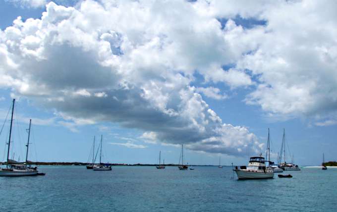
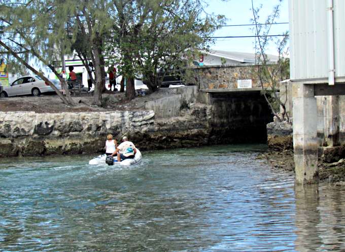
Above you can see where I waited on anchor for a couple hours. I left there and was around the south side of Rat in minutes and upped the outboard to over 3/4's throttle to help all I could. Well I come around the corner and instead of seeing a wall of water ahead of me it is almost dead flat and I just motored out the cut at the same speed as I entered it. I thought all that worrying and that was a piece of cake.
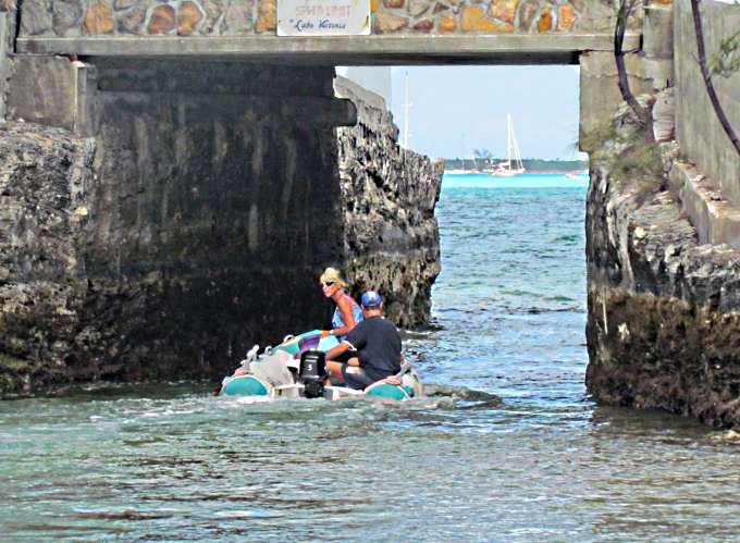
Well things quickly changed. You can see the nice smooth curve of the boats track around the point, it wasn't as close as it looks, and for a short ways out. Then the track starts to have that 'drunken sailor' look too it. I entered absolutely the worst water I'd ever been in before and felt I have no business being here. Big waves, non-breaking thank goodness, on top of large swells pitched the boat up over crests and down into troughs higher and lower than I'd ever experienced before, with the bow going under at times when the boat hit the bottom of the trough.
I'd try turning the boat at an angle to run up and down a few and then the other way for a few more. The outboard was cavitating a lot and I thought there is no way I could hand steer into this for 17-18 miles averaging 2 kts as that was all I could muster with the waves just killing the forward motion of the boat and that also really hindered the steerage. After 15 minutes or so I looked back and it didn't look like I'd made any progress. I didn't feel like I was going to die but also did not like the situation one bit and knew that it was a dangerous one.
Initially I'd planned on going more of less straight east once clear of the cut for a little over ½ mile until I hit the route that most boats take to or from Georgetown (shown on the chart above as a dashed line). Once clear of the cut instead of doing that I immediately started to angle SE thinking I'd pick up the route a little further south. Well that decision was keeping me closer to shore. I started to wonder if that was causing these waves to build in height so much and spacing them so closely together. The only way I was going to find out was to go further out and that is a hard concept in a situation like this to actually embrace. Your gut says go into land and I honestly would of turned around here and headed back to Rat Cut and its flat water but I also didn't feel safe turning the boat in these waves and putting them on my stern. I felt safer facing them near head-on at an angle.
I turned the boat more to the east and started to work out. The further I got out the better it became and the moments between the outboard being lifted out of the water lessened. The situation was improving and I could even return to the tiller-pilot and had to help it less and less. Expectations of making it to Georgetown were looking up.
With the worst water I'd ever seen behind me I headed off SE and stayed off shore until I hit my mark to go in at Georgetown. If you every do then get outside and away from the shore. As Paul, who had anchored nearby before this leg later told me in Georgetown, told me 'you have water that was 6000 feet deep being driven west up onto shore or into shallow cuts'. We had prior to this and during a lot of E and SE wind moving that water west.
Also on this day unlike a couple before the wind did lessen as the day became hotter so the waves on top of the swells went down and it turned out to me to be an enjoyable day on the water if I could put out the terrifying couple miles after the cut.
Did have one other interesting moment before I got into really easy water. I noticed that the Manson Anchor was not pulled up tight in the bow roller and was pivoting back and forth some. Not enough to hit the boat but things like that bother me so I put my safety harness on and attached it to the tether and the tether to the life lines and worked forward on the deck to the bow. When coming off anchor I pull the anchor in tight on the bow roller and wrap the chain around a cleat twice and then the rest is in the rode bag which has a lid that has been snapped shut. Not trusting just that I also have a line off a center cleat there with a carabiner on it and snap that onto the chain also. I just hadn't taken the slack out of everything when I secured the anchor and it had moved forward 6-8 inches.
While up there it was an interesting ride as the boat was still diving down into some of the waves. Came close to going under a few times but didn't.
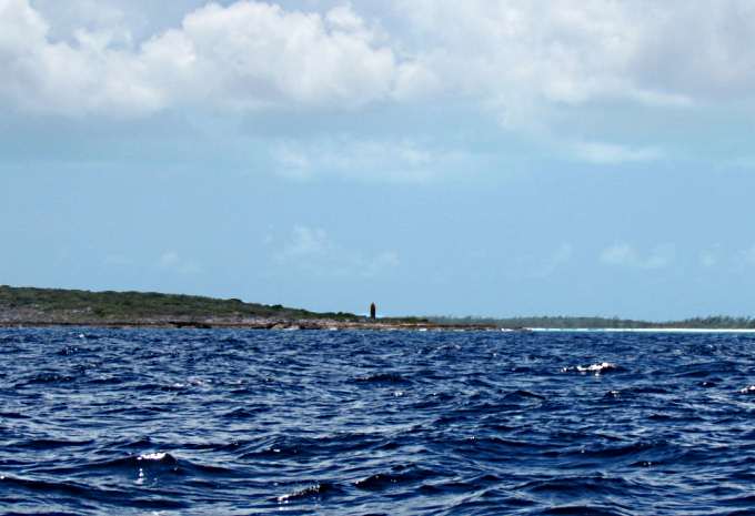
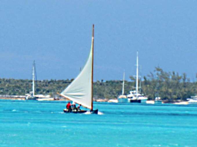
In the previous picture and the one above I'm passing Soldier Cut which is where Mike and Sandy went out with their Macgregor X and where he said that he was thankful for the 50 HP he had to get out and is the main reason I chose Rat about 6 miles north of it and would again. I'd just do the part after the cut differently.
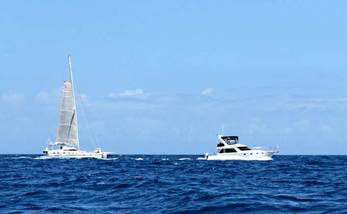
Most of the boats that day like days previous were running north but the power boat and cat above caught me about the same time and were headed south. Like the cat I now had the main up but it wasn't doing much except stabilizing the boat. I didin't have it up going out the cut as by myself I sometimes need to keep things simple as there is only so much I can do and during that worst part I couldn't take my hand off the tiller for even a couple seconds, I was glued to it.
Just after passing me the cat turned in and ran toward Emerald Bay, shown above, a high end marina and development/golf course about 12 miles north of Georgetown on Exuma Island. They called in and inquired about the price of slips and the girl started quoting different prices with the lowest being $1.00 per foot. They asked what do you get for the buck a foot and was told 'water' and that was it. Then they asked if they could use any of the facilities there. Well 'yes they could for an additional fee that started at about $120 if I remember right. They circled back out as if they were going on to Georgetown and then circled back and went in. Someone on board had probably had enough 'sailing' for one day.
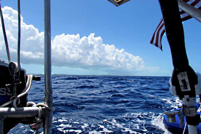
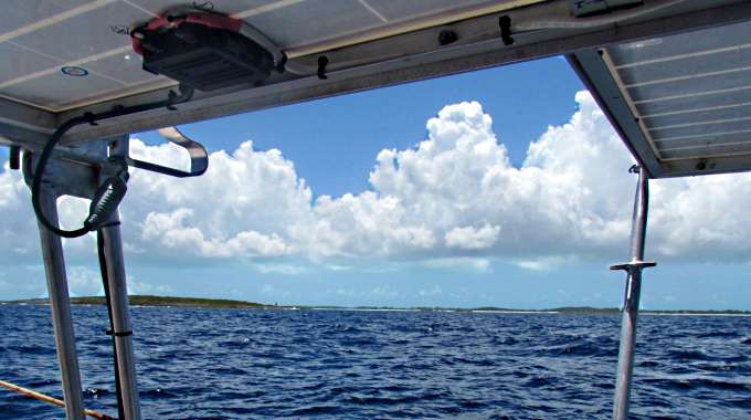
On a number of days you know exactly where the Exuma chain of islands and cays are by the cloud bank that follows them NW and hangs over them like a long white row of cotton balls.
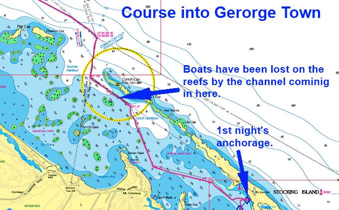
At this point things were down right enjoyable motoring along letting the swells lift and lower the boat as they more or less peacfully passed beneath the hull but I had the entrance into Georgetown coming up and boats had been lost on the reefs going in there. A couple that were at the boat yard by Placida where I had been left before me and got this far and lost their boat going into Georgetown when they ended up on one of the reefs there. That was a sad situation.
The cut in and the course you take is actually I feel much easier than the cuts to the north as you have more room for error. Run your waypoints and watch the water (I wouldn't do this in the dark) and you will be fine. One thing to keep in mind here is that even though you have a lot of room to play with the currents here can be very strong and deceiving. The guide books talk about setting course for a house up on a hill as you come in and make the SW runs. Well my bow was pointed about 60-70 degrees off that house but I was going towards it like I was suppose to be keeping an eye on where the boat was in relationg to the course I'd laid down on the chartplotter. So the boat was seriously 'crabbing' do to the current.
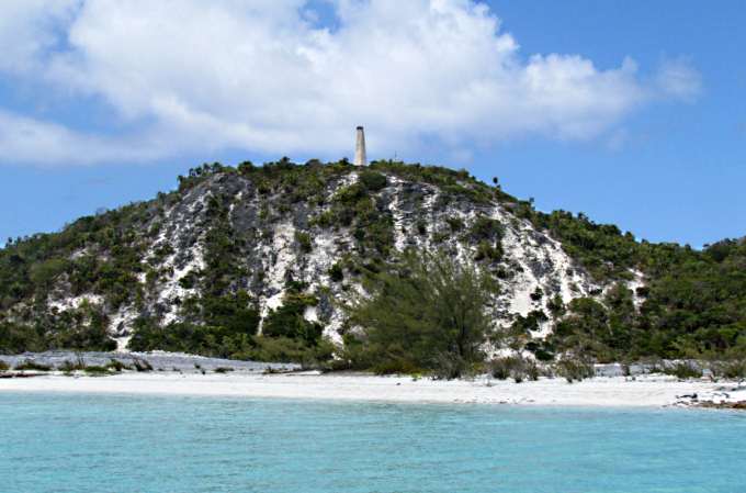
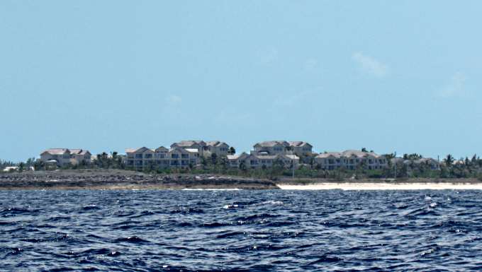
Once in, being beat, I stopped at anchored at the first major anchorage at Monument Hill and since there are no boats ahead of me above and ...
... being they were all behind me you can see the Mac was in closest to the beach.
===============================================
|
..................................................(April 14th to 19th) Anchorage --- N 23º 30.319´ ==== Trip Mileage = 731 miles .7...............W 74º 45.688´ ==== Day's Mileage = 2 miles |
===============================================
The Monument anchorage was fine except for two things. One is I had a very weak Internet connection and the other, and the major one is that it is over 1 ½ miles across Stocking Harbor to Lake Victoria where there is a dinghy dock in the heart of Georgetown. In about any kind of wind that can be a long wet ride in a slow dinghy. I'd downsized from a 5 HP that could plane with me alone in it to a 3 ½ HP to cut down on the weight getting on and off the dinghy and on the Mac where is is normally to be found since I won't tow with it on the dinghy. So not wanting to make a 3 mile run a couple times in a slow dinghy the solution was to move closer to town.
It take long and I had the Mac underway and on the way to an anchorage just off Moss Cays, three very small Cays that don't give you much protection from the wind, but some. I found out that the weak Internet connection that I had hoped to improve actually disappeared and in its place I found a couple others but they were even weaker and I'd find I could use one part of the day and another a different time of the day and sometimes neither worked so moving trying to find better wifi was a failure. Still it was good enough to send e-mail and check some of the sites I hang out on.
The dinghy ride was shorter but still about ½ mile going in and out and still got wet most trips but only went in 3 times.
The shot above is from the new anchorage back over to the old one under Monument Hill. It was taken with a telephoto so not as close as it looks.
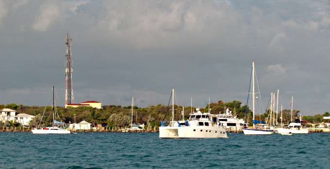
Some of the boats between me and town. I could of moved over there and found a spot in amongst them but then I would of lost what little protection that Moss Cays were giving me.
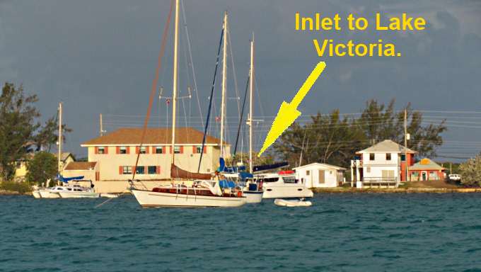
So being close to town the next business was actually getting there with the dinghy. A nice fellow who had seen me anchored further north sailed up to the boat in his little sailing dinghy. He had sailed over from Monument just behind me and wasn't wet. We had a nice chat and I found out that he and his wife were from Naples. He also pointed out where I needed to go with the dinghy to gain access to Lake Victoria since it wasn't that obvious from the anchorage and the boats further in were kind of blocking the view. I found out I need to head for the right side of the two story building shown above. I decided I'd go in the next day.
Above is another example of the huge difference between the haves and have nots in the Bahamas. Lots of wealth down there and lots of poverty. I don't know for sure buy I doubt that the above residences or what ever they were we not lived in by the local population but have to say that is a guess on my part. Another sailor told me that it was only a few that owned the majority of the land here and unemployment was very high. Every where I went, just not Georgetown, the locals were quick to say hi to you while you were just walking down the street from the young kids to people older even than I. That was nice as it is pretty much what I am use to where I live, a small town, and something that is now missing in much of America.
I loaded the two 5 gallon gas containers in the dinghy after topping off the 20 gallon inboard tank that had been last filled up at Highborne Cay and set off for town. There had been warnings on the morning VHF Net, channel 72, about the current going in and out of Lake Victoria. They suggested using the lanyard that if you fall overboard will kill the outboard. I was going in about midway between high and low tide with the tide coming out, so not slack, but what the hey it can't be that bad.
Well it was and the little 3 ½ was running wide open under the bridge and I was barely gaining headway. Once in just a bit with the lake widening things got a lot better but I told myself the next time try and do this with a slack tide at least in one direction and hopefully use an outgoing tide to help in getting out. The problem with the outgoing and I saw this happening with people going out as I went in was if the wind is blowing waves towards the opening and the outgoing tide there are going to be larger waves there that you will have to buck through but at least the tide is pushing you the right direction.
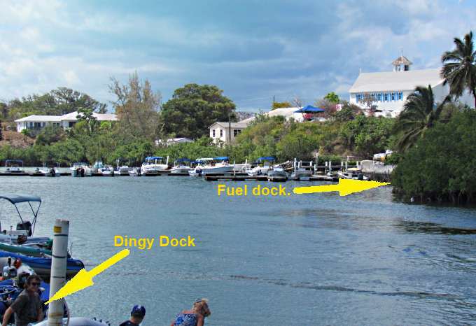
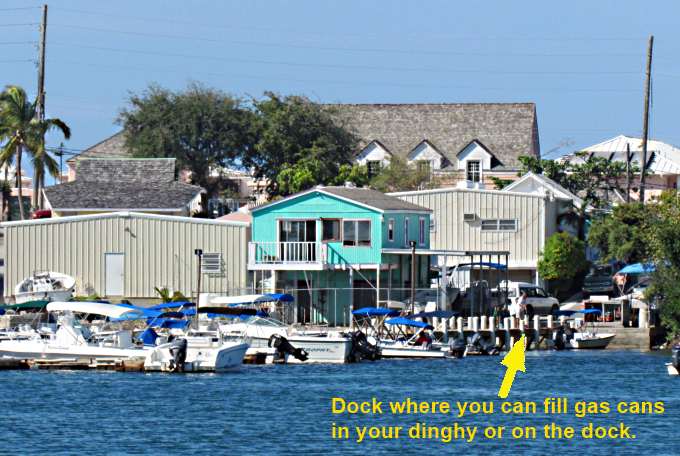
Once in I headed off to the right were there is a fuel dock that only sells gasoline. They have a hose on the dock and you can fill the containers either in your dinghy or up on the dock. I did it on the dock and was glad as the fuel hose was leaking by the nozzle and I would of had gas inside the dinghy. The gas guy gives you a receipt and you walk up towards the street and pay inside the office. Inside I had to wait about 20 minutes as the woman there was renting out boats to two different couples. As in other trips I'd made to shore I started to not feel too good and there was a table with chairs there and brochures so I sat and pretended to read them just hoping that things at the counter would move along and I could get back out in the fresh air before I passed out or something.
I got the gas paid for and once I was back in the rocking dinghy started to feel better.
I made my escape from Lake Victoria and bucked the waves coming in and got back to the boat, wet of course.
Going back to the boat the outboard died about 100 yards short and had a hell of a time paddling into the wind to get to the boat. It has a small tank and thought it went dry but when I filled it wasn't so sure so now even thought the outboard has probably less than 10 hours on it I'm questioning it. I have found that I need to use a lot of choke to get it started and keep it started. Before I had thought I was flooding it but that wasn't the case, just the opposite.
Latter that day I posted on the Internet about my 'land-sickness' condition that had been bothering me the few times I went ashore. Once ashore I found the ground constantly moving and it was making me nauseous and light headed like what happened in the office where I paid for the gas. At this point I'd been on the boat 30+ days and off the boat less than 10 hours or so total in that time. A friend, Joe, researched it and posted others had also experienced this. For some taking something like Dramamine helped. Here I'd never been sea-sick before but had bought some Dramamine just in case so had it on-board.
The next day I went in again to get some water, groceries and to see if I could exchange some books I had on-board for others.
I downed a Dramamine about an hour before leaving just to make sure I wasn't going to have a reaction of any kind. I had two types and took one from the bottle that claimed you wouldn't become drowsy or at least less drowsy than the other one they make. This time I made the trip in at about the end of the high tide cycle so went right in, well almost right in. On the way in the outboard died again like it had run out of gas. It started right up and I was tempted to turn back to the boat as I sure didn't want to have to try and paddle from the dinghy dock to the boat as that would of been mission impossible for me. I figured worst case some kind soul would tow me back to the Mac. After I re-fired it I ran it almost wide open throttle in and didn't have the problem again. I'll bet there was some water in the float bowl on the carb and at light throttle it was going up and blocking the main jet. Running wide open might of sucked it on through. When I did get back to the boat I did drain the bowl but as I just mentioned no more problems.
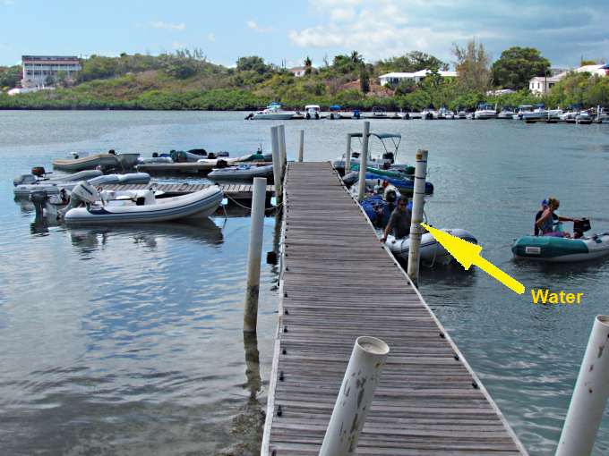
Just inside to the left is the town dinghy dock (see above) and on one of the pilings is a water tap. Pull your dinghy up and fill up without having to go ashore. That was nice. Then move your dinghy to another location on the dock and tie off. They recommend using a long line so that others can tie up also. You just push someone else's dinghy out to the end of their line and out of the way so you can tie to the dock with your long line and then push yours out. This day there weren't many dinghys on the dock but other days there were a lot with over 200 boats in the harbor.
Once on shore I thought I could really tell a difference having taken the Dramamine. I wasn't 100% normal but felt way better that on other shore visits and didn't feel like I needed to make a hasty retreat back to the Mac. So with my new found land-legs I went walking.
Before I left the dock though I got a couple pictures of people going out that had to buck the last of the tide still coming in. The couple above is already getting in the current and as they have to give the outboard more and more gas....

... the stern sinks further and further into the water. While I was there some of the tides were running over 3 feet so you have all the water in Lake Victoria raising and lowering 3 feet a couple times a day and all of that water gets funneled through this narrow opening.
The next couple also bucking the current. I can be hard keeping your dinghy pointed where it needs to go. A couple times I thought I might be into one of the walls but never was. Also incoming vessels have the right away. If you are incoming you should line up with the opening well ahead of getting there and the boats inside should wait on you. Besides dinghy's there are larger powerboats that burn gas that also come and go through this opening and will come in and head to the fuel (gas) dock. It is an exciting little experience.
When you leave the dinghy dock you go up a narrow walkway and the building to the left of the walkway is the grocery store. That is handy as you don't have to carry your groceries far back to the boat. Just past the store you go over the bridge that you had gone under coming in.
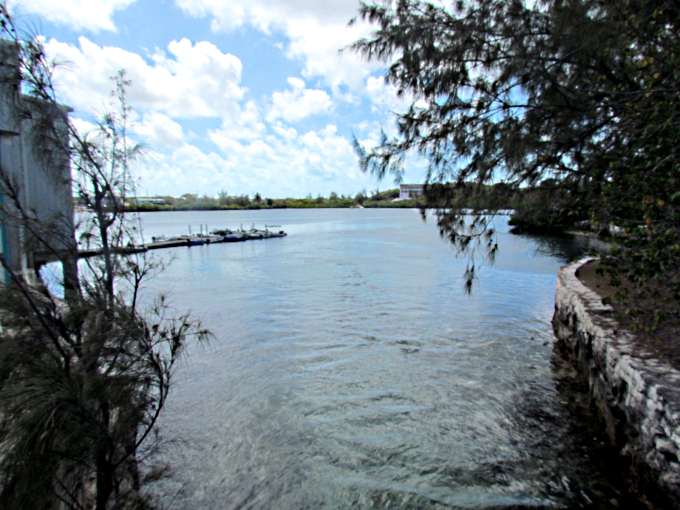
A view from the bridge towards the dinghy dock and past to what is Lake Victoria. Not huge but still a considerable amount of water involved here that is going in and out with the tidal changes.
Looking out into the harbor.
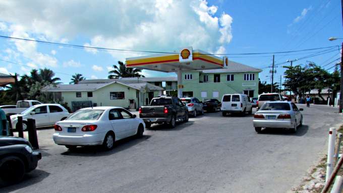
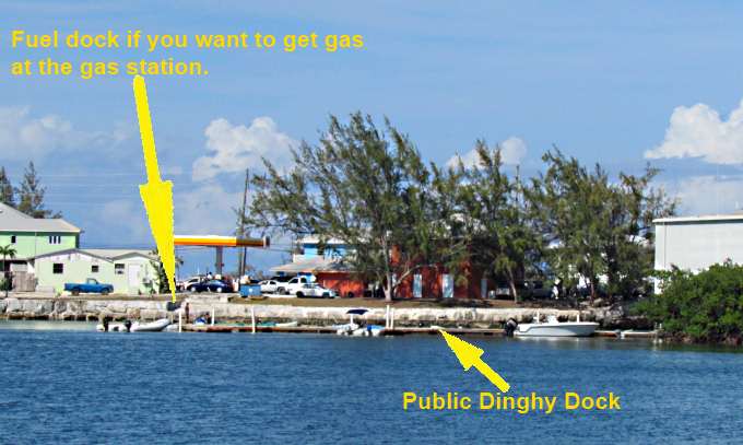
Just past the bridge is the only gas station in town and there is always a line. Down on the water behind it and before the other gas dock is a dinghy dock, where if you want, you can tie up and carry your gas cans up here and wait in line. I don't know if there is much price difference or not as I didn't check but don't think so.
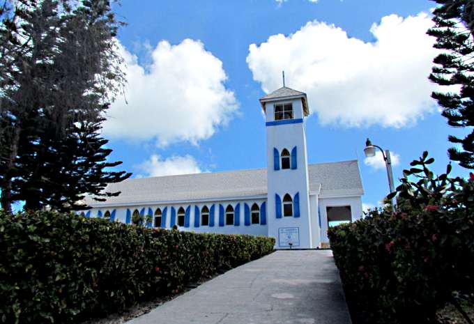
Further up the street is one of the churches on the island and the setting of this one is impressive. Before here was the library where I had hoped to exchange books but it was closed due the electricity being off and that was do to the fact that there had been a fire across the street at the Straw Market and the fire and done some damage out front of the library but no structural damage. I don't believe anyone was hurt in the Straw Market fire but what was there along with a huge tree were all gone. I hadn't seen it before the fire so don't know exactly what it consisted of.
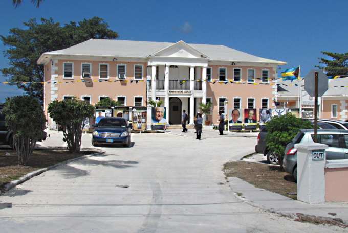
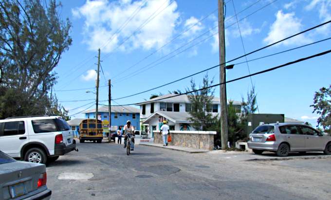
There is a large government building also in this area and the street in this area is all one way only and maybe I'd been on the slow boat too long but it seemed like people were driving fast considering the foot traffic and such that is also using the street at times.
A view back towards the bridge with the govenment building to the left.
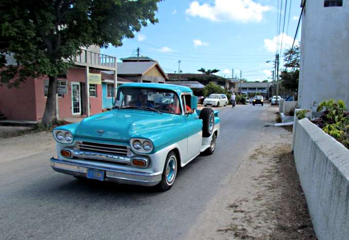
Further back this nice 58 or 59 Chevy pickup came by (both years are pretty much identical) and I got a picture and would of liked to of talked to the driver being a 'car guy' myself but didn't see it again.
So now I've walked back around the south side of the lake and you can see the dinghy dock and the gas dock that you use if you want to use the gas station. The bridge/inlet/outlet from the lake is under the far trees and behind the corner of the building there which is the grocery store. The store is well stocked with about anything you could want. Not as modern as the stores are now in the states but just picture going in a grocery store in a smaller town 20 years a go and you will have a pretty good picture in your mind.
Further to the left than what was shown in the previous picture you can see the gas dock that I used. I continued on and had snapper strips at the Edgewater restaurant and bar at the far side of Lake Victoria after another boater had recommended the place. Not many people actually eating there but lots and lots of locals came in and picked up call-in orders so the place is well liked by the locals. It was a long wait but I didn't have anything else to do and the snapper strips were delicious. I could of gotten a whole snapper but figured that was just too much and had a hard time actually finishing the strips and fries. If you are into the food and not the ambiance of the restaurant I'd for sure recommend the place. You can't miss it. Walk clockwise on the road around the lake and it will be on the left side of the road about half way around.
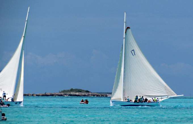
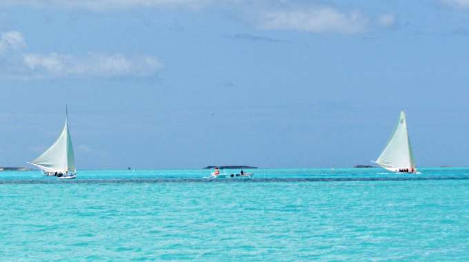
About Friday some of the boats started to show up for the annual National Family Island Regatta where there are I think a total of 5 different classes of boats including the lager native sloops shown above. They were asking if any of us non-Bahamians would like to crew while they were practicing the first day or so and some did. The regatta started the following Tuesday and I planned on staying for at least one day of it.
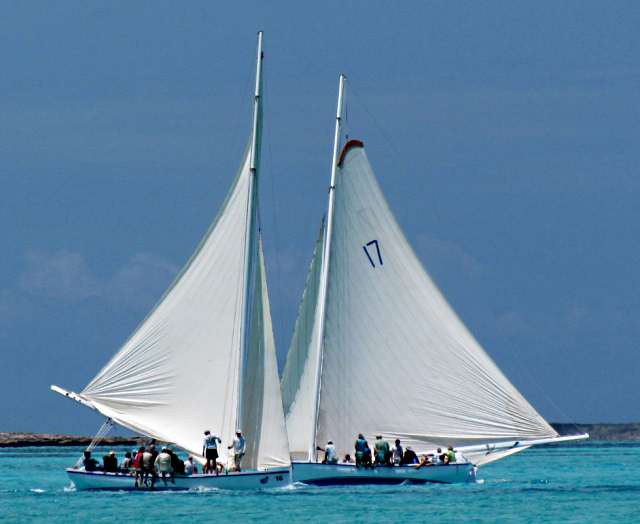
On these boats there are long boards that can be slid outboard to port or starboard and then the 'live' weight hikes out onto the boards.
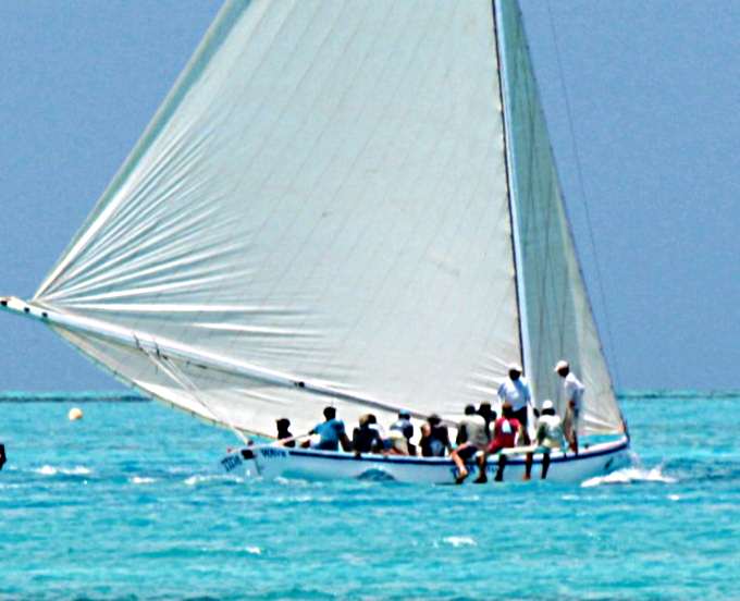
It is quite impressive and they carry a lot of sail on these boats.
.
I read that there were 5 classes but only saw three different type boats. The larger sloops and then some like above with a smaller crew but still the boards to hike out on. Then there were some smaller boats with a crew of one (pictures on the next page).
So I just kind of hung out and went into town a few more times after the library had reopened and traded books and also visited the grocery store. Finding the Dramamine cure for what had been ailing me made the trips ashore much more enjoyable. Still...
... I started to think I needed to be headed north to some more remote anchorages that is more my thing.
=========================================================
........................................................................................Next Page If There Is One...