.......................MacGregor Index Page.......... 2015 Bahama Trip Index Page
....................................Previous Page......................................Next Page If There Is One
=========================================================
|
............ ...........................................--- Black Point ---.. ..............................................................--- to --- ...........................................--- Darby Island --- ........... |
.....................................................................................................
|
..........................................(April 10th to April 12th) Anchorage --- N 23º 50.843´ ==== Trip Mileage = 685 miles ..................W 76º 14.101´ ==== Day's Mileage = 27 miles |
===============================================
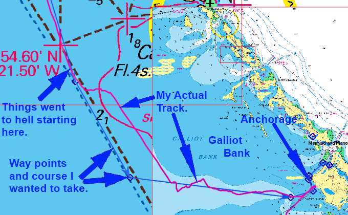
Once again I probably left sooner than I should. The wind fools you in some of the anchorages as it isn't that strong so you say 'let's get going' and then get out from the wind shelter and say 'maybe not' but hate to turn back so go on. Chris promised me, not really, 14-16 kt winds and that is what I got pretty much on the nose for the first 12 miles or so but was able to motor-sail to some degree. Most days as the day got hotter the winds went down, but this one was an exception as about 12 miles towards my destination, Darby Island, the kicked up to was I guessed was 18-20 and the sea with them. There had been too larger boats motoring and paralleling me and running just a tad faster from Black Point. They were running in closer to the chain of cays and I should of been in there also instead of pounding into the waves but once out didn't want to put on the other mile to get in and then back out further down were there was shallow water well out. So I stuck with the situation. Another boat had been sailing outside of me that finally overtook me. When they weren't too far ahead they tacked back into Little Farmers Cay along with the boats running closer in.
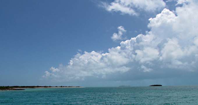
So I continued on south and it was about 4-5 miles after leaving all my company that the higher winds really kicked in, top left arrow.
So I'm thinking I need to move further in as I was starting to cavitate the outboard more and putting the anchors under water on the bow. Well after diverting in a ways I noticed that Galliot Bank, where I was headed for, was marked 'shallow' on the chart with some of the water under 1 meter so turned SE and paralleled the course I had decided on to begin with and just toughed it out. At least I had some angle on the waves coming in which turned out to not be the case once I made the turn in a few miles further south.
At that point you can see my actual track above became quite erratic. I was constantly searching for a way into the waves that was bearable to some degree and actually wonder if I was going to get in.
The tiller-pilot couldn't handle the situation of the boat falling off the waves to one side or the other and then the wind would grab the bow and push the boat further off course. So it was all hand steering for a lot of this. I was running the outboard over ¾ throttle and only making 2 kts at times as the waves would almost stop all forward momentum, but the Tohatsu just kept plugging away at them.
I also had one other small problem. The bow went totally under on a few sets of waves on the third big wave in the set. On one of these episodes the water lifted the road bag on the starboard side, the one for the Manson anchor and when it came back down on the deck it landed on some of the chain that went from it to the anchor. The bags are tied on well so loosing one over the side wasn't going to happen but the bag was now sliding around a little on top of the chain and I didn't like that. I put on the safety harness and hooked onto the tether that was already in place and worked forward to the bow and got the bag off the chain and and the chain pulled in some to get rid of the slack that was on deck. It was quite an exciting ride up there during this.

More info on the rode bags and how all of that is setup (HERE).
As we moved in closer and started to get a little wind shadow I was able to connect the outboard tiller to the rudder tiller with the connector I had made and the tiller-pilot could now handle things most of the time. Finally was able to made it into the lee shore of Darby and put the anchor down and I refreshed my vows to myself that I would try and avoid days like this as they just weren't much fun.
I rate this as one of the worst 3 days wave/wind wise for the trip to this point and the last 3 hour period the worst period for less than a day but unfortunately in just a few days this day would loose its hold on first place for miserable conditions for less than a whole day. The other bad wind/wave days before this were Ft. Myers Beach to Marco and Whale Cay over The Northeast Providence Channel to Rose Island near Nassau. All of these were worst than crossing the Gulf Stream and the overnight run across the Great Bahama Bank so don't think that if you have those behind you it will be all gravy.
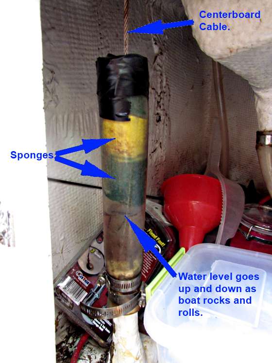
After some of these pounding into the waves episodes I'd gotten water into the two bilges under the settees in the cabin. Now us Mac owners call them bilges but they are the two lowest spots on the boat beside the water ballast tank where if you take on water it will accumulate. I checked them and there was more water than ever. I took 4-5 gallons out of each side and finally found out where it was coming from. I needed to get something from under the sink and had a wash tub in there and it was full of water also.
As you can see above the SS cable going to the centerboard that allows you to pull it up or down runs from the centerboard up through a glassed in riser and there is a clear tube clamped to it and the cable comes out the tubing. The top of the tubing is just open. So what was happening was as the boat pounded down into the larger wave sets water was hydraulicking up and out the top of the tube into the area under the sink and then draining out of there into the two bilge areas.
It is also worst for me as the boat heavily loaded sits about 2-3 inches deeper in the water so the static level, never really static, is higher in the tube so it doesn't need to go as high to be forced out the top. I've never heard another Mac owner experience this but I'll bet it has happened if they were in a bad enough situation. I'd started trusting the boat more and more so was running in a lot worst situations than I would of before and except for the ride and this situation the Mac has never felt unsafe just the situation, especially at times if the outboard would quit.
I need to really address this area and when I get the boat back out of the water I'm going to raise the fiberglass riser a lot higher, maybe high enough to get rid of the tubing and then devise a sleeve for the cable to run through so it will be hard to force much water out of here. What I did do was cut up some sponges and but them in the riser and tape off the top some to hold them in there. Their purpose is to dampen the water that is trying to surge up the riser at times. This did seem to help as a few days later I again experienced a similar if not worst situation and later only had a few sponge loads of water in the bilges.
So I'm on anchor and plan on staying there until favorable conditions arrive since the next jump is outside on the east side of the Exuma chain and a 20 mile run or so outside before going back in at Georgetown. Outside on the east side is different than off-shore on the west side of the chain on the Exuma Bank where the water is shallower and you are more on the lee side of the Exuma's. Getting outside on the east side puts you in the Exuma Sound deep water and where you are more exposed to the east trade winds and the waves they can produce along with a swell that you don't deal with on the Exuma Bank.
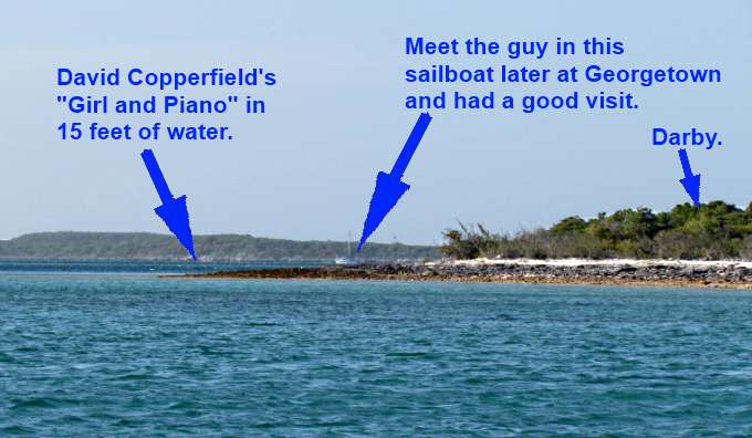
On the way back past here I hope to maybe get to dive on Copperfield's underwater 'mermaid and piano' that was just north of where I was anchored.
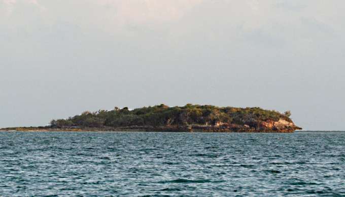
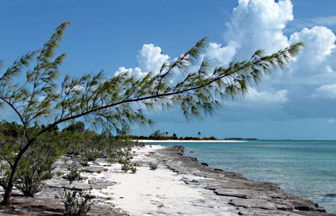
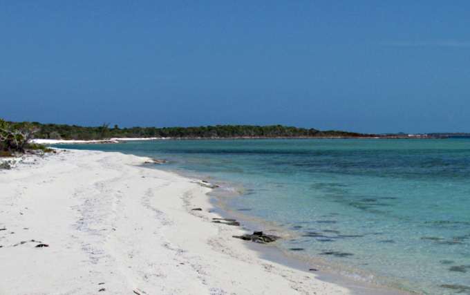
Much smaller Betty Cay was a short distance to the south.
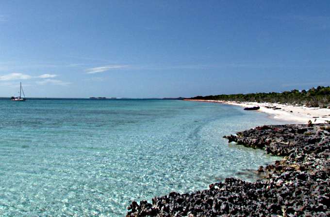
Betty Cay is to the right and I decided to go ashore and see if I could make it up to the point on Darby at the center of the picture above about 3/4's of a mile from where I'd go ashore.
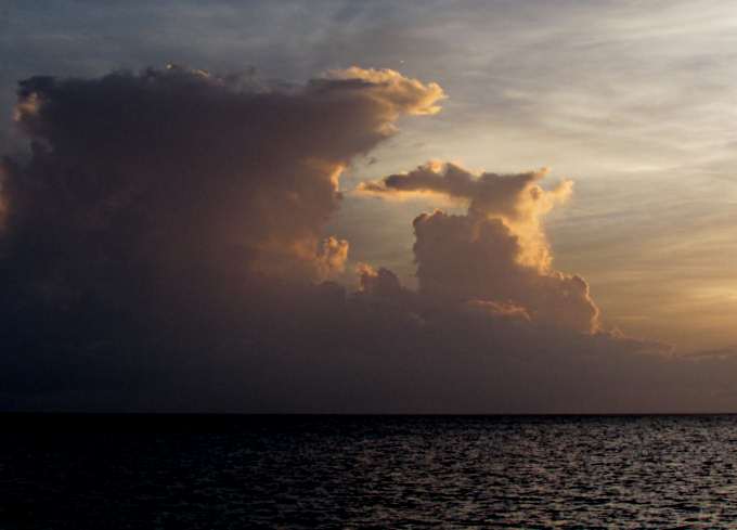
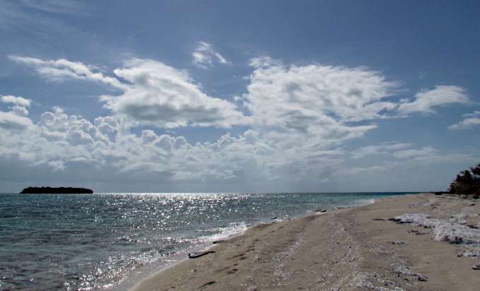
I guess by now everyone is tired of the cloud pictures along with the sunsets and sunrises but you are going to have to endure a number more before the trip is over as I love them.
With the dinghy ashore I proceeded kind of south. You need some good shoes and I find a walking stick really helps when you have to walk over these exposed reefs as they are really sharp. I'd brought the walking stick I'd made while on Whale with me and it really helps as after being on the boat a lot you find your balance on land isn't what it normally is.
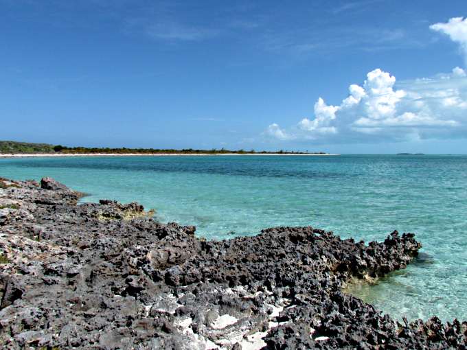
My destination in the distance. This was the only part of the route that was over reef like this. I would of cut inland but it was thick brush.
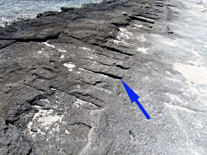
I came across these straight cuts in the stone and knew they weren't natural as nature doesn't create to many things that are straight or evenly spaced.
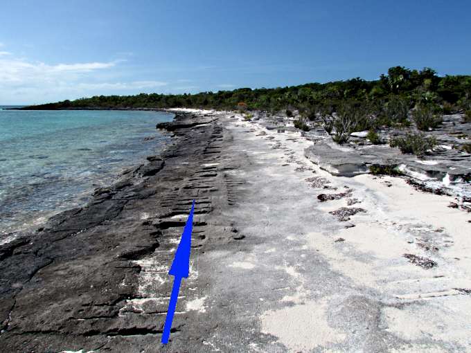
When I looked back it immediately became evident that someone had driven a tracked vehicle along the beach here.
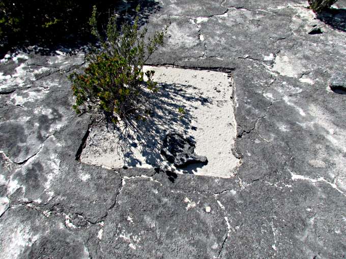
Also in this area it looked like they maybe cut out ...
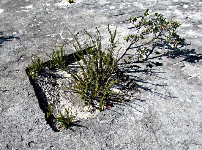
... squares out of the stone also maybe used in the construction or ....
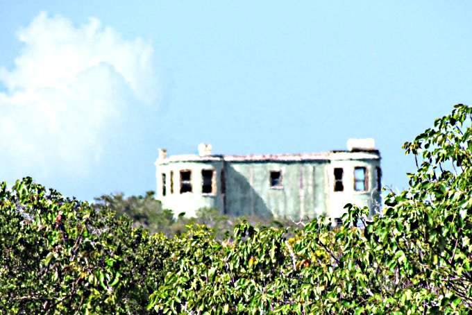
... on the grounds of this deserted castle built by Sir Baxter in 1938 an Englishman that some say was a German sympathizer but at one time was the largest employer in the Exumas more (HERE). The way the windows are situated I felt more than once someone, maybe the old guy's ghost, was watching me through some binoculars from. I was about 3/4's of a mile from the old castle and didn't try and get closer as I wasn't to sure if it was OK that I was on shore here.
I'm getting closer but still have ways to go...
... before I start to arrive...
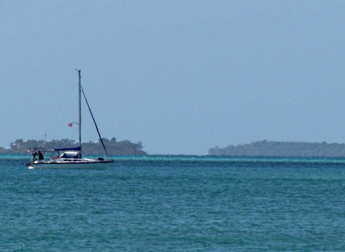
... and get to look back to where the Kera Jane is beyond the far point.
I figured I shouldn't go much further as I had again forgot to bring water and want to make sure I ...
... still had the energy for the walk back. It was only about a 1 ½ mile hide according to the 'measure tool' in OpenCPN but far enough for me on this day.
... back at the dinghy I shot a picture of the boat and paddled back out after a nice trip ashore.
I stayed here a couple days before heading off towards Georgetown.
Now the 'tip of the day'....
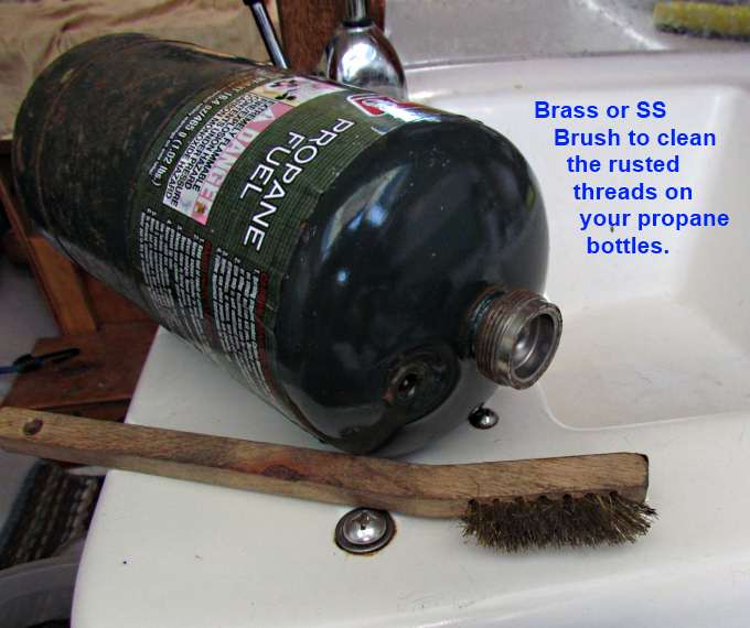
... for those that use propane bottles and keep them out of the boat's interior. Out there with salt spray and the high humidity they will develop rust on the threads. I'm going to try keeping them in ziplock bags and see if that helps but if it doesn't the brush comes in handy as I don't want to screw up the threads on the stove.
=========================================================
........................................................................................Next Page If There Is One...