.................................. Return to Sumner's Home Page....
Return to N Scale RR Main Menu........... Return to Building UP's Canyon Division Menu
=========================================
...............Previous Page.............................Next Page If There Is One
=========================================
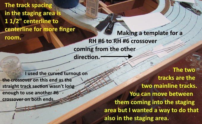
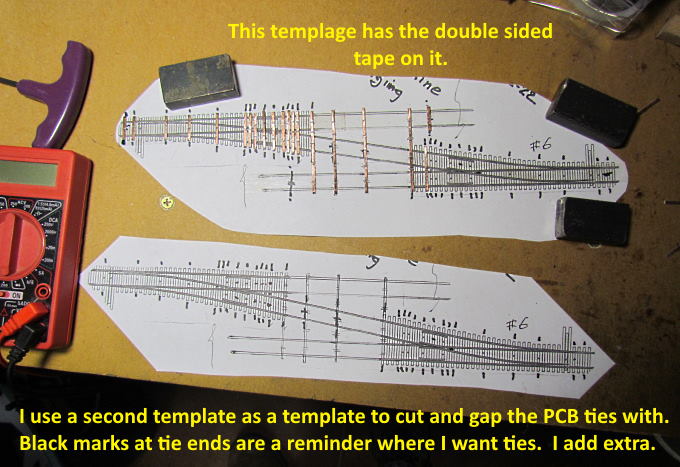
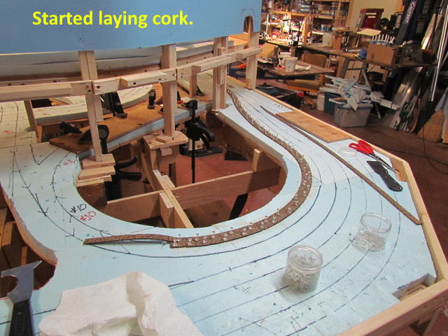
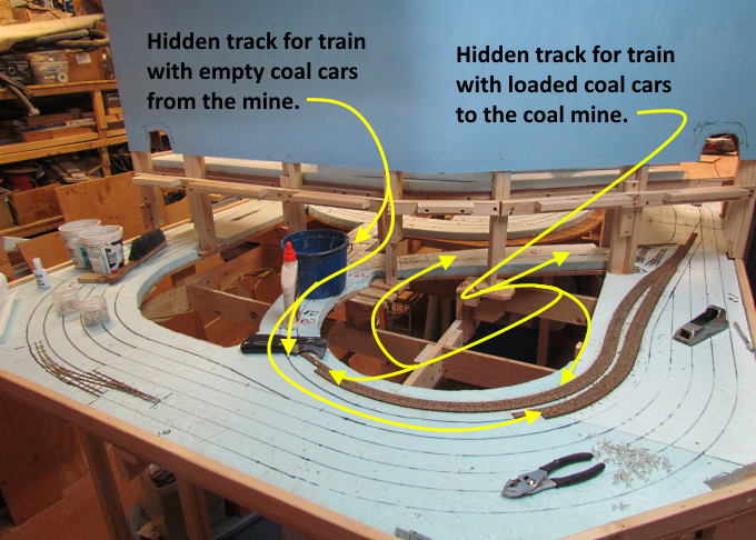
… …...........--- Hidden Coal & Staging Tracks Pt. 3 ---
============================================
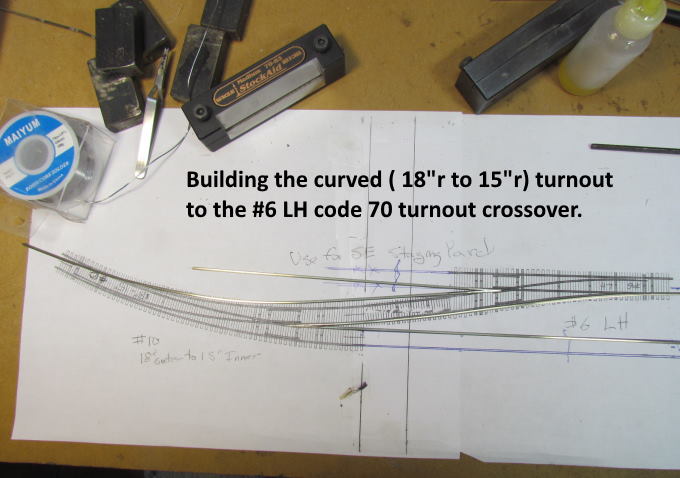
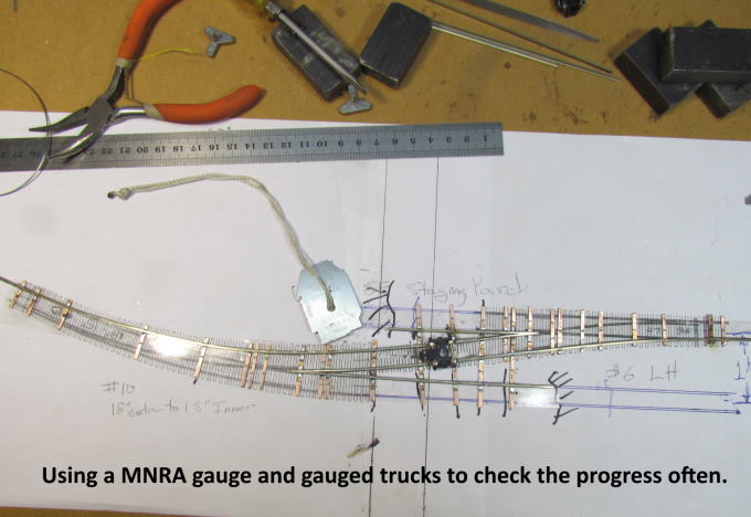
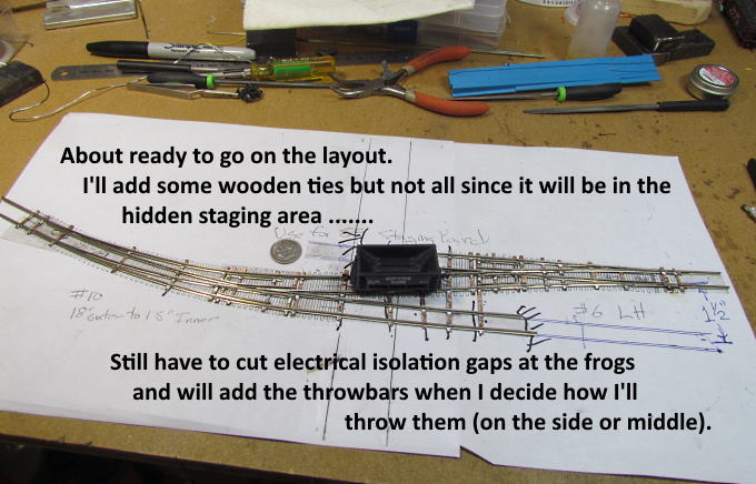
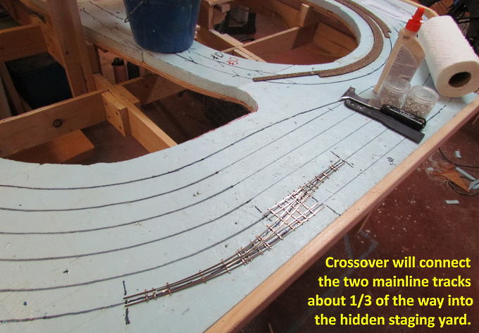
Moving along jumping to whatever I feel like working on for that day.
.
.
.
.
.
.
.
.
.
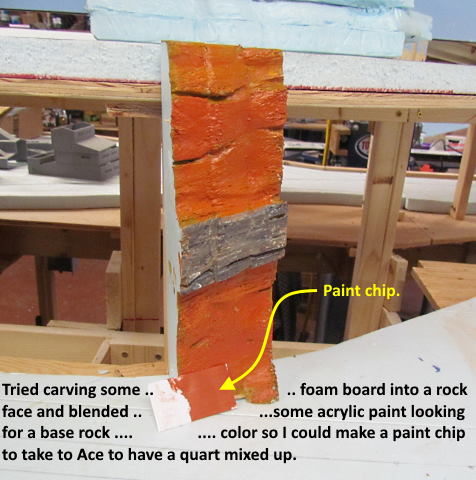
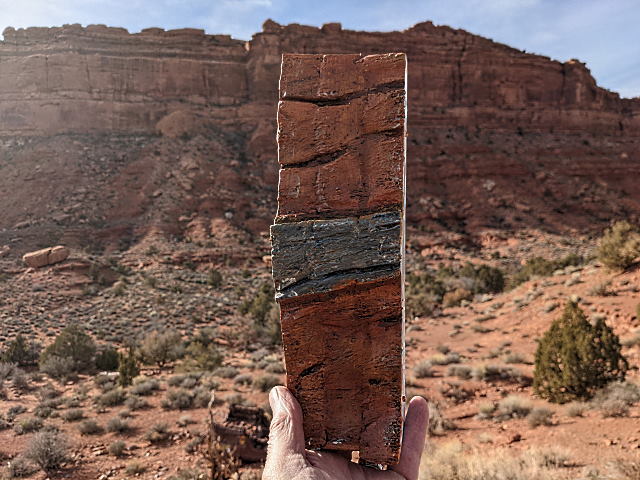
Christmas Day Dottie and I made some sandwiches and drove 40 miles south to Valley of the God which is on the north side of the San Juan River in Utah. Monument Valley is on the south side of the river and they have similar rock formations, mainly the vertical Wingate red sandstone with the sloping Chinle sandstone talus slopes below. I was interest ….
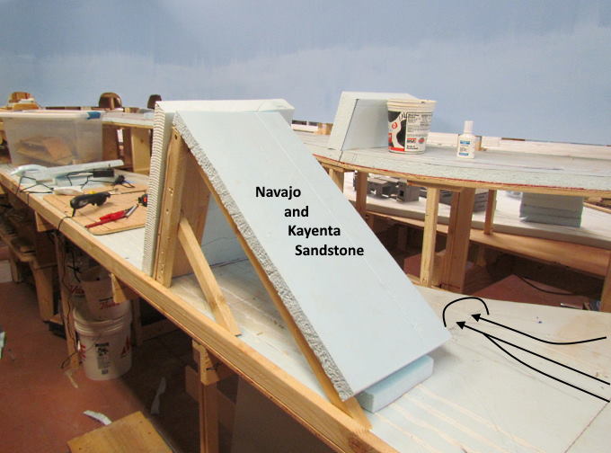
…. in seeing if the paint that I came up with for the rock work I was trying to make out of foam was similar to the real thing. I'm pretty happy with it at this point and will tweak it a little when I start putting it in place on the layout. The gray layer in the model is a limestone layer that forms a cap rock in the area but the real thing is very thin so way out of proportion on the model.
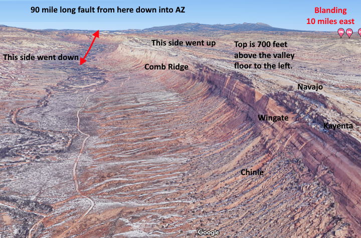
I'd like to have the lower level tracks go through a ridge similar to Comb Ridge about 10 miles west of our house and shown above. Of course it is going to be scaled down considerably as trying to duplicate the 700 foot high ridge above would end up with it being about 54 inches high on the layout so I'll have to compress it.
You do find much smaller ridges like this, often call Hogbacks, along the front range north and south of Denver and some by Gallup, New Mexico and other places in the country where there has also been an uplift usually along a fault line.
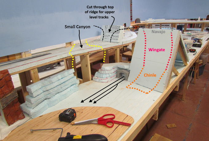
To see if I thought this was going to be possible I spent an hour or so just mocking in what I hope will work out. If I can do this I think I'm going to like it as it will act like a mini-divider and setup a scene on this side where I can have the edge of a small town by the tracks and...
….. on the other side will be the tracks going to and from the coal mine complex and the main line going further west.
Also the coal mines in eastern Utah area are in the Blackhawk formation that is younger and above the Navajo sandstone and other formations that make up Comb Ridge. Since the Navajo is dipping down it is somewhat realistic that the coal mine can be a ways away in the higher Blackhawk formation that contains coal in the area to the north (actually about 150 miles in real life). Lots of work ahead. I'll pull the mock-up off the layout and continue with getting roadbed and track down but glad I did this as it changes the track plan somewhat in this area.
If you came into the build here you can find the main index for the build ( HERE ).
=========================================
...........................On..............e.........Next Page If There Is One