........MacGregor Index Page.............. Flaming Gorge Trip Index Page
.................Previous Page........................................Next Page If There Is One
=========================================================
|
...........--- Just North of Lucerne Marina --- .................................................--- to --- ...................--- Near Jarvis Boat Camp --- ..........................--- After Going to Dam --- |
.....................................................................................................
|
............ .............(Wed -- Jun 22nd) .................Anchorage --- N 40º 56.083´ .................................W 109º 29.080´ ....Trip Mileage = 54.4 NM ---- Day's Mileage = 27.7 NM Sailed = 0.0 NM.-- .Motored = 11.7 NM -- Motor-Sailed = 16.0 NM |
=========================================================
We were starting to feel the pressure of the trip coming to an end as we had to be home the next week as company was coming. It was now Wed of the second week and we needed to take out the coming Monday. We had really enjoyed the sailing and had sailed most of the 50+ miles down to Lucerne but we were going to have to now primarily motor if we wanted to try and get down to the Dam as we would be entering the narrow canyon part of the lake where the next 25 miles to the dam would be a lot harder to sail with the high canyon walls and erratic winds and wind directions.
Dottie pulled the shore lines in and started stuffing them in their bags while I pulled the bow around to the side of the cove where I was able to step onto the bow using the Manson anchor as a step. We motored out and ...
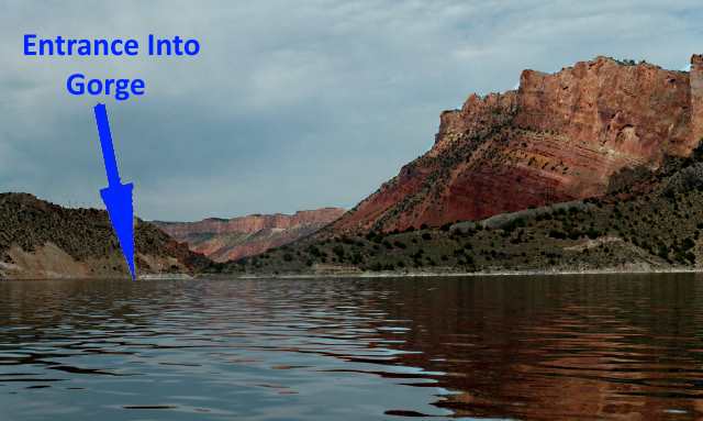
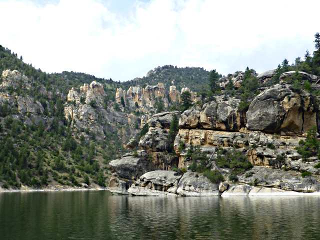
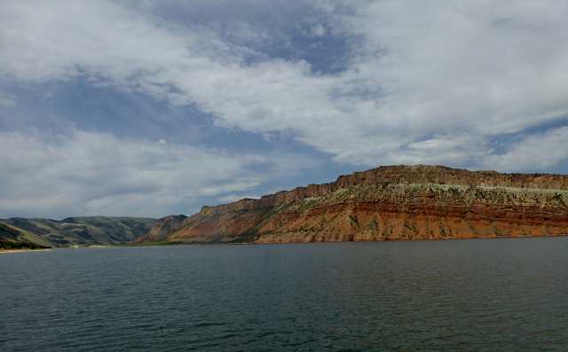
..... started motoring towards the entrance into the gorge about 2 miles away. From across the lake it is hard to make out exactly where the opening is that allows you to continue on down the lake but it is between the Boar's Tusk to the east and the red cliffs to the west.
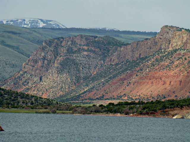
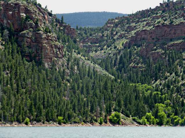
At the opening and beyond it becomes quite clear why this is 'Flaming Gorge'. It is beautiful and quite impressive with the red escarpment rising over 1000 feet above the lake's waters.
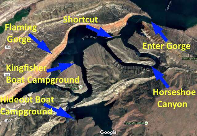
Just a little ways into the canyon you are faced with a decision. Do you take the shortcut that has been dug just under the red cliffs or do you enter Horseshoe Canyon, the original course of the Green River? We decided we want to see Horseshoe Canyon and would save the shortcut for the return trip.
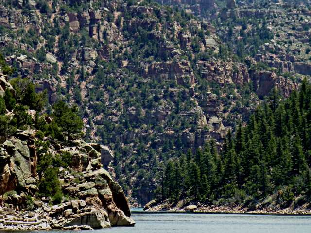
We didn't know how far we would make it today at this point but wanted to enjoy ....
.... the high canyon walls that ....
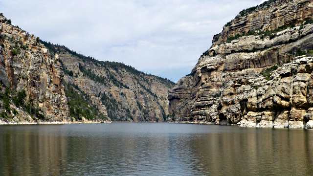
.... lined the Horseshoe Canyon part of the lake.
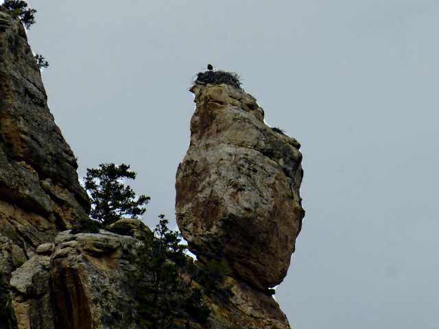
We started to see many large nests, this one atop a precariously balanced rock.
The Horseshoe Canyon is a little over 3 miles in length and well worth seeing.
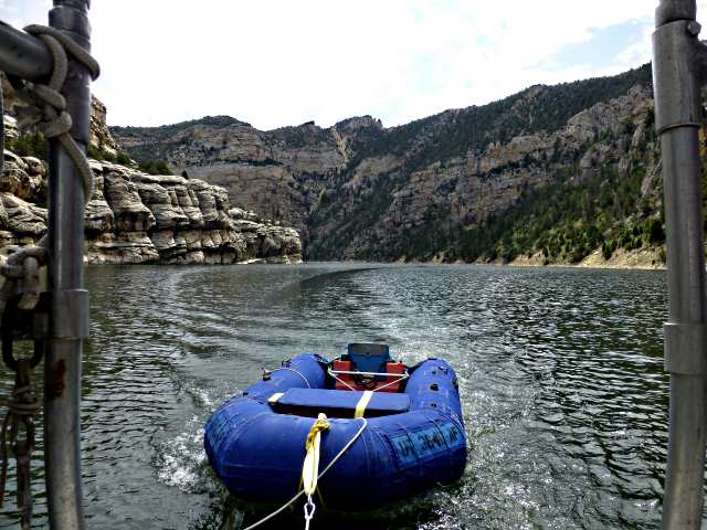
At the end of the Horseshoe you come back out facing the red rock wall of the Flaming Gorge again just to the southwest of the 'short-cut'. We had considered staying at the Kingfisher Island Boat Camp a little further down the lake but there were quite a few people there so we pushed on. One of the rangers at Lucerne had highly recommended the Hideout Boat camp another couple miles down the lake so we thought we would take a look at it also.
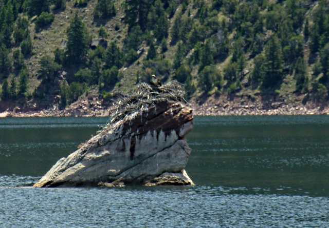
On the way there we passed an Osprey Nest on a rock in the lake. We could of motored by within 20 feet of it but....
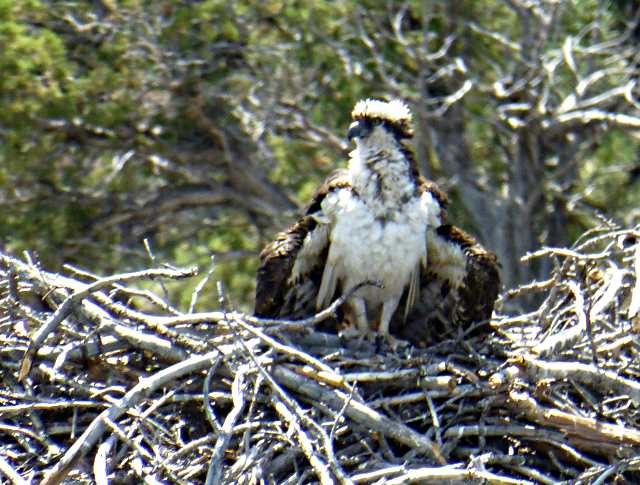
..... worried about frightening the baby there so kept our distance and he just gave us 'a look' as we went by a ways away.
We got to and passed the boat camp at Hideout and kept heading towards the dam. I was worried about places to beach or anchor the boat in this part of the lake with its rocky shore and the depth of the water just off shore in most places but started to see some little coves that looked like they might let us beach the boat as we had now been doing.
Most of the lake down towards the dam is called Red Canyon and although it isn't the same rock formations that we saw by the Gorge it still was very pretty and a number of places the rock rose over 1000 feet straight above the lake. We kept making good time running around 4 1/2-5 kts on the motor and were motorsailing at times in light to 10 mph winds with the genoa when the wind was from the right direction. That would usually add a knot or so to the speed.
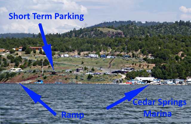
We got to and passed Cedar Springs Marina and Ramp ....
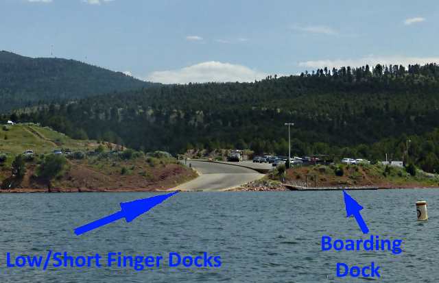
..... where we had considered launching from a week earlier. With Dottie being the fast learner that she is I would now feel confident of us launching from a ramp like this were I could put her and the boat in the water and she could take it over to a boarding dock.
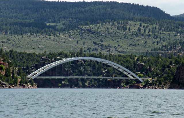
We then passed the Highway 191 bridge that crosses an arm of the lake just before 191 crosses the dam itself and ....
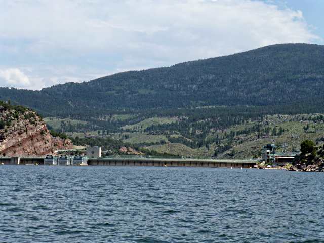
.... then not that much later got to the dam itself. A day or two earlier I hadn't thought we would get to the dam but we did. Not much to see here.

It was more of a 'let's see if we can get to the dam or not' thing.
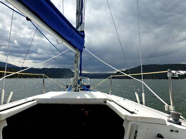
As we turned and headed back up the lake the clouds darkened and the wind picked up and we put on rain gear and endured a short shower.
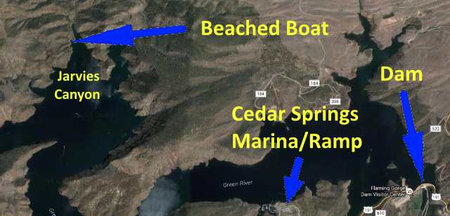
A few miles up the lake we entered the Jarvies Canyon arm of the lake and where we considered tying up to a dock at a boat campground. Upon arriving at it there was a large group of what appeared to be scouts using it so ......
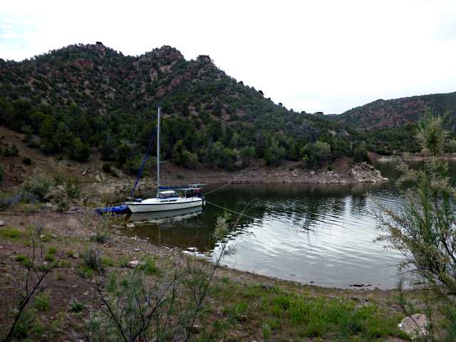
..... we motored on across the end of the arm and beached the boat in a nice little side cove there.
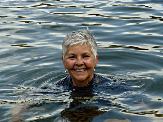
Dottie went for a swim and ....
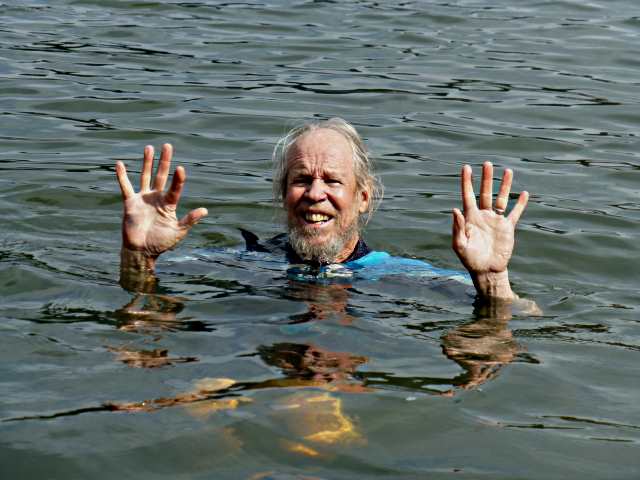
..... this time I joined her, but only after donning a 3/4's wet suit.
=========================================================
...............................................................Next Page If There Is One...