........MacGregor Index Page.............. Flaming Gorge Trip Index Page
.................Previous Page........................................Next Page If There Is One
=========================================================
|
.................................--- Blanding Utah --- ......................................................--- to --- .................--- Buckboard Ramp, Wyo. --- |
.....................................................................................................
|
.............(Mon/Tue -- Jun 13th and 14th) .......Buckboard Marina, Wyo --- N 41º 14.781´ ..........................................W 109º 35.668´ ........Road Trip Mileage to Lake = 429 miles |
=========================================================
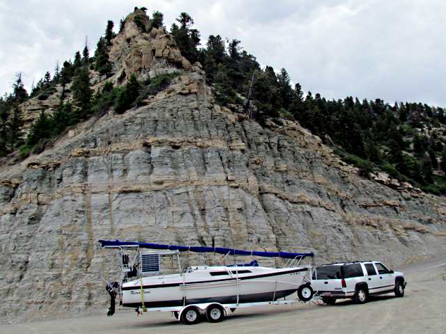
Prior to starting on the trip to Flaming Gorge, we spent considerable time working on the boat since the Kera Jane hadn't been in the water since the trip to the Bahamas in 2015. At the end of that trip the cheek-plates on the bottom of the rudder post that hold the rudder on had broken just after clearing the Gulf Stream on Florida's East Coast. I repaired them and did some other maintenance and Dottie helped me setup the mast and make sure all the lines and such were there and we cleaned up the boat in general. Next we packed supplies and water for a couple weeks out since we had no idea what we would be able to find once on the water.
We had thought about going to Lake Powell and sailing from Halls Crossing/Bull Frog to Hite Crossing at the end of the lake, hoping to finish sailing the length of Lake Powell. Something Ruth and I had tried to accomplish in 2009. Since it was supposed to be in the 90's we picked going to Flaming Gorge Reservoir, where 80 degree temperatures were predicted instead. Flaming Gorge Res. is on the Green River where it exits Wyoming and enters Utah and is about 90 miles in length. I had driven by parts of it but you see very little of it from the two highways that run along side the lake on the east and west sides. Also Dottie had never been to Wyoming so it would be a first for her.
After spending a couple very long days getting the boat ready we headed out on Monday the 13th of June, 2016.
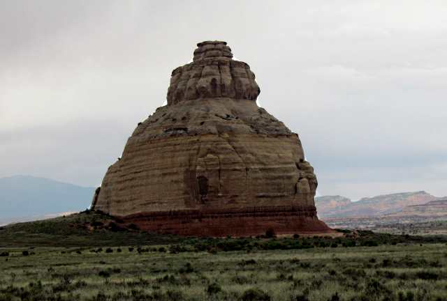
With the boat behind the Suburban we headed north towards Moab on 191 and about 40 minutes later passed Church Rock.
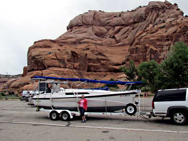
Just south of Moab we stopped for a quick visit at the very nice rest area there.
Highway 191 passes through our small town, Blanding, UT, and also by chance goes right to Flaming Gorge Res., crossing the dam where it then heads north just to the east of the lake on its way to the Canadian Border. It is about 334 miles from Blanding to the dam if you take 191 the entire way and we wanted to go to the the ramp at Cedar Springs Marina which is very close to the dam.
Another route though, was about 11 miles shorter and involved taking 191 to I70 north of Moab, where instead of following 191/I70 west you head east on I70 to just west of Grand Junction, CO where you head north on Highway 139 up and over the Book Cliffs and on to Vernal, UT where you again pick up 191, which takes you to the lake.
I had been over both routes some years before and unfortunately hadn't remembered them clearly. With a foggy memory in place I decided to take the slightly shorter route over the Book Cliffs. What a mistake!!
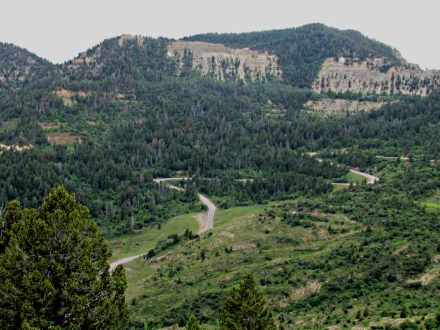
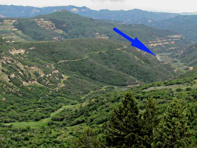
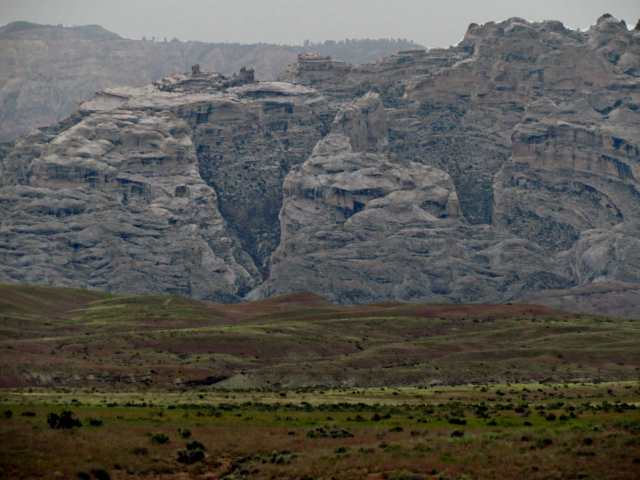
The climb up and over the Book Cliffs is a very steep climb on a narrow twisty road with many switchbacks, some of which can be seen above. The summit, Douglas Pass, tops out at an elevation of 8,268 feet after climbing over 3,500 feet from the valley floor. The suburban pulled the hill but was in 1st and 2nd most of the time running about 20 mph.
The picture above was taken from a turnout near the summit looking back down at the road in the valley below.
I would never pull the boat over this pass again and did not want to make the trip down it on the return even though the brakes on the trailer and Suburban are good.
Once clear of the pass we made the descent on the other side and on to Rangely and Dinosaur in Colorado and eventually arrived in Vernal, UT where we decided to spend the night. There were more hills in this stretch but none near as bad as the one up Book Cliffs. Once in Vernal we set up camp in Walmart's parking lot there after getting a bite and were soon asleep, beat from the day's trip and previous days of getting ready.
In the morning we were off to the ramp at Cedar Spring's Marina but first....
...we had to climb up over the east flank of the Uinta Mountains in northern Utah. Once again it was switchback after switchback as the highway climbed to almost 10,000 feet before descending via more switchbacks to the ramp near the dam. More miles of 1st and 2nd gear running 20 mph. This 4,800 foot climb clenched it. We were for sure not coming back this way and if that wasn't enough to clinch it, what was to follow for sure did. This pass and the one before it over the Book Cliffs were huge anxiety producers as I worried whether we were burning up the transmission or not. I did look at the transmission fluid after transversing the two passes and the color looked good and it didn't have a burnt smell so hopefully all was still good.
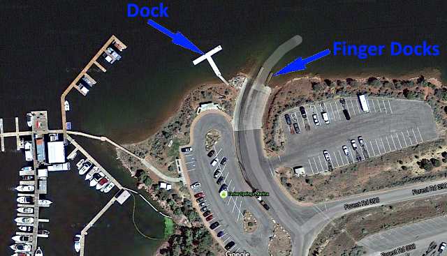
Once at the ramp at Cedar Springs we first met a nice young lady that inspected the boat for mussels. Once passed, she gave us a card to place in the Suburban while we were on the lake. Next we parked in the lot there and walked down to the ramp and I wasn't happy with what I saw. It was quite steep and that worried me a little. The bigger problem was that there were two little finger docks just off the water with the main dock off to the west. You would have to use the outboard to take the boat over to the main dock since you couldn't line it that far. I thought the finger docks were too low to easily board the boat from them. This was Dottie's first trip with the boat so it wasn't fair to her to put her in it and back into the water and expect her to take the boat over to the dock under power and I didn't like the idea of me doing it and leaving the Suburban and trailer tying up the ramp.
We walked down to the marina and talked to a knowledgeable employee there about the situation. He said that most sailboats put in and primarily sail the Wyoming part of the lake and suggested we go to the ramp at Buckboard on the west side of the lake in Wyoming and put in there. We knew of one other Macgregor owner who used that ramp so decided to go there.
NOTE: We also bought a FISH.n.MAPCO Flaming Gorge Plus Green River Below map at the Marina and one should definitely get one at the lake or a safer bet would be to get one on-line before making the trip.
Next problem was how to get there. The logical way was the road up the west side of the lake to the ramp but the guy said that way involved a section of switchbacks and steep grades and suggested instead that we take 191 up the east side to Rock Springs, WY and then I80 over to Green River and from there 25 miles south to the ramp. Later someone else said the road up the west side wasn't that bad and said 191 was worst, so who knows? We pulled out of Cedar Springs back onto 191 and crossed the dam...

..... and headed north about 65 miles to I80 west of Rock Springs. More hills but the road was good. Once on I80 it was west 10 miles to Green River and then 25 miles south on Highway 530 to a side road that takes you to the ramp at Buckboard Crossing. We went into the store at the marina there for a cold drink and found out that we needed a Zebra Mussel sticker for Wyoming on the boat.
It was back 25 miles to Green River to get the AIS decal at the local Ace Hardware Store. It was $30 and we had to buy a second one for the inflatable since it has an outboard. Buying the sticker just funds the Zebra Mussel inspection program so you still aren't through once you buy one. They inspect the boats at some of the ramps but not all. We found out they weren't inspecting at Buckboard so next we headed over to the Wyoming Game and Fish office which was just a couple blocks away. They inspected the boat and gave us more paperwork to carry on the boat with us in case we were stopped on the lake, which we later were. Of note, is that if we would have gone into the lake in Utah and then traveled north into Wyoming and not had the AIS decal we could of been ticketed.
With some fast food in us, it was 25 miles back south to the ramp at Buckboard. Driving from Vernal to the Cedar Springs ramp and then on to the ramp at Buckboard via Rock Springs and Green River and then back to Green River was a total of close to 200 miles for the day. We still needed to set up the boat and that isn't a 45 minute job. You have to raise the mast and put on the main and the various lines. The main sheet, Genoa sheets, preventers for running, lazy jacks for the sail pack, the single line reefing and the topping lift all need to be run.
The anchors had to be put in place with their rodes and rode bags along with mounting the inflatable's outboard, which hangs off the starboard side of the boat. By the time all of that was done we called it quits for the day and decided to sleep in the boat overnight in the parking lot by the ramp even though the signs there said that was a "no-no". We left the Zodiac setup for the morning. It was the end of the second day and we had driven about 500 miles and still weren't in the water. At 72 I have to admit I was beginning to wonder how many more years I'd be able to do this. Dottie being somewhat younger was hanging in there well and always there to take on whatever the job. We were tired but excited about getting on the lake.
=========================================================
...............................................................Next Page If There Is One...