.....................MacGregor Index Page.......... 2015 Bahama Trip Index Page
....................................Previous Page......................................This is the Last Trip Page
=========================================================
|
...........................--- West End, Bahamas ---................................ ..........................................................--- To --- ......................--- Port St. Lucie, Florida ---
|
.....................................................................................................
===============================================
|
....................................................(May 31st to June 1st) Anchorage --- N 27º 09.231´ ==== Trip Mileage = 1294 miles 7................W 80º 11.736´ ==== Day's Mileage = 91 miles |
===============================================
I was up at 1:30 am and began what was going to be a long hard day ending in a fairly big letdown. Let me backup a minute though.
As the trip was coming to an end, and while in Fox Town, I began feeling like I didn't want the trip to come to an end. I considered staying in the Bahamas longer, but with hurricane season soon starting didn't really want to do that. What I was feeling in the mood for was once back to Florida heading up the ICW and hopefully making it up to Conn. to visit with my sister and her family. They live just off Long Island Sound. I love using my computer/chartplotter running OpenCPN and it had done a great job of this trip, but considering all the miles I'd be running on the twisty ICW, wanted a better chartplotter in the cockpit with me.
I decided on a Standard Horizon CPN700i. I felt it had a lot of features and also comes with charts for the US, the Bahamas and Mexico, all important to me. The gpsstore.com had a great price on them and I was able, via e-mail, to order one and have it sent to Charlotte Harbor Boat Storage, where my other sailboat was and where the Suburban and trailer were. I'd also found a friend on a Mac forum, that had a dock on property up the Florida's east coast where I could tie the boar up for a while. I could then return to the boatyard for tools and such to install the chartplotter and do other service on the boat and outboard. By the end of the day those plans would be pretty much dashed though.
Getting back to the trip, after awaking at 1:30 I proceeded to get off anchor and motor back out the passage I'd come in on the night before, being careful to stay on the previous day's track in the dark. That went without incident and soon I was off on a heading of about 270 towards the Florida coast. As you will see further down this page, being on a heading of 270 doesn't mean the boat will actually head straight across to Florida but will instead, due to the Gulf Stream's current, end up quite a ways north up the coast.
A couple hours out I saw a boat on my AIS that seemed to be headed towards me. I kept an eye on it and started changing my course to a more southerly one hoping to pass the boat starboard to starboard, with a good distance between us. It seemed that even though I had changed my course I wasn't gaining the separation that I wanted. I finally saw the other boat's lights, a 35-40 foot sailboat. I tried to raise the boat on the radio but had no luck. I turned a little more to port and we passed with about 100 yards separating us. I saw no one on deck and the boat passed like a ghost in the night. I'm sure the boat was running on the diesel and autopilot with no one awake at the helm. They didn't have that much further to go before they would be at West End. Surely they must of awaken before then?
I tried taking a couple 15 minute naps myself. I'd set the alarm on the smart phone and tuck it down in my pants with the ringer on high and the vibrate on and would try and drift off. I didn't have much luck but slept briefly a couple times before the phone would go off. I also kept an eye on the AIS for other boats, especially container vessels and large oil carriers. I saw a few but none in my path, unlike when I made the crossing west to east at the beginning of the trip a few months earlier. Finally the sun came up and ...
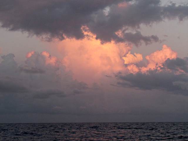
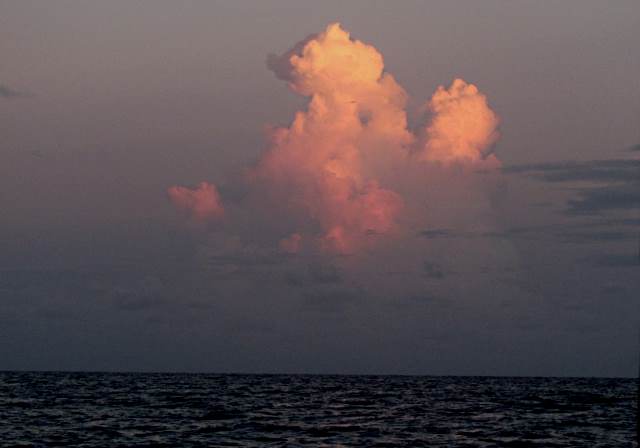
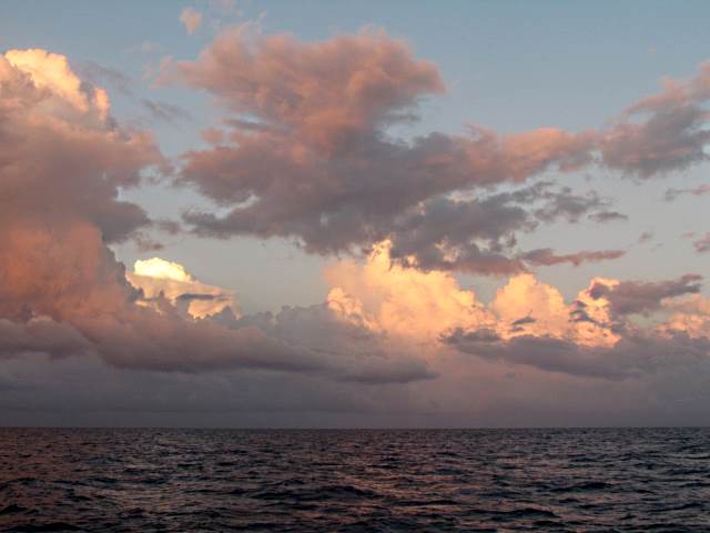
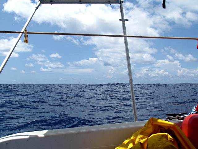
.... there were threatening clouds to the south of me ....
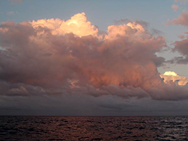
.... but they managed to stay there.
I had really hoped to of sailed across this last leg but that wasn't to be. There was very little wind. I tried to motor-sail and wanted the main up just to stabilize the boat more but it seemed to be slowing me so lowered it and just motored on with the trusty Tohatsu 9.8 HP moving the boat in the direction of Florida. As usual I found running about 5 knots proved to be good for me as that kept the engine noise down.
As the morning wore on, out of sight of land now, the swells began to develop and had more height to them than any I'd encountered on the trip. They were spaced quite far apart so were not threatening. What they did do was slow forward progress as the boat would slow as it climbed them then accelerate to some degree down the other side, but it seemed the slowing was more pronounced than the acceleration.
Along with the swells running in one direction there was another set of waves coming from another direction. Both were coming from astern but they were 30-40 degrees apart. If the two different waves would meet at the same time the boat was on their crest it would result in the boat rolling off to one side. Nothing serious or frightening just uncomfortable as the day wore on.
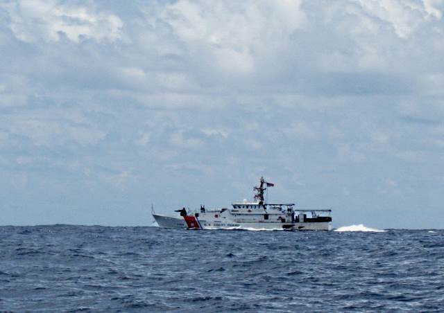
I was still out in the middle of the Gulf Stream when I noticed a large boat come from the southeast over the horizon headed straight towards me. It turned out to be a 154 foot Coast Guard Sentinel Class fast cutter. When it was 200-300 yards from me it turned to the west so that we were pretty much beam to beam and stopped.
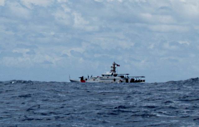
It stayed there for a few minutes and then headed off to the southeast and disappeared over the horizon. I assumed it put some high powered visual inspection of me and my boat numbers and looked in their data base and wrote me off as not worthy of further inspection. I had registered under the Small Vessel Reporting System so my basic float plan was in the system along with a description of the boat and its registration numbers. This also allowed me to just phone in upon returning to the sates vs. having to report in person.
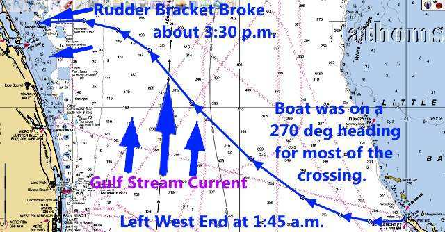
I kept the boat on a 270 degree heading for most of the trip across the Gulf Stream and in hind sight should of cranked in a few more degrees to the south. Above you can see how much effect the Gulf Stream current had on the crossing. If I would of been moving at a faster speed things would of been better also. My destination was Saint Lucie Inlet near Stuart, FL. I had been able to start sailing again and I had the outboard up which soon proved to be a major problem.
While I was still about 6 miles out, but within sight of land, minor disaster struck. The rudder bracket broke rendering the rudder useless. One cheek plate broke all the way off and the other cracked and bent up at a sever angle. The rudder stayed attached to it and the broken side stayed attached to the rudder.
There was a pretty good swell coming in from the east and the boat turned so that it was hitting the boat from the side causing the boat to roll considerably side to side. I wanted to get the outboard down hoping to but the dinghy and drifted around to the port side and was trapped against the side of the boat due to the swells. The lines to it blocked me from lowering the outboard. I tired to pull it back around the stern of the boat and lost one boat hook in the progress. It was now about 4 in the afternoon and I had hoped to go in the inlet at a slack tide as this inlet can be quite dangerous. I'd been up for about 14 hours and was beat and feeling like an old man, and at 71 was to some degree. I'd come close to losing my footing a couple times trying to get the dinghy back around the boat and didn't want to end up in the water by myself. I was still not close to shore, so in no immediate danger, but worried about the inlet if things stretched out.
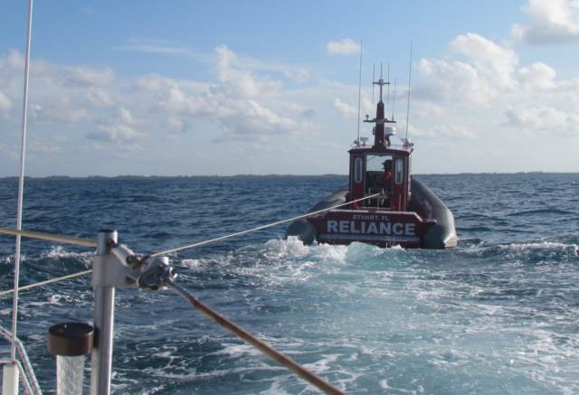
I finally gave up and fired up the phone and called BoatU.S. for a tow. I'd been paying for tow insurance for some time so decided this is what I had gotten for so it was foolish not to use it.
They responded quicker than I expected and the captain was really nice and very professional.
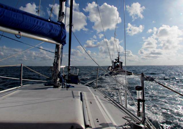
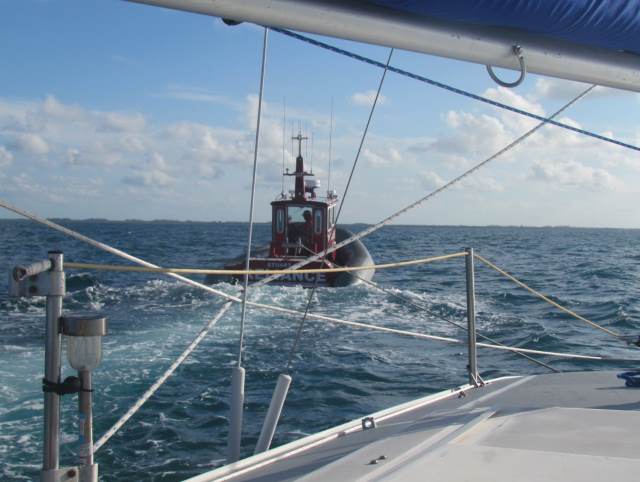
Once hooked up he was able to tow me slowly ahead and that allowed me to get the dinghy back around the boat and in position and to lower the outboard. I figured it might help me to steer the boat some. We took off towards St. Lucie Inlet and it was a ride I hope to never experience again.
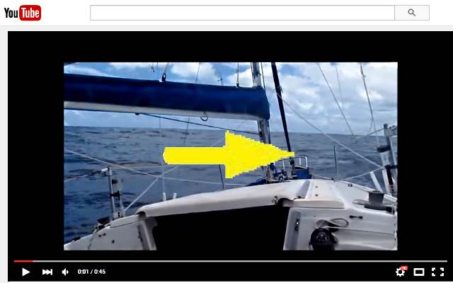
The problem was that I had no steerage so I would swing wildly off to his starboard side and ....
... then off to his port side. I feared that we might rip the bow eye out but it held.
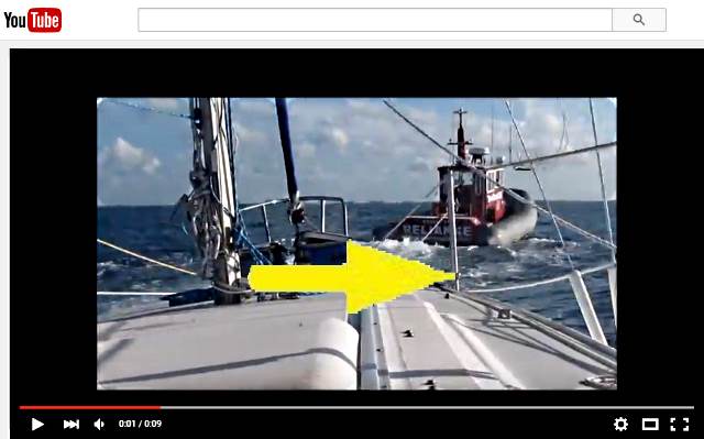
The video above shows how violently the boat would take off in one direction or the other. I tried to help steer with the outboard but that proved totally useless so stopped. He slowed some but the wild swings didn't settle that much.
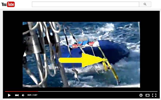
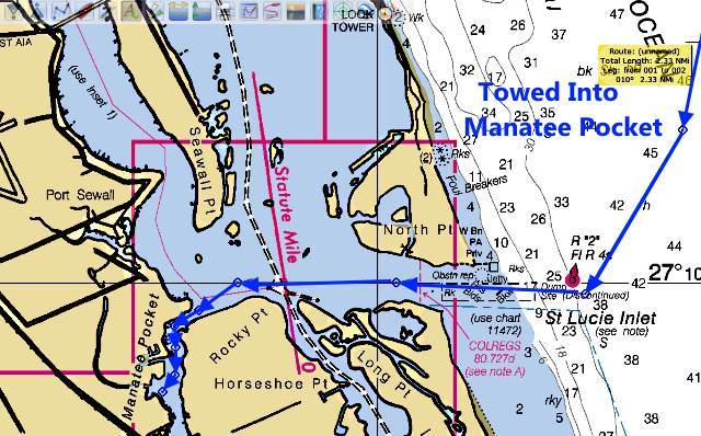
I also feared we were going to pull the dinghy under and called him on the radio and we slowed a little more. We went to and through the inlet with no real problems except as we moved further in we came dangerously close a couple times to collecting a channel marker with the Mac.
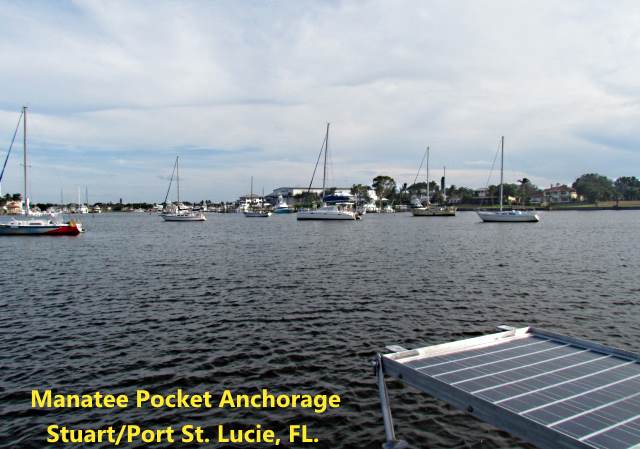
I'd asked him if he could pull me into an anchorage and he did. He pulled me in the Manatee Pocket Anchorage where the boat turned 1294 miles for the trip. I set the anchor and he disconnected and filled out the paperwork. He told me that without the insurance the tow would of been $700 to $900. The insurance paid it all and he was really good at what he did.
I called my friend Scott, who lives at Port Charlotte, and has a boat at the boat yard, to see if he could get the Suburban and trailer and come over and get me. I had left keys with him and he had helped me out also at the beginning of the trip. I spend the night on the boat at the anchorage and he drove across the state the next day to retrieve me (Thanks so much, Scott).
I tied the rudder up so that it was hanging in the water and when he arrived at the ramp about a mile away I motored down there and onto the trailer once he had backed down into the water. We then head back to the Florida's west coast, and the boat yard, with the Mac in tow.
It was a let down to not be able to sail the last few miles of the trip, but considering that the rudder bracket could of broken mid Gulf Stream or back crossing from the Abacos to West End, I was very lucky. I had notice a "clicking" sound the last day and assume that it was the bracket bending back and forth and cracking a little further each time. I had tried to do a visual on the boat more than once during the trip but never caught this. (note: I've since repaired the rudder and will keep a much closer eye on it in the future).
While Anchored in Manatee Pocket I pondered my options and one was to try and get the boat out and see if I could find someone to repair the rudder and then continue north as I had hoped. I was tired and beat and took the predicament as an omen that maybe it was time for the boat and I to head home to Utah, which we did.
This was a trip though that I'll remember for the rest of my days, with 86 days and 1294 miles of very, very fond memories. I will long to return to the Bahamas, hopefully with the larger Endeavour.
If you have made it to this point, thanks for hanging in there, and follow your dreams,
Sumner
=========================================================
.................................................................This is the Last Trip Page...