......................MacGregor Index Page.......... 2015 Bahama Trip Index Page
....................................Previous Page......................................Next Page If There Is One
=========================================================
|
............ ........................................--- Rudder Cut Cay---.. ...................................................................--- to --- ....................................--- Little Farmers Cay ---
|
.....................................................................................................
===============================================
|
..........................................................(April 25th to 28th) 1st Anchorage --- N 23º 57.417´ ==== Trip Mileage = 788 miles .......................W 76º 18.669´ ==== Day's Mileage = 10 miles |
===============================================
After starting the day visiting the Mermaid and Piano underwater (see previous page) it was off to Little Farmers Cay as Chris had predicted some bad weather coming in where winds would clock 360 degrees over a multi-day period. To weather that the bay between Little Farmers, Big Farmers and Great Guana Cays looked like a good place to be for a few days.
I found that with the outboard on just idle and the Genoa out I could move north between 3-4 kts. I only had 10 miles to go so I really liked that pace. It allowed the cays and islands to just gently unfold in front of and along the sides of the boat giving me plenty of time to see them as they passed by.
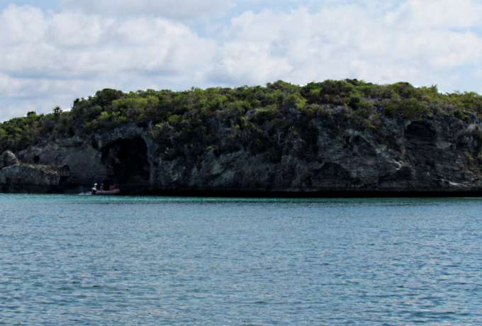
As I passed the point that was just north of the previous night's anchorage people from a nearby boat were exploring the entrance of a cave on the northwest side of the point. On the previous page there is a picture of a cave on the south side of the point.
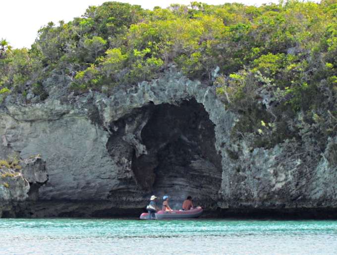
As you can see the one on this side didn't go in very far.
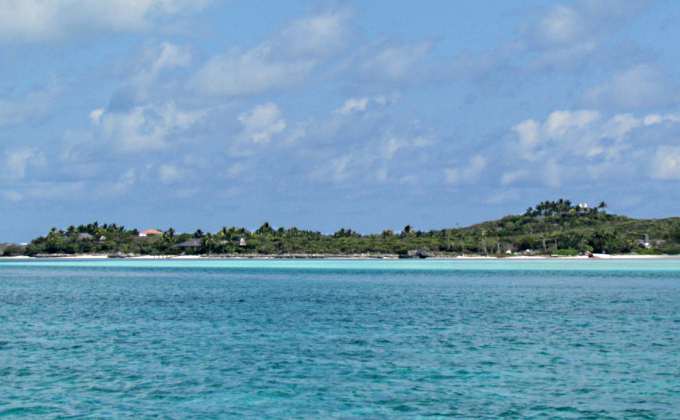
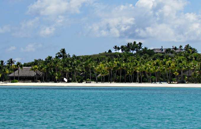
From what I could read on the Internet later Rudder Cut and Moosha Cay just to the north of it both belong to David Copperfield. I didn't see buildings on Rudder Cut, but there is a runway on the very north end of it. There were a number of buildings on....
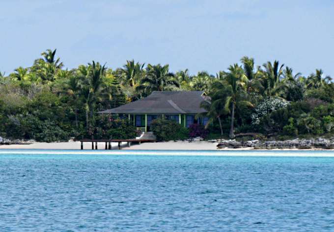
Moosha Cay and ....
... if I understood the info on the Internet you can ....
... book these when they aren't otherwise in use.
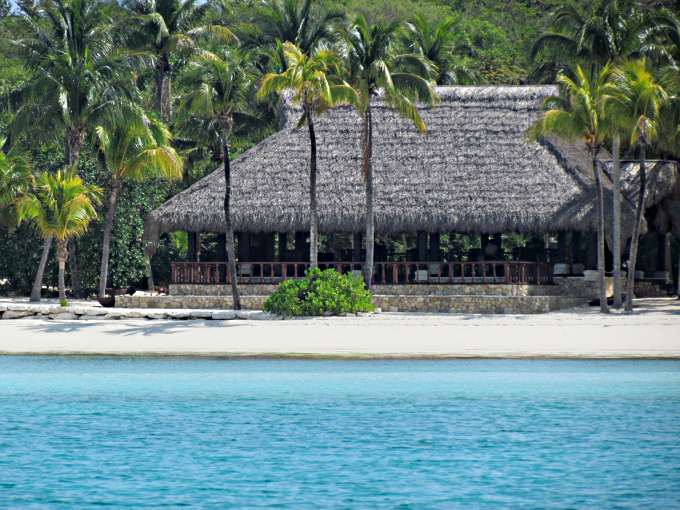
l believe they have a restriction on how many people can be on the island at one time. I forgot the number but think that it was under 50 and this is one of those deals where if you have to ask how much then you probably can't afford a stay here. I wondered to some degree why he put the Mermaid/Piano a fair ways to the south of here at the southern end of Rudder Cut. About the only thing I could come up with is where it is happens to be a place where most would not try and anchor and an anchor hooked on them wouldn't be a good deal.
Moving north of Moosha you first pass Cave Cay Cut then Galliot Cut. If the tide is running both of these will have high current that you will have to deal with depending on which way it is running but regardless as you pass the cut you will experience both high and low boat speeds as you approach and then retreat from the cut again depending on which way the tide is running. I usually saw decreases and increases in boat speed vs. running before and after the cut of about 2-3 kts and you will be adjusting the throttle settings to deal with this.
If you aren't actually going out the cuts don't be afraid of them but do respect them none the less. Galliot Cut was a populay cut for boats coming north out of Georgetown. During the bad weather over the next days I'd hear them going through the cut over the radio and the first boat through would relay what the conditions were like to the next boat and so on. If you are in a smaller boat with shallow draft I'd go south of here as I did. You'll see more and still have a good choice of places to go outside if Georgetown or beyond is your destination. A number of the boats using this cut couldn't go much further south inside due to their draft.
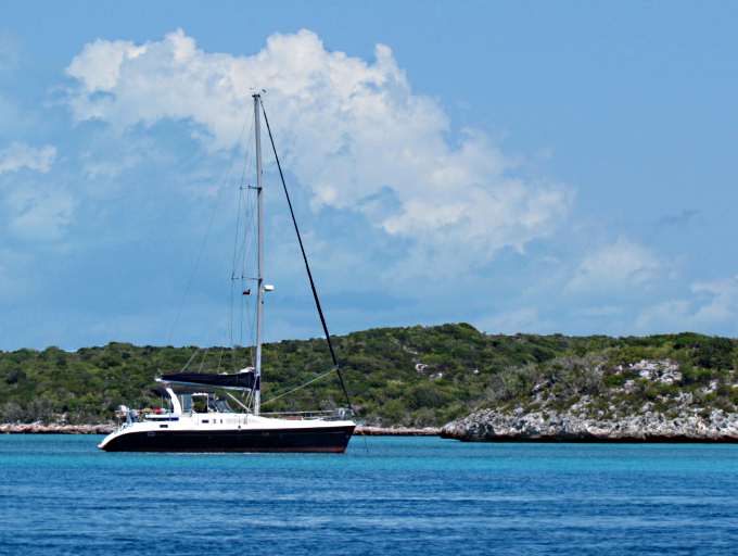
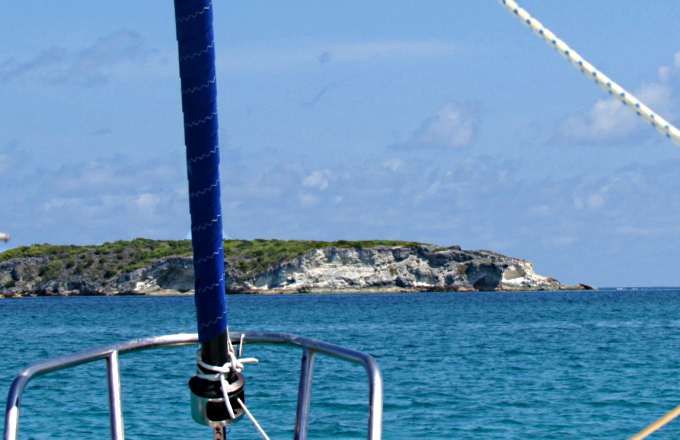
Sitting just inside Galliot and maybe waiting to go out was this pretty boat.
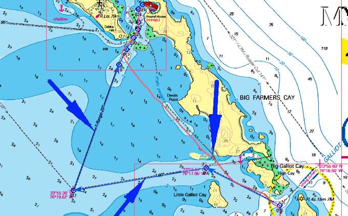
Up to this point I hadn't really pushed taking shortcuts through really skinny water but that was about to change. When I laid out the route to Farmers I plotted waypoints on the conservative route where I'd head west just north of Galliot Cut, bottom arrow and then back northeast into Farmers, left arrow, all over deeper water.
On the chart there was a 'dinghy passage' going north along the western shore of Big Farmers Cay.
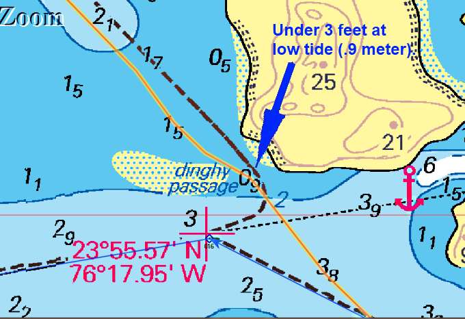
Most of the route had 3 feet of water or a little more except at the very southern end of Big Farmers where the chart showed about .9 of a meter at that point, arrow above. The chart also shows a sandbank there that could be shifting in location. You can't take these charts as being written in gold. I decided to see what the water looked like at the entrance to the dinghy passage and if it looked good I'd go for it.
As I approached I had a large motor yacht starting to approach from my stern and didn't want to be too hesitate so that he would clearly see my intentions. I diverted off of my route and headed for the point with the sand bar just off it to the west. As I neared it I could tell from the color of the water that it was shallow but looked doable.
At this point disregarding the chart I just looked for what looked like the deepest water and headed to it and through it. I'll bet the motor yacht thought I was nuts to do this with a sailboat and expected to see me run aground. I could see the very shallow water over the sandbank and as I ran just to the east of it the rudder kicked up so I knew it was less than 3 feet. I didn't try and pull it back down as that would of probably been pointless but just reached for the outboard tiller and steered towards what looked like deeper water . Within 100 yards the water deepened again and I pulled the rudder back down and headed north with no further problems crossing the bank where most of the water was about 5 feet deep.
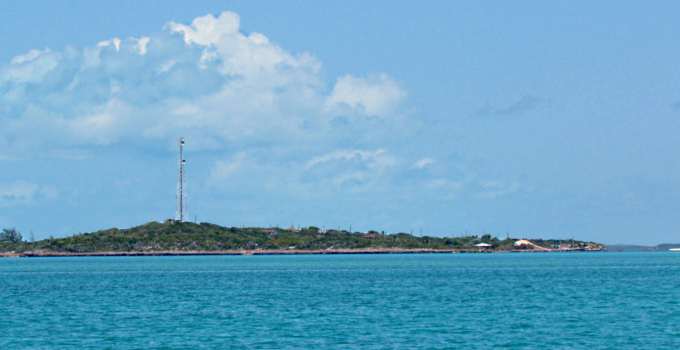
Ahead I could see the Batelco tower rising above the island. When I reached the track I had programmed into OpenCPN and the handheld I turned to starboard and headed for the point on the southeast side of the island, right side of island above and ....
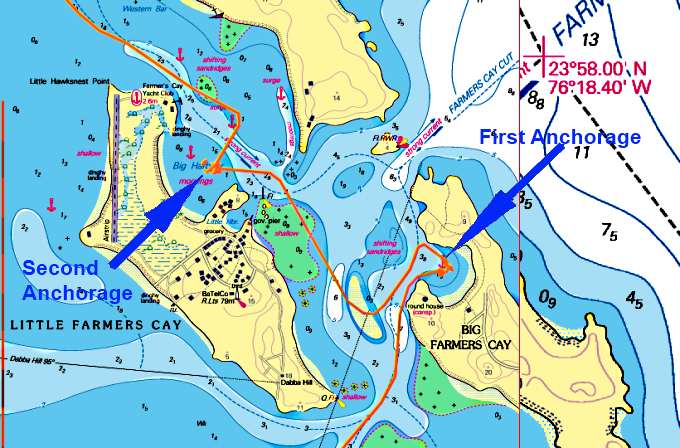
... headed towards my intended anchorage in a small bay on the north end of Big Farmers Cay, right arrow. Later I'd move over to Big Harbor just off of Little Farmers, left arrow.
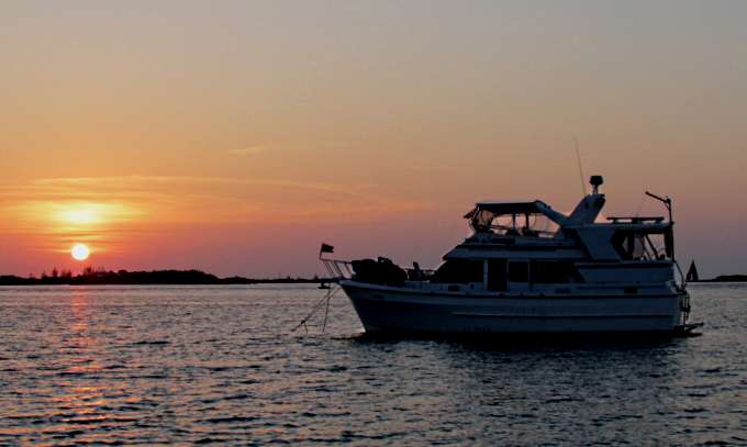
l was anchored in the small bay for a couple days. At low tide I'd end up with just a foot or so under the keel. There were some nice ...
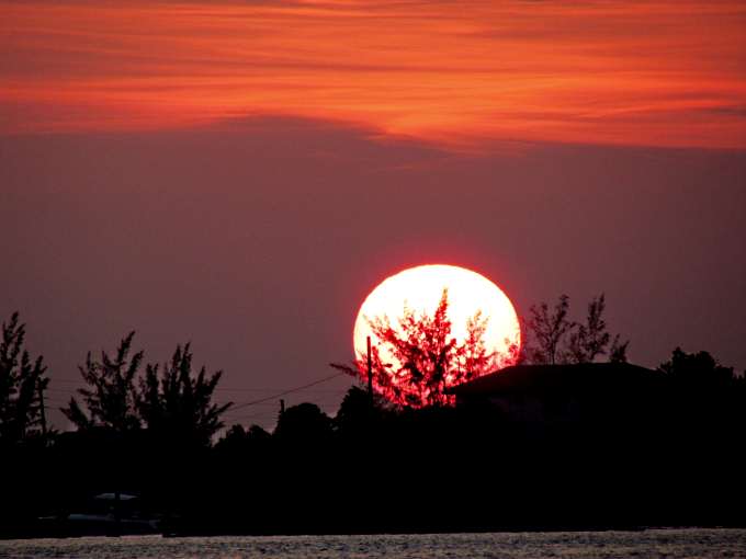
... sunsets from that bay. There were a couple negatives though. One was that the dinghy ride into the settlement was over ½ mile. The other was the anticipated SW, then west and then NW winds that were in store. With all of that in mind I decided a move over to Big Harbor might be a good thing to consider but still stayed on this anchorage for a few days more.
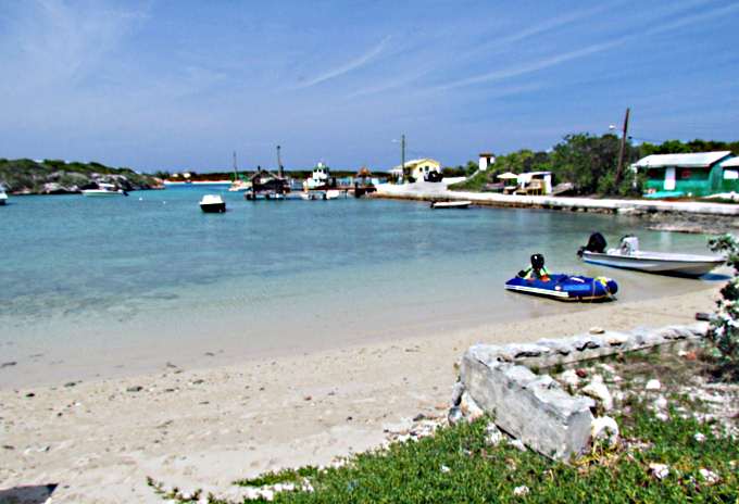
On the 28th I put the outboard on the Zodiac and motored over to Little Harbor, above. It is a picturesque little bay. I had a number of potatoes on the boat that I'd bought back in Florida and they were still good but wouldn't be for much longer and I wanted to find someone to give them to. I took them ashore and as I beached the dinghy a woman was walking by on the street a short distance away. I asked her if she was interested in the potatoes. She wanted to know if they were 'Idaho' potatoes. I told her I wasn't sure about that but she could take a look at them. She looked and said yep she sure would like them as her boy loved mashed 'Idaho' potatoes.
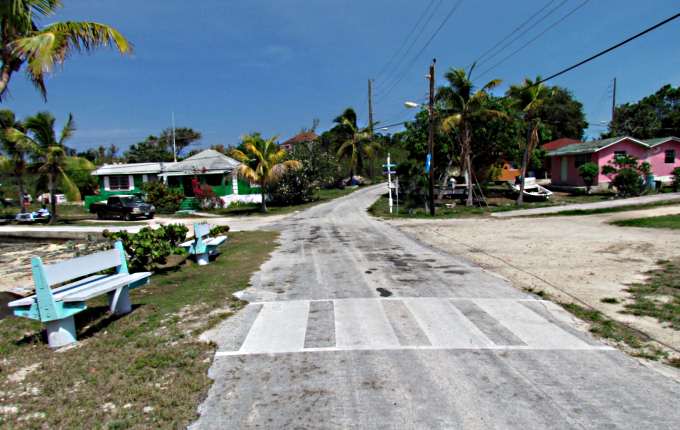
So with the potatoes off to a new home I did a little walking and got a kick out of the marked cross-walk in the street going to the bench where you could wait for the bus that would never come. The beach is about 40 feet to the left of the bench and we are looking south along the main drag.
The view to the north on the same street.
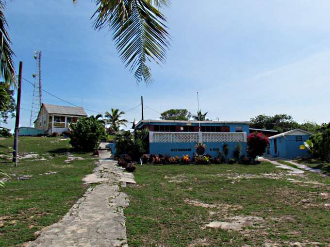
More or less looking west from where the last two pictures where taken we can see....
..... Ocean Cabin Restaurant up a small hill. I originally went there in search of new reading material as the women I gave the potatoes to said that they exchanged books there.
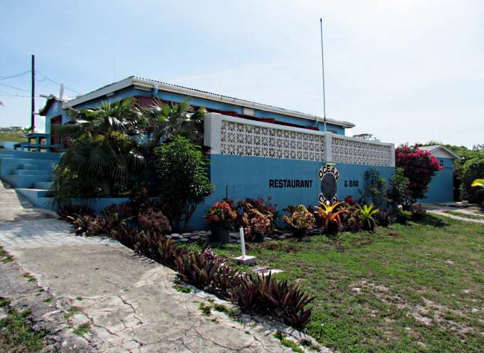
There is a nice view of Little Harbor from the front porch and ....
..... the inside is really nice. Clean and has a warm atmosphere and in some ways reminded me of my house in that the beams in the ceiling are exposed. Other than that not much in common. I asked Terry, the owner, about exchanging books and he said first I needed to read the rules regarding that and then proceeded to read them to me but not quite all of them. He looked at the two books I had and said they were in good enough condition to exchange so I started to look for two new ones. He had a nice collection and it didn't take me long to find two new books. I asked him if I could have the two books and he again told me to read the rules and then told me that it was a two for one deal where I'd give him two books and only get one in return.
I explained that I only had three books total, one still on the boat, and that I really didn't want to get down to only two books and asked if I could just buy one of them. By this time I'd bought a Coke and told him I'd be back at 5 for something to eat so he relented, the nice guy he is, and said to take the two books :-).
He asked what I wanted for dinner and I asked if I could have the conch fritters and fries they serve more as a lunch meal and he said that would be fine. Most of the small family run restaurants on the islands like to know 3-4 hours ahead of a meal what you want and how many will be eating so they can prepare the meal.
Terry explained to me that his wife, Earnestine, prepares the meals and he does everything else. He also has a small, but well stocked with the basics, store in a separate building on the hill leading up to the restaurant. He also sells Batelco phone cards and as mentioned earlier has some of the mooring balls in the harbor.
To contact Ocean Cabin for any of the above go to oceancbn.com or email him at oceancbn@balelnet.bs or by phone -- (22) 355-4006.
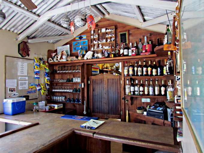
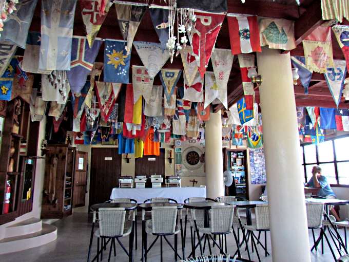
Before leaving I took a quick look at the small but cute bar that is in a small room off the larger room.
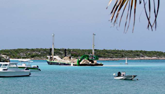
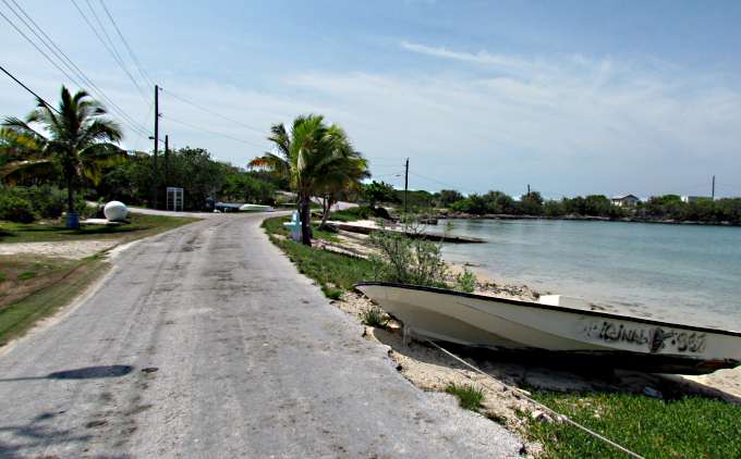
I left the books as I'd be back and walked around for a couple hours. On the dinghy ride in I went past a barge with ....
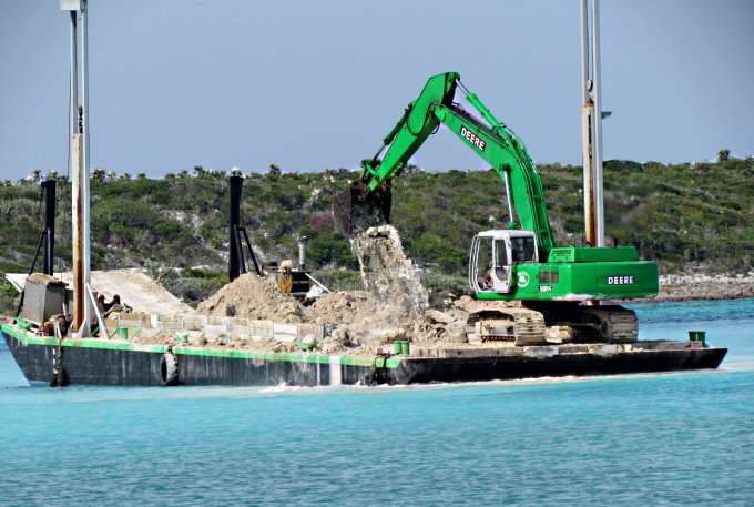
..... a back hoe on it. They had been using it to dredge out the channel into Little Harbor since I'd been there. They would put in long hours, first placing bottom material on the barge and when it was full moving it a short distance down the shoreline and unloading it on the edge of the shore there.
The scene above reminded my of a number of water colors I've seen that looked somewhat similar of places in Florida, the Bahamas and the Caribbean.
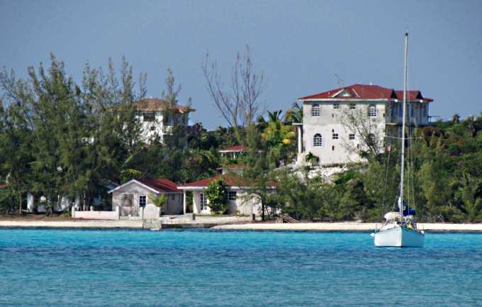
The buildings above are all the way across the harbor and are on the south end of Great Guana Cay and the boat is probably on one of the mooring balls in the channel over there.
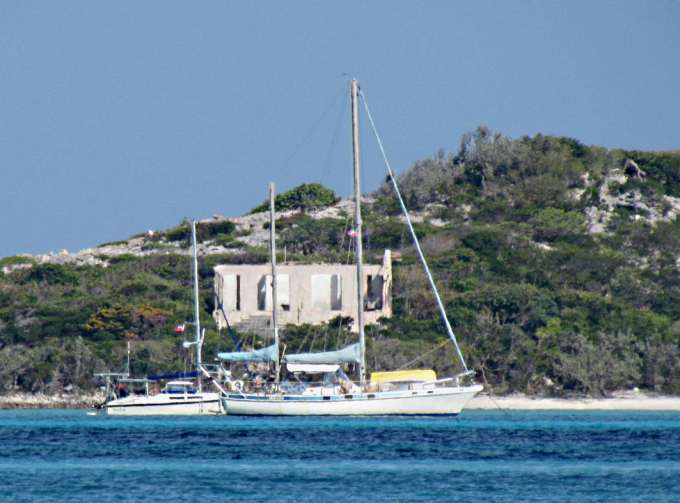
During these days I was anchored in the cove on the SE side of the harbor about 2/3's of a mile from town. The Kera Jane is of course the smaller boat further in above. After I'd been there a night the ketch belonging to Mike and Jenny came in and anchored in the deeper water just outside of me. They also had their son on board and were on the way back to the states after a long trip way down in the Caribbean to Guadeloupe over 1300 miles as the crow flies, if there are crows there, from Florida and much further than that by the actual course they took to get there. I enjoyed talking to them and ran into them some days later up at Warderick Wells and as I approached Rose Island to the west of Nassau later yet I heard them clearing in with the Harbor Master at Nassau and talked to them again on the radio. They were headed to Key West and I to the Berrys and Abacos so that was our last contact. They said they use to have a Macgregor 25 and were going to probably downsize again to a trailerable boat and start seeing the U.S. with it.
The picture quality above isn't great as I took it from the yacht club a mile away. I've been really happy overall with the Cannon PowerShot SX30 IS I'd bought back in 2011. I've taken thousands of pictures with it and the 30X optical zoom can really bring things in. I'm starting to think I need to buy a good quality backup camera as sooner or later this one is going to bite the dust. I do have another Cannon PowerShot but it isn't near as good as this one since it doesn't have much of an optical zoom.
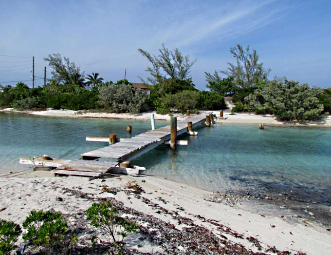
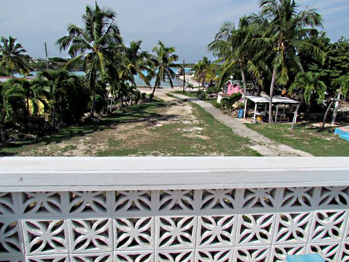
I took the road off to Farmer's Cay Yacht Club and it ends at the creek that goes inland and south in this part of the island. The yacht club put this small foot bridge in to make the walk into town shorter vs. following the road from the yacht club that circles around the island's west shoreline.
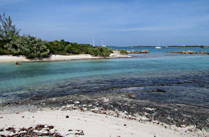
A view from the foot bridge out into Big Harbor where I would move to the next day.
I failed to go into the yacht club so can't comment on what is offered there but you can connect to their wifi while there. I was able to get wifi from the boat with my long distance wifi from both anchorages so never had to go ashore to connect.
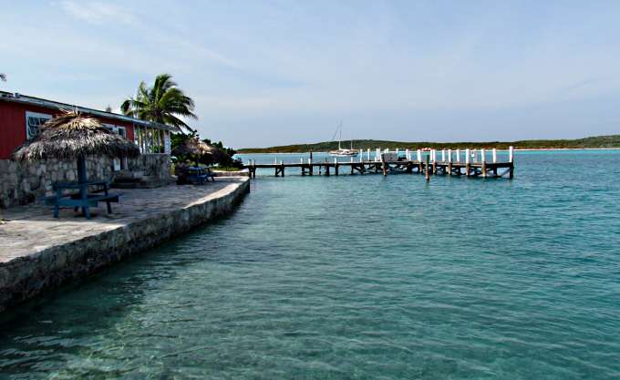
A view of the yacht club from my anchorage later in Big Harbor.
=========================================================
........................................................................................Next Page If There Is One...